In July of 2017, I was fortunate to join Bay Area Sea kayakers Mike Higgins, Ken Sund, and John Somers on a 3 week trip to the sea kayakers' mecca of Haida Gwaii, a large island north of Vancouver Island, about 60 miles west of the British Columbia mainland.
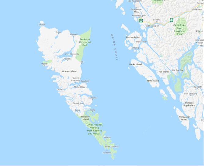
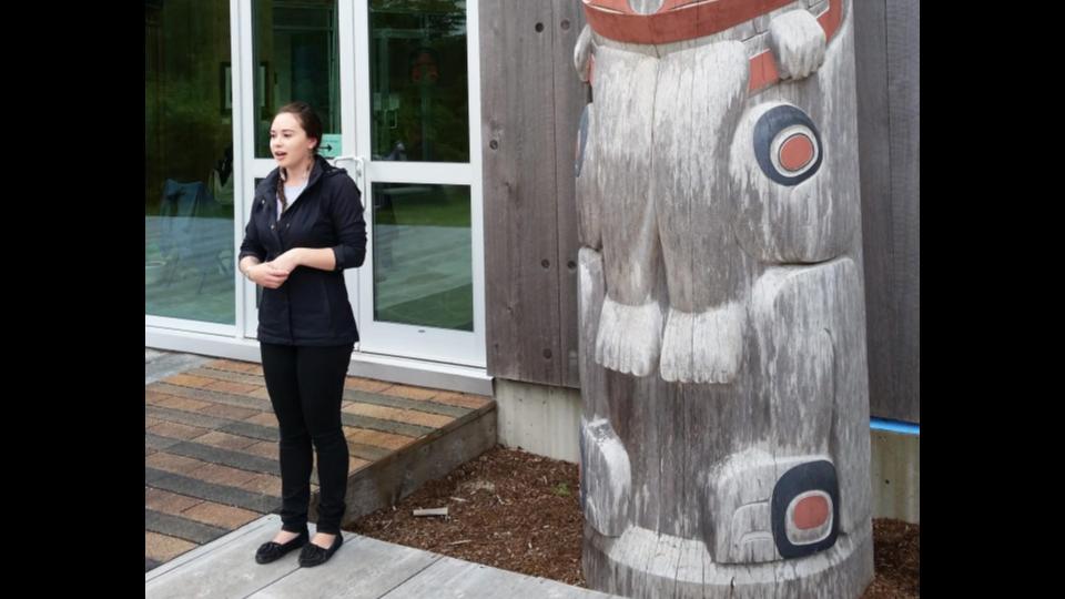
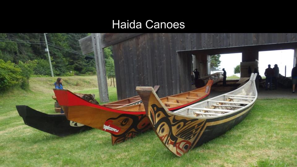
While my fellow kayakers drove up in one truck with our kayaks, my limited vacation time required that I fly to Prince Rupert, where we all met to catch the overnight ferry to Skidegate, on Graham Island. We spent nearly the entire day at the Haida Cultural Center, seeing the historical exhibits, getting the required orientation, and catching the totem tour. The wealth of information at the Cultural Center was vast, making it well worth the visit.

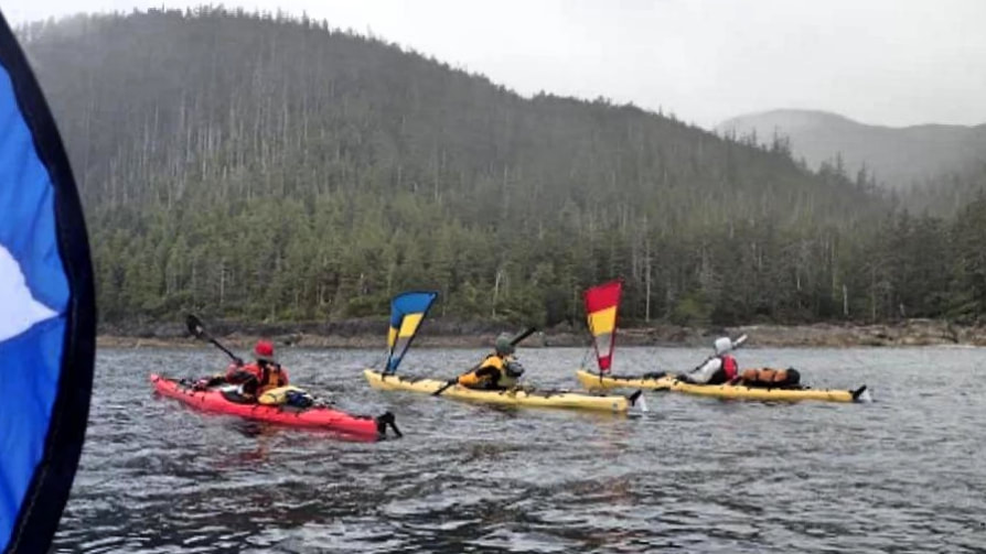
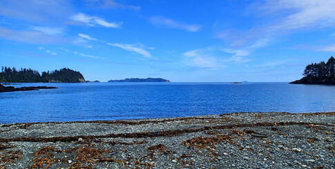
After taking the ferry to Moresby Island, we camped overnight in Moresby Camp, before getting a transport the next morning from Moresby Explorers, who offered a bone-chilling ride down to Kat Island. This saved us a few days of kayaking, and Kat Island offered an excellent starting place. On our first morning, the weather and the water was calm.
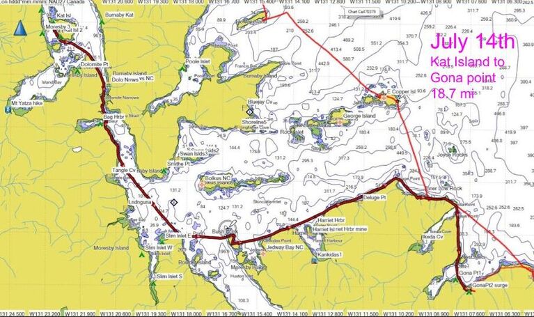
We paddled to Gona Point on our first day, almost 19 miles / 30 km (Bold red line).
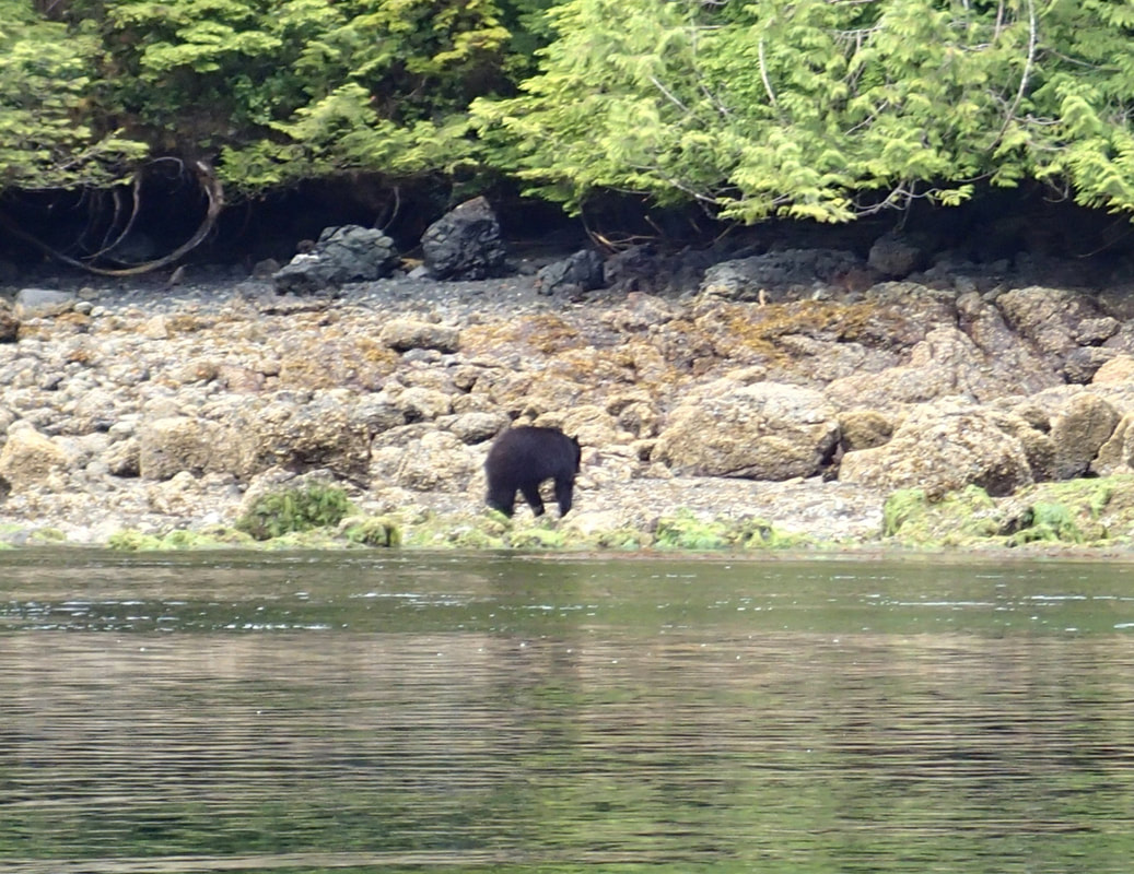
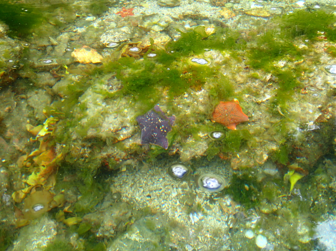
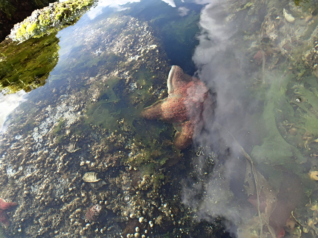
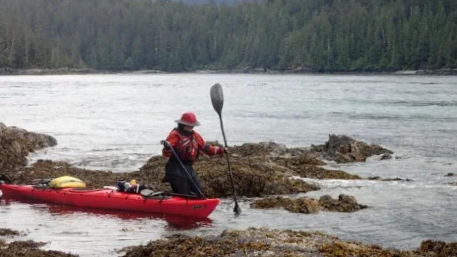
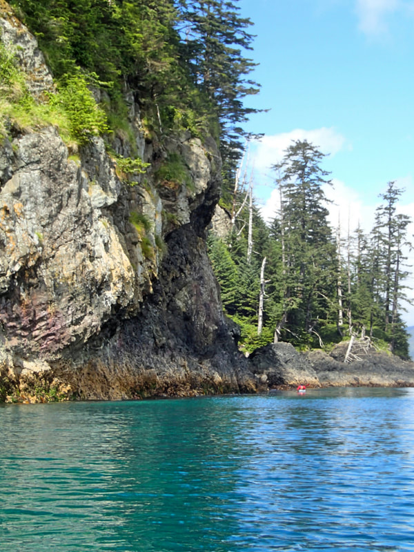
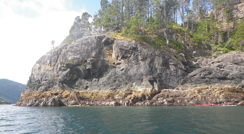
We saw our only bear of the trip on the shoreline of Moresby Island. The water throughout the islands was very clear, enabling us to see many feet down. This was particularly enjoyable near Dolomite Narrows, where the sea bed was colorful and the clouds were reflected.
The next day, a bit of rain and tailwind assisted us as we paddled south to Raspberry Cove. There was a strong current flowing eastward out of the passage between Moresby Island and Kunghit Island. I watched as a strong fellow paddler made no progress on the current treadmill in the middle of the channel before I chose to take the easy way, walking my kayak around the point rather than battling the strong current.
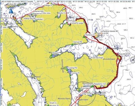
Gona Point to Raspberry Cove, approximately 16 miles / 26 km.
We had a bit of current assist for the paddle to the Gordon Islands, after enjoying our beautiful campsite at Raspberry Cove. The Gordon Islands were more rugged and rocky, but we found a nice campsite facing west to S'Gang Gwaii, our next destination.
Raspberry Cove to Gordon Islands, ~ 10 mi / 16 km

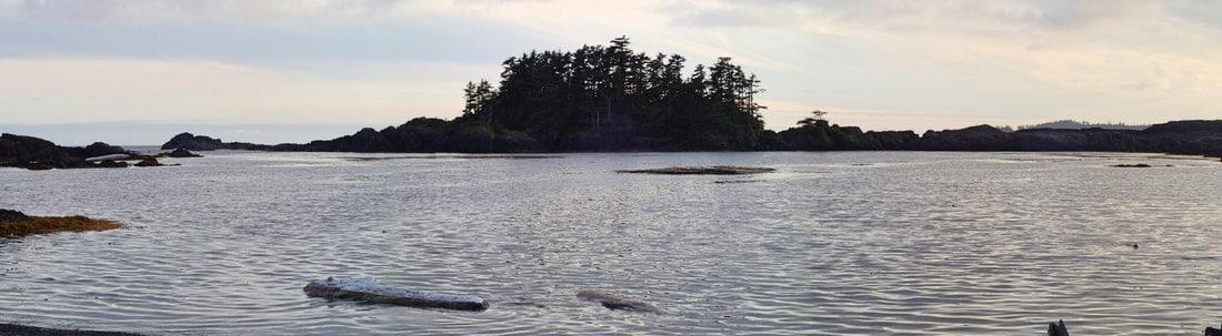
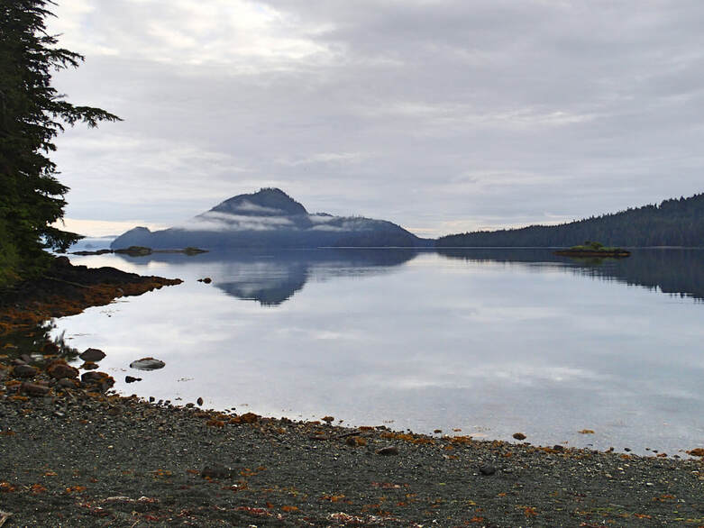
Gordon Islands Campsite View, facing West
The next day, the weather was favorable for the expected highlight of the trip: The crossing and tour of S'Gang Gwaii. After the tour, we were able to circumnavigate the islands before returning to Raspberry Cove. We spent quite a bit of time on the tour, talking to the Watchmen and seeing the Haida village ruins (slideshow below).
S'GANG GWAII SLIDESHOW
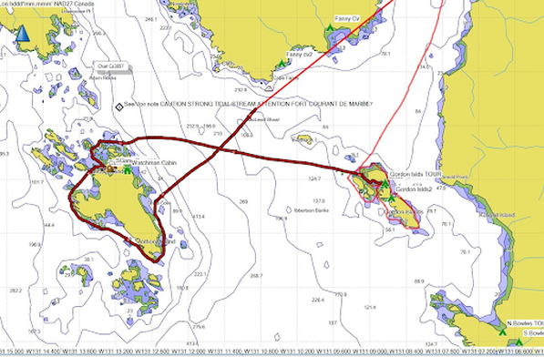
Gordon Island around S'Gang Gwaii and back to Raspberry Cove, ~15 mi / 24 km
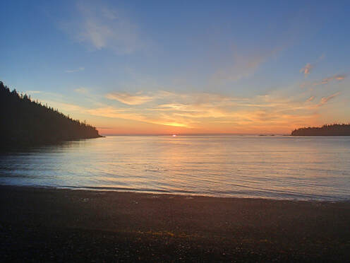
Over the next few days we paddled north, camping at Rankine Cove on Moresby Island, where we enjoyed a beautiful sunset, and then at Merrican Bay on Burnaby Island. The beaches were gravel with plenty of room above the high tide line.

Click to expand photos
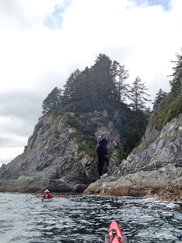
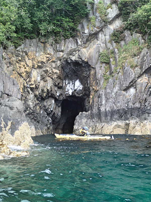
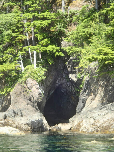
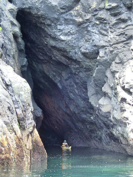
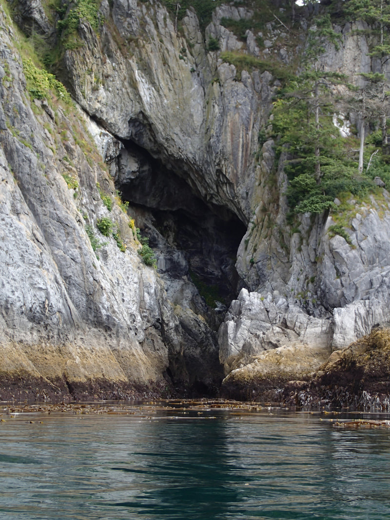
We visited some of the islands along the way - the Copper Islands, Howay Island - and saw some unusual cave formations.
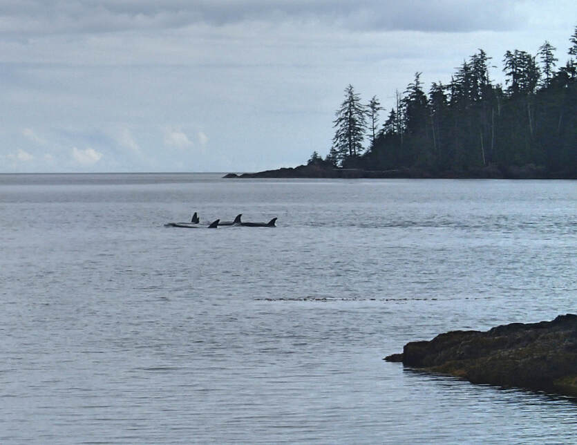
We were thrilled to see a pod of Orcas as we paddled out of Merrican Bay, and they stayed in our sights as we crossed Skincuttle Inlet.
We were thrilled to see a pod of Orcas as we paddled out of Merrican Bay, and they stayed in our sights as we crossed Skincuttle Inlet.
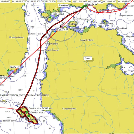
After a brief stop on Ramsay Island, we radioed the Watchmen for permission to land on Hotsprings Island in the evening. A weather front was expected, and the natural hot springs at Hotsprings Island were indeed active and open. Although there was limited room above the high tide line as we weathered the rain for an extra day, the hot springs were refreshing, and we enjoyed a meal of freshly caught shrimp from some local fishermen. We also had time to explore whimsical seashell-marked trails to the east side of the island.
Merrican Bay to Hotsprings Island,
~ 18 mi / 29 km
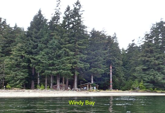
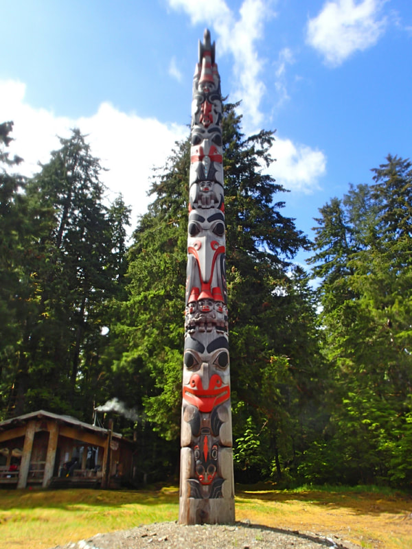
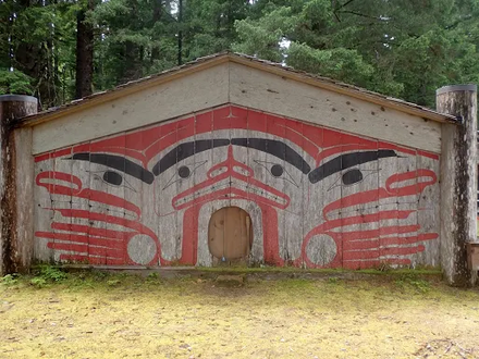
The next stop on the Haida Cultural tour was Windy Bay, a relatively short 10 mile / 16 km paddle. We landed in the early afternoon and spoke to the Watchman family living there as we took photos, and camped on a nearby beach. The surrounding forest was dense and verdant.


|

|
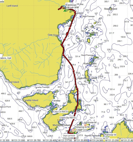
Hotsprings Island to Windy Bay, ~ 10 mi / 16 km
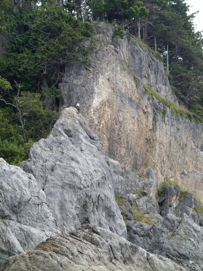
The next day we had another short paddle in good conditions to Kunga Island, which served as our basecamp for paddling over to visit the Watchmen and Haida ruins at Tanu Island. There were more dramatic features and interesting caves along the way.
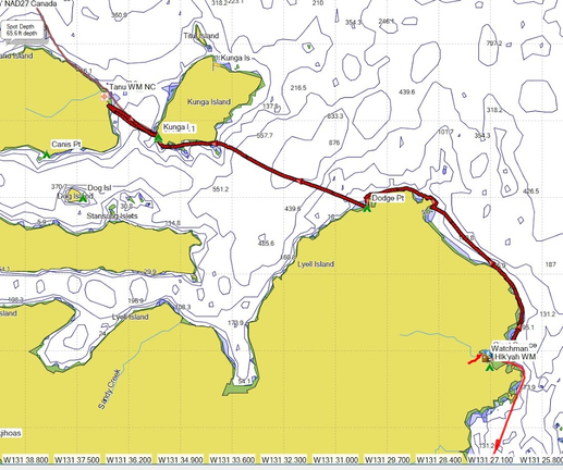
Windy Bay to Kunga Island and Tanu Village tour, ~ 11 mi / 18 km
|
|
The Haida Tanu Village Ruins Slideshow
From Kunga Island we paddled north on a sunny day with mild winds, past Talunkwan Island and crossing to Louise Island, where we camped at Breaker Creek. The chilly creek was just deep enough for a brief but refreshing rinse.

Kunga Island to Breaker Creek, ~ 13 mi / 21 km
|
|
The next morning we set off on a day paddle to Skedans Point, the last Haida village of our trip populated by Watchmen. The morning paddle was calm, with caves and more dramatic granite cliffs and features. A south wind picked up in the afternoon, making us work to get back to camp.

Breaker Creek to Skedans Point and back,
~ 12.4 mi / 20 km round-trip
The Skedans village was smaller, with the totems seemingly closer to returning to the earth. The Watchman cabin had several reference books on the totems and the Haida culture, and the Haida staff were, as everywhere else, gracious, friendly, and passionate about educating others about their history and culture.
Skedans Haida Village Slideshow
We got a later start for the next day's paddle, and a southwest wind made for a slog to Rockfish Harbor, where we stopped before proceeding through Louise Narrows to Carmichael Point the next day.
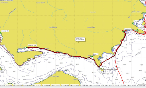
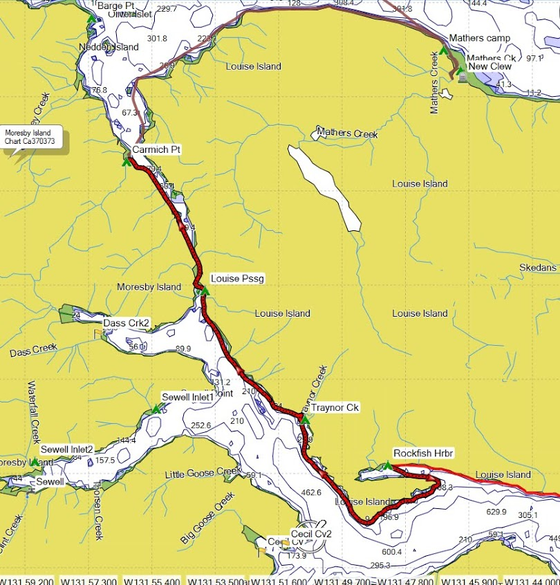

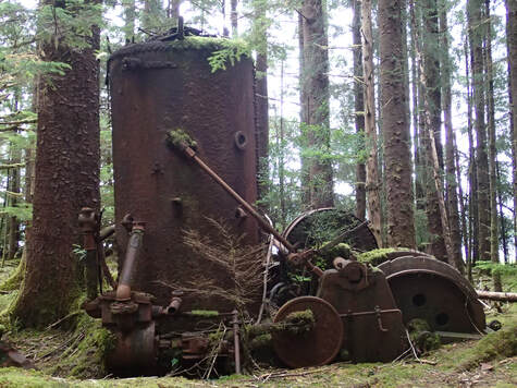
On the next-to-last paddling day, we headed east across Louise Island to Mathers creek, where there were remains of a village and old steam engine. There was a well-worn path leading deeper into the woods that I wanted to explore, but there wasn't time. Perhaps next time...
Point Carmichael to Mathers Creek, ~ 12 mi / 19 km |
|
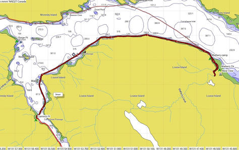
On our last day, we paddled west under grey stormy skies back to Moresby Camp, after first stopping to check out the abandoned Aero Camp on the north shore of Gillatt Arm. Aero camp is an abandoned logging camp, last used in the 1960's, so named because the wood was used to build airplanes. Sadly, it was the end of our paddling trip, but we had seen a great deal of the south islands. We spent a couple more days visiting Graham Island to the north, and seeing more of the Cultural Center near Skidegate. A fantastic trip in a truly unique paddling environment!
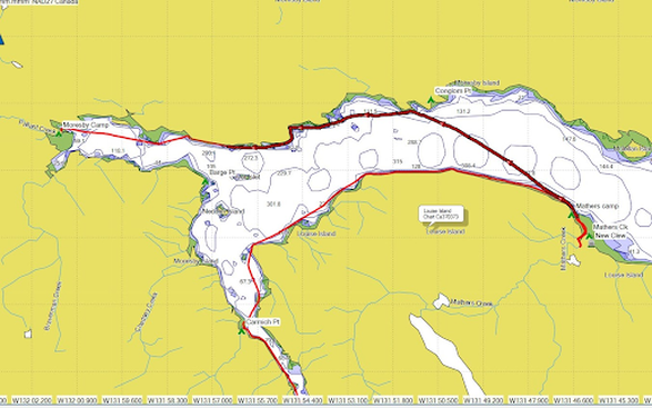
Mathers Creek back to Moresby Camp, the final paddle; ~ 11 mi / 18 km.
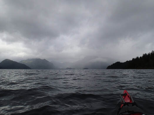
Paddling west in a building storm
|
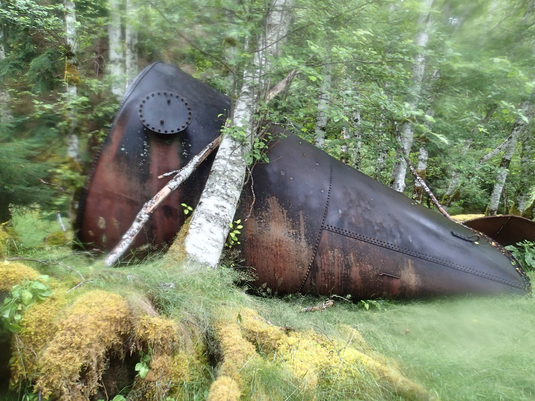
Abandoned equipment at Aero Camp
|
REFERENCES AND INFORMATION
Photographs by Cris Lewis, Mike Higgins, John Somers, and Ken Sund -- excellent paddling companions!
Logistics links:
BC Ferries from Prince Rupert to Skidegate, Haida Gwaii
Moresby Explorers
Reference books:
Boat Camping Haida Gwaii, Revised second edition: A Small Vessel Guide (an excellent reference for planning your trip!)
Those Born at Koona
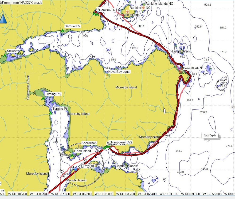
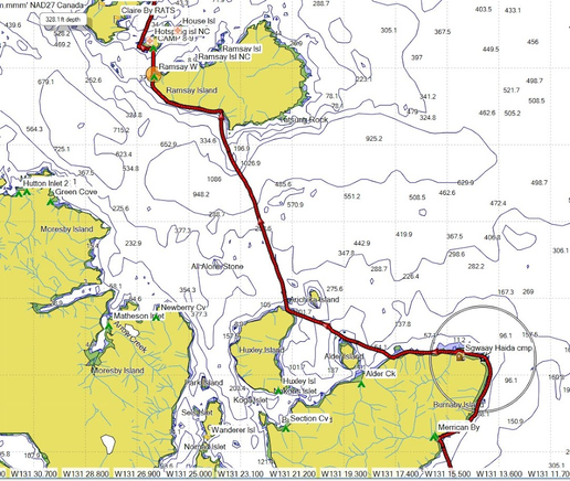
Feel free to download and share this GPX file of campsites and waypoints. These waypoints and campsites were all generated from the book "Boat Camping Haida Gwaii" referenced above, or were generated during the trip. The waypoints indicated with orange bisected circles represent where camping is NOT ALLOWED, often also designated by "NC". The yellow flags represent campsites that are likely too small for four people, or are otherwise less desirable. Contact me if you have questions.
Logistics links:
BC Ferries from Prince Rupert to Skidegate, Haida Gwaii
Moresby Explorers
Reference books:
Boat Camping Haida Gwaii, Revised second edition: A Small Vessel Guide (an excellent reference for planning your trip!)
Those Born at Koona
Feel free to download and share this GPX file of campsites and waypoints. These waypoints and campsites were all generated from the book "Boat Camping Haida Gwaii" referenced above, or were generated during the trip. The waypoints indicated with orange bisected circles represent where camping is NOT ALLOWED, often also designated by "NC". The yellow flags represent campsites that are likely too small for four people, or are otherwise less desirable. Contact me if you have questions.
