Kenai Fjords National Park, Alaska 2025
A 3-week Sea kayaking expedition in the Kenai Fjords in Alaska, from Homer to Seward
Paddling in the Kenai Fjord peninsula in central Alaska had been on my to-do list for some time. In early January, BASK member Stuart Cook shared my campsite in a club Morro Bay outing, and invited me to join him on a trip from Homer to Seward in the summer, if I was interested. After thinking it over, I gave a yes later in the spring, and the trip was expanded to include another BASK member Franca Cioria. The biggest challenge was that the Alaska Marine Highway Ferry system no longer offered a ferry route from Juneau west to Homer. And because Stuart wanted to paddle from Homer to Seward, instead of round-trip from Seward, our options for kayak rental were limited: Stuart was unable to find an outfitter who would loan us kayaks for the 3 weeks necessary to make the trip. So our last option was to take our Feathercraft kayaks, which made for a bigger logistical challenge. I almost cancelled my trip when a key part of my Heron Feathercraft broke, but a kind BASK member offered to loan me her older model K1 for the trip. Stuart purchased an older K1, and Franca borrowed a K1 for this trip. Although I would have much preferred to take my new Pilgrim Expedition, or to rent a plastic boat, this seemed to be the only viable option for a trip from Homer to Seward.
Route Overview: ~223 Nautical Miles*, 17 Paddling Days

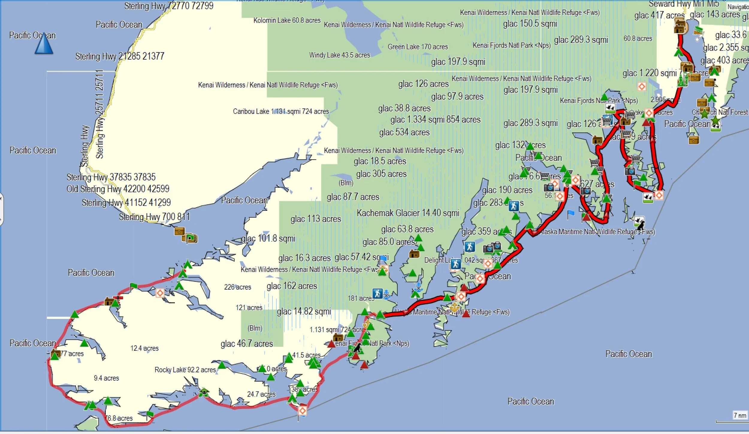
L: Location of the Kenai Peninsula in South Central Alaska
R: Overall track from Homer to Seward. (The track from Homer Spit to Elred Beach, and from Cloudy Mtn to Surok Point, are missing.)
Pre-Trip Logistics: Stuart had family living in Anchorage, so he was able to meet Franca and I at the airport and help us get our extensive gear (including the folding kayaks) to our lodging. We had a day to go shopping for last-minute items, and to re-arrange our gear. Stuart had already purchased fuel and bear spray, which of course we couldn’t transport on the airplane.
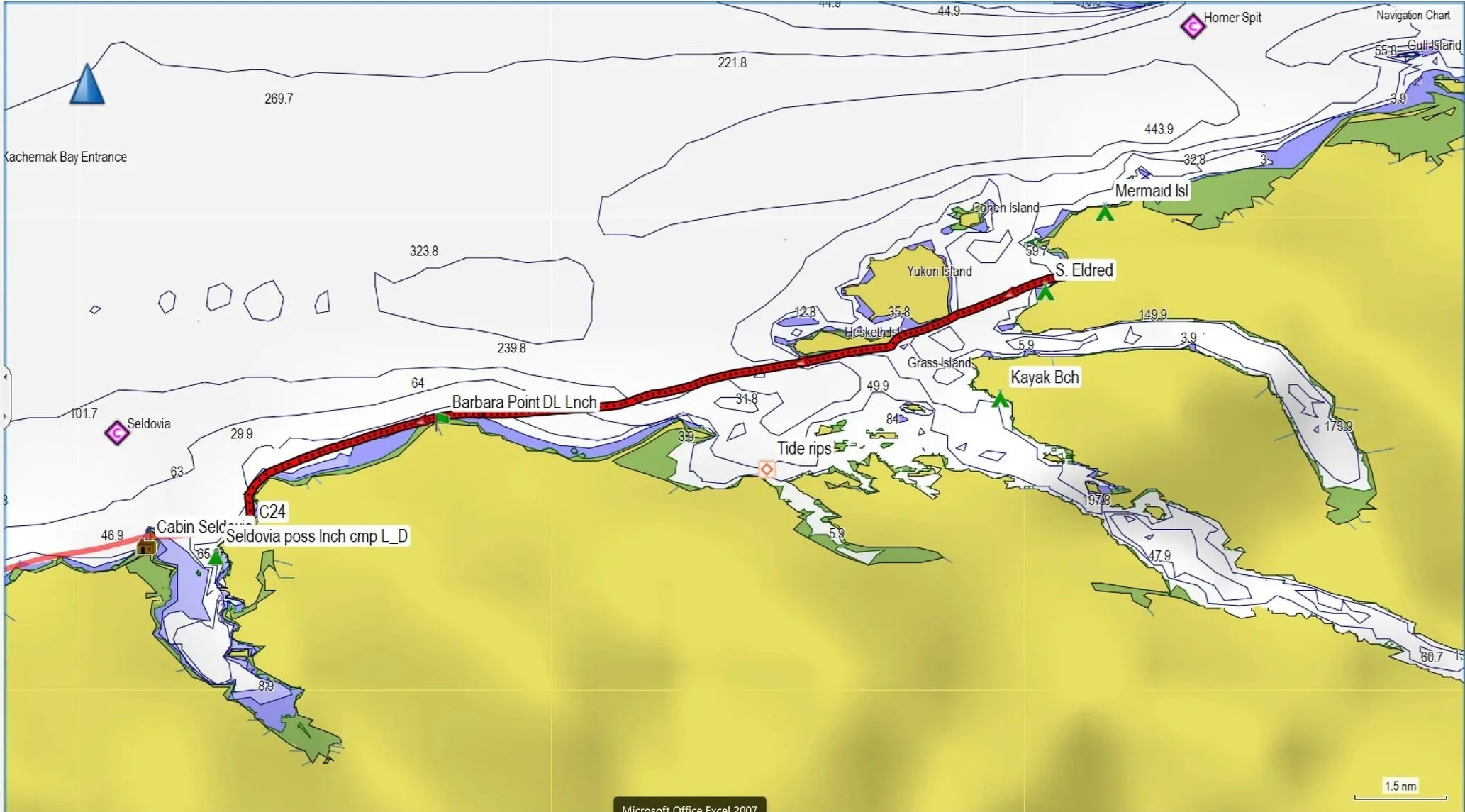
Day 1: Homer Spit to S. Elred beach ~ 5 nm, 9 km
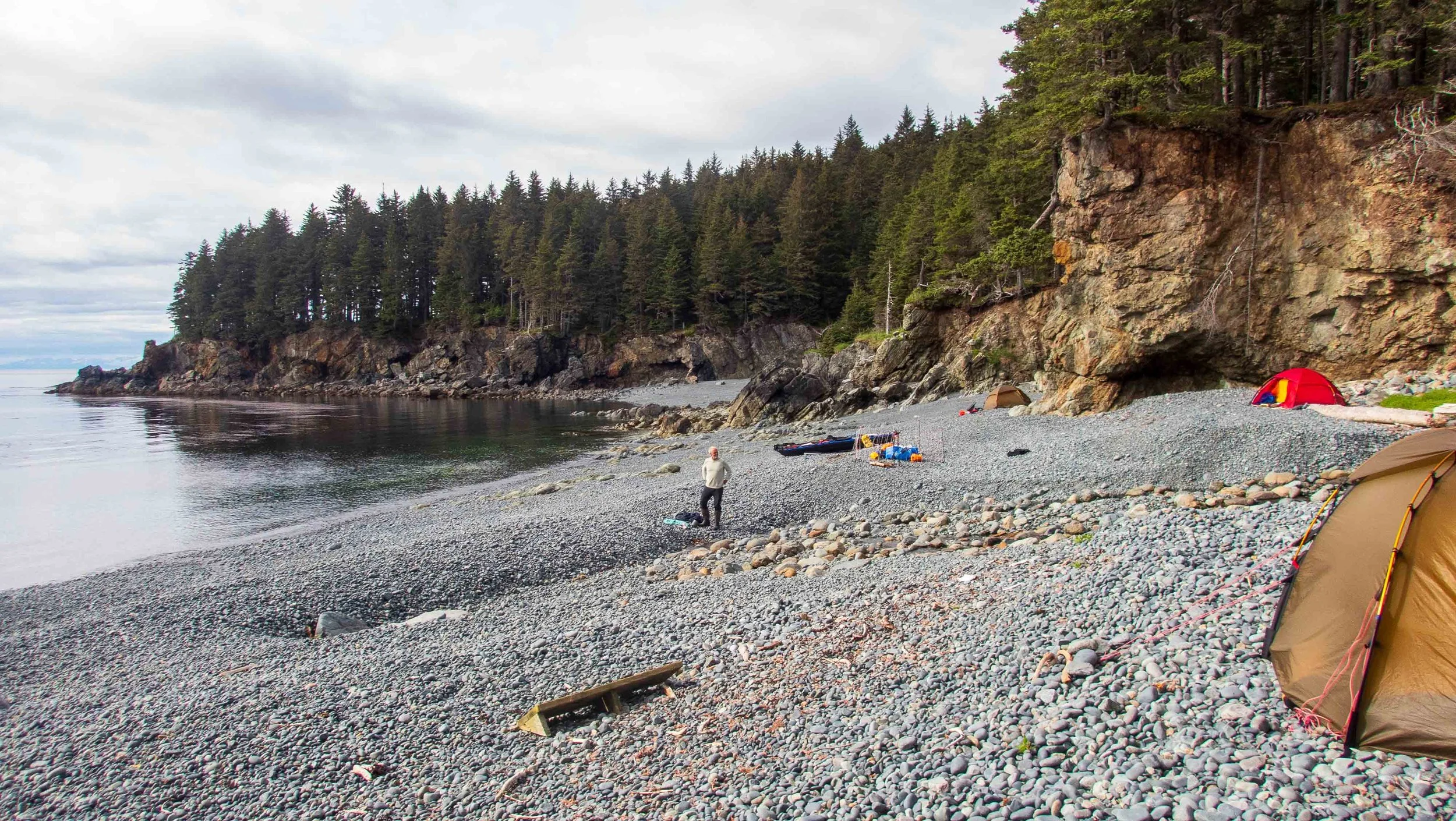
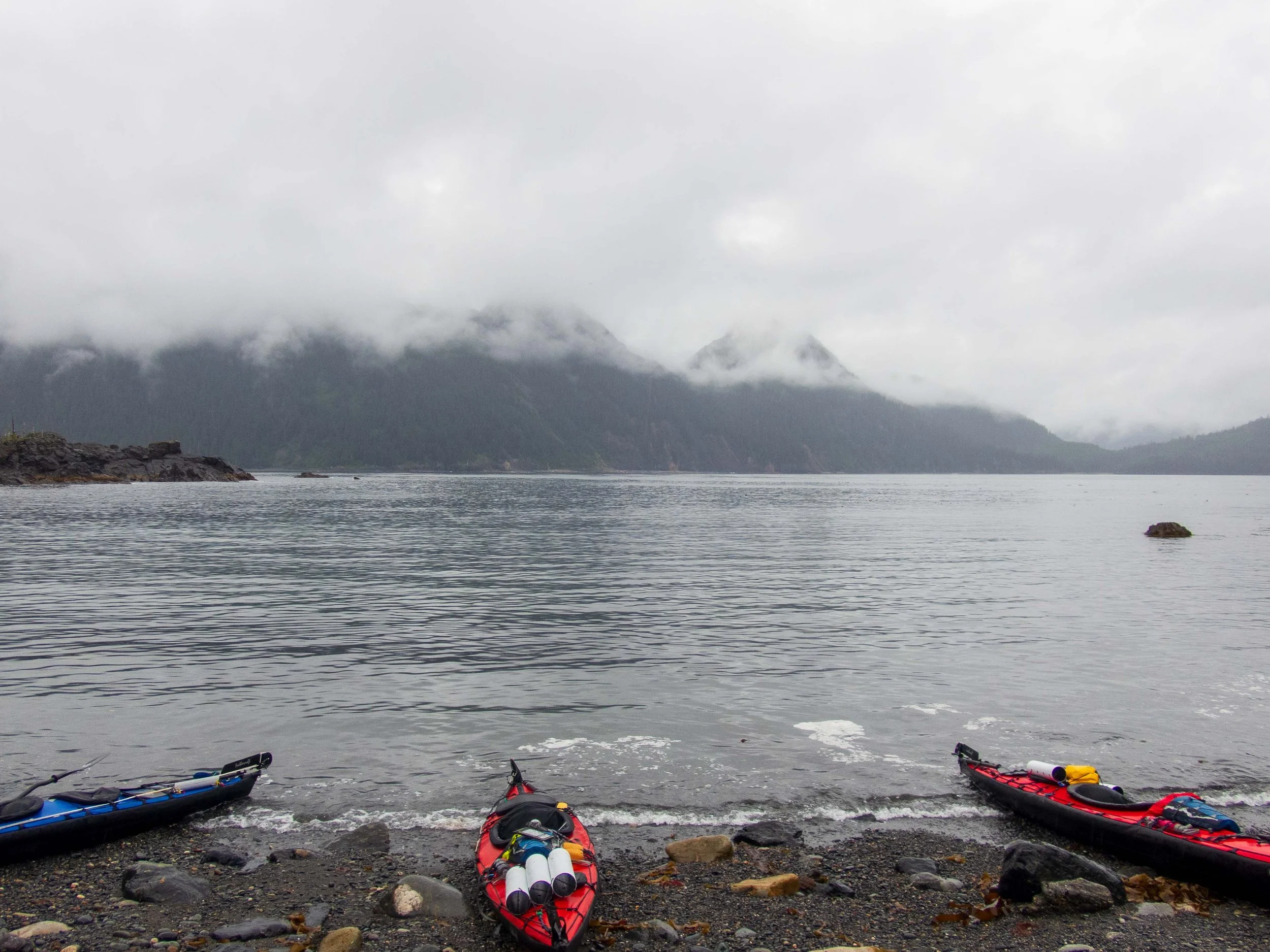
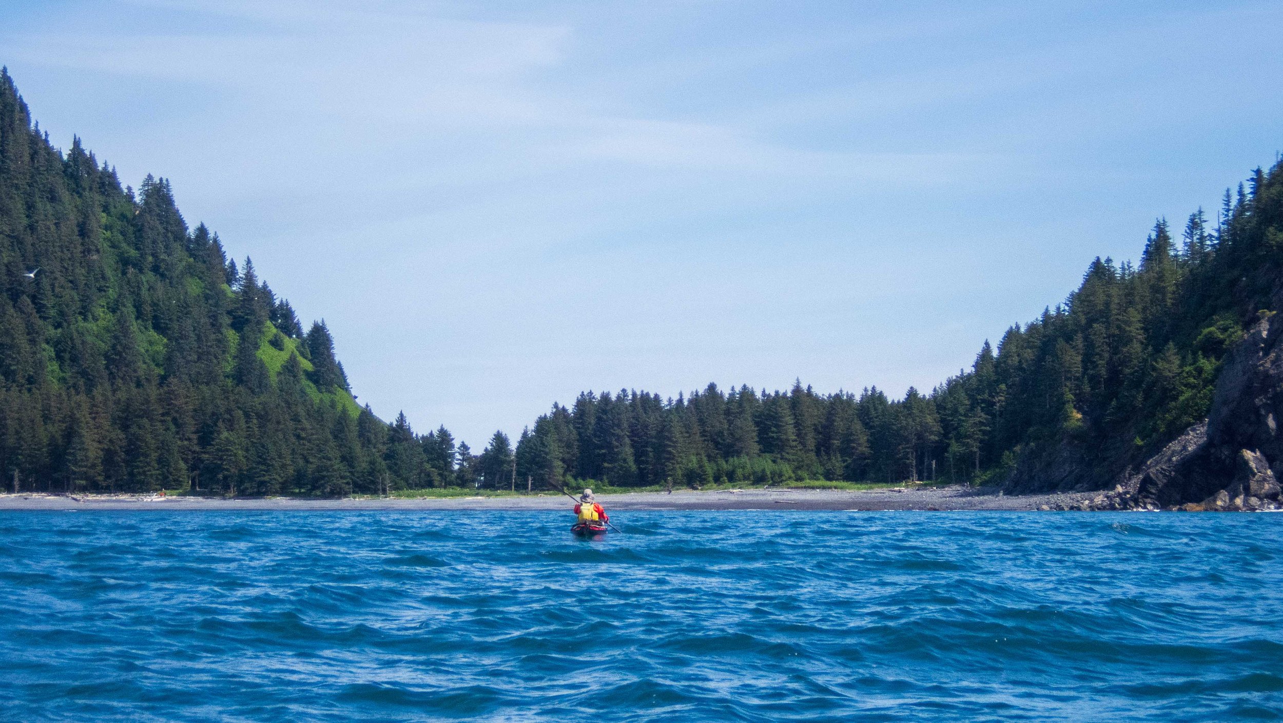
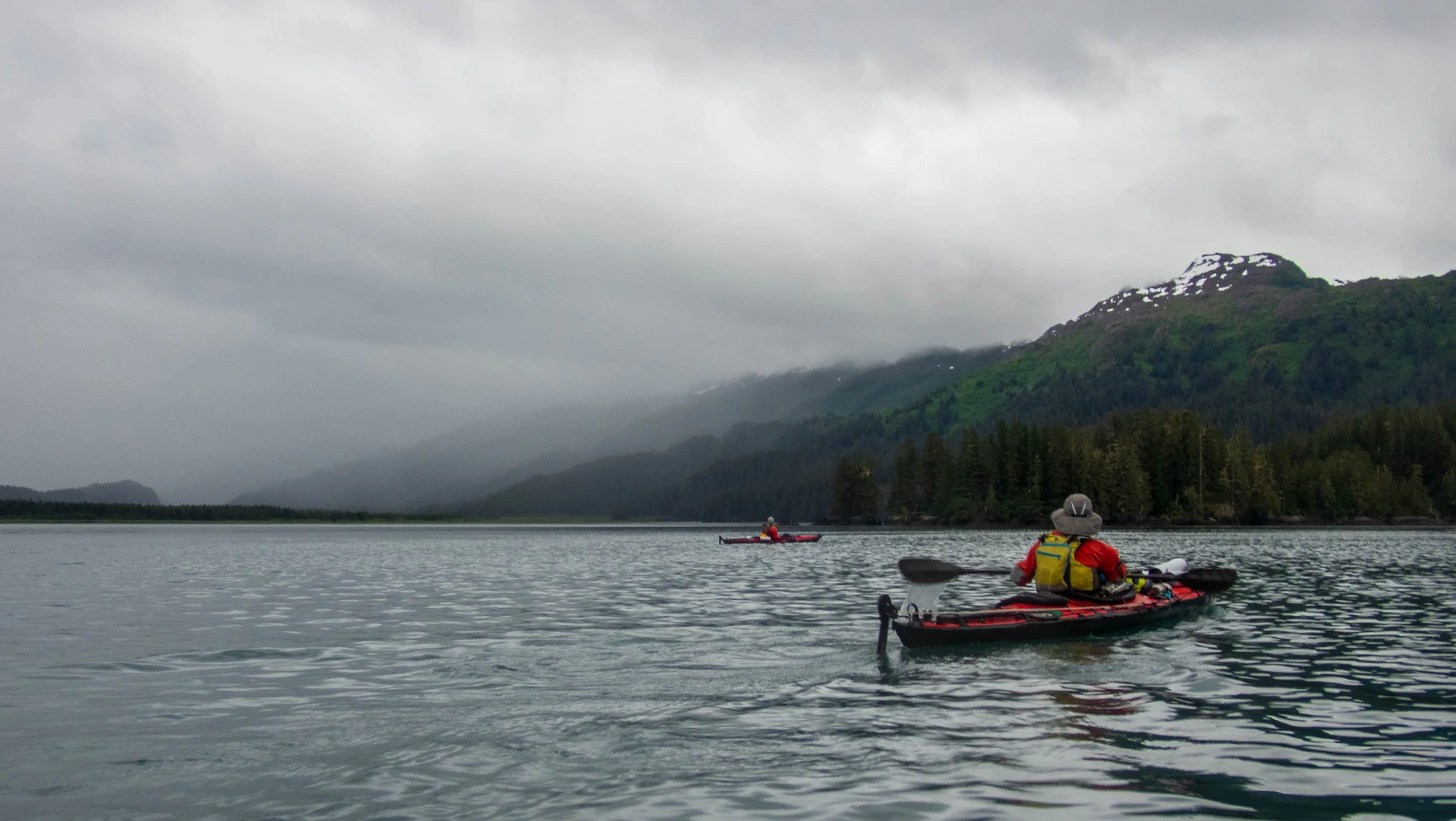
Stuart picked up Franca and I and all our gear at our lodgings early on the morning of June 30, and he and his family drove us in two cars to his uncle’s house, a beautiful place outside of Anchorage. We arrived after a long drive to Homer about 1 pm, when we immediately set about assembling our boats near the Fisherman’s memorial near the Homer spit.
When dinner time rolled around and we were still assembling and packing, Stuart’s lovely wife Stacy and daughter Layna were kind enough to go fetch some delicious food from a nearby eatery (Johnny’s Corner, which I highly recommend). Franca had to repair her coaming inserts, as they had been damaged during transport, and Stuart had difficulty aligning the skin on his kayak with the aluminum keel frame. We finally finished the assembly, then the loading began. Stuart and Franca brought quite a bit of gear and supplies, as relatively new expeditioners. As a result I was stuck carrying the bulky and heavy bear fence for the entire trip. But it’s always great to finally be on the water, especially in this case with so much travel and kayak assembly.
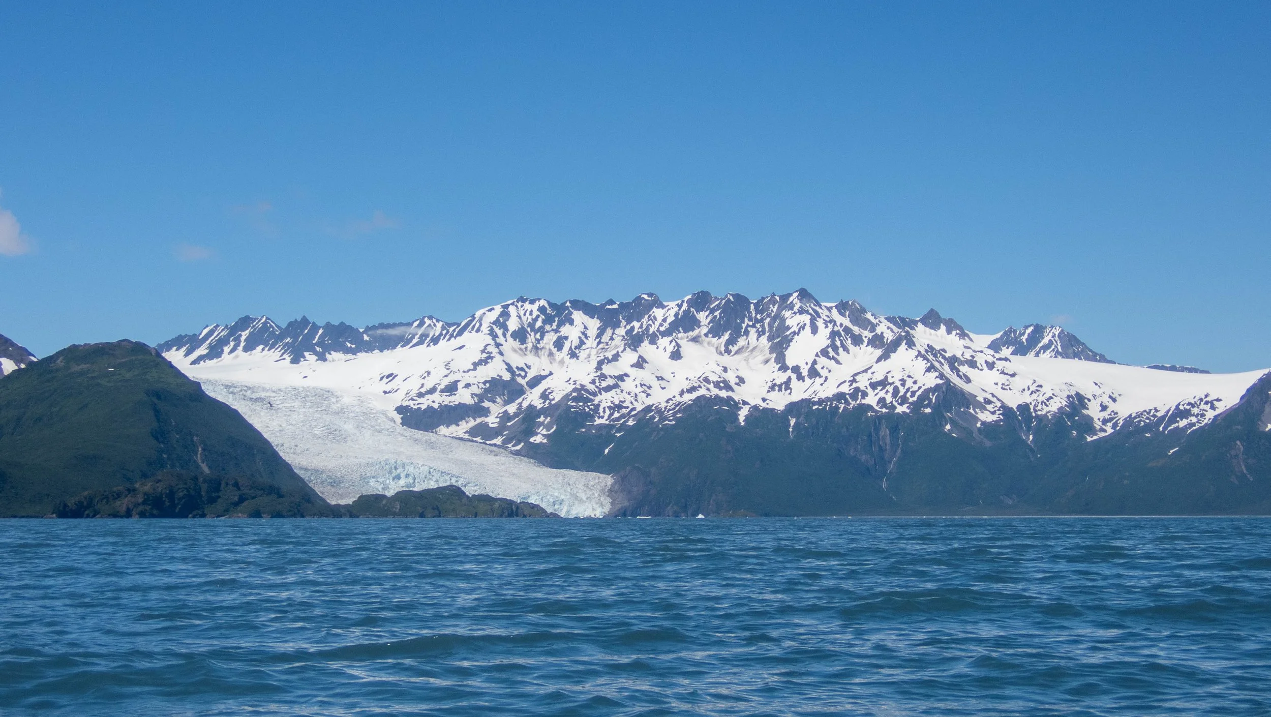
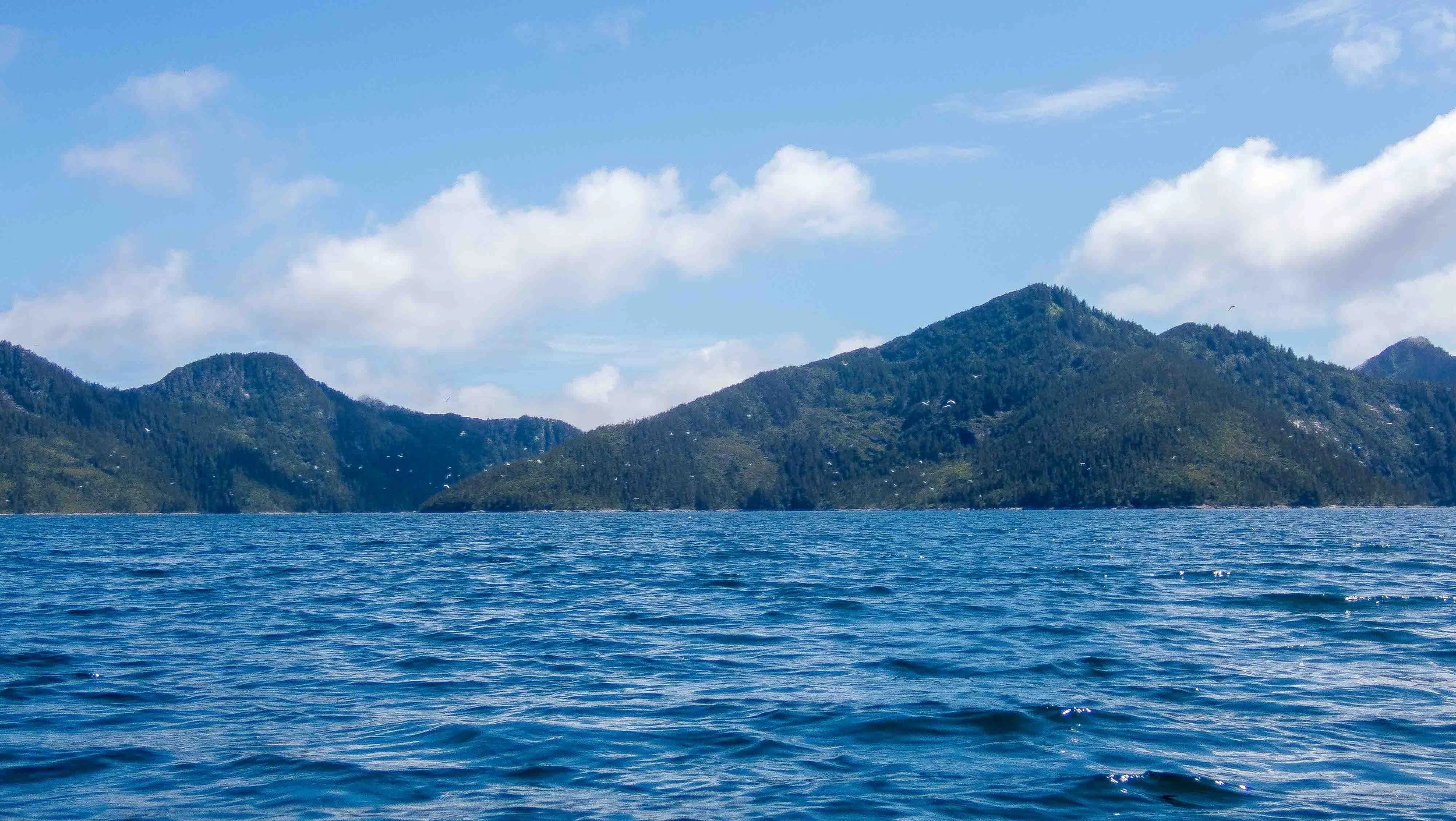
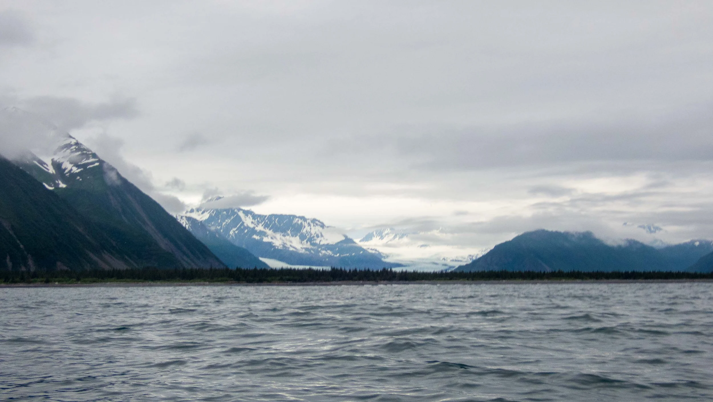
Finally on the water after launching from Homer Spit. Fantastic mountain scenery!
We had planned for a quick trip across the channel to a campground, but when we saw it was occupied we decided to paddle a bit further. We landed around 10 pm, and after setting up the bear fence in the dark, I didn’t get to sleep until after 2 am. But the winds were strong toward the west so we planned for a rest day the next day, to sort out any gear issues and re-align Stuart’s kayak skin.
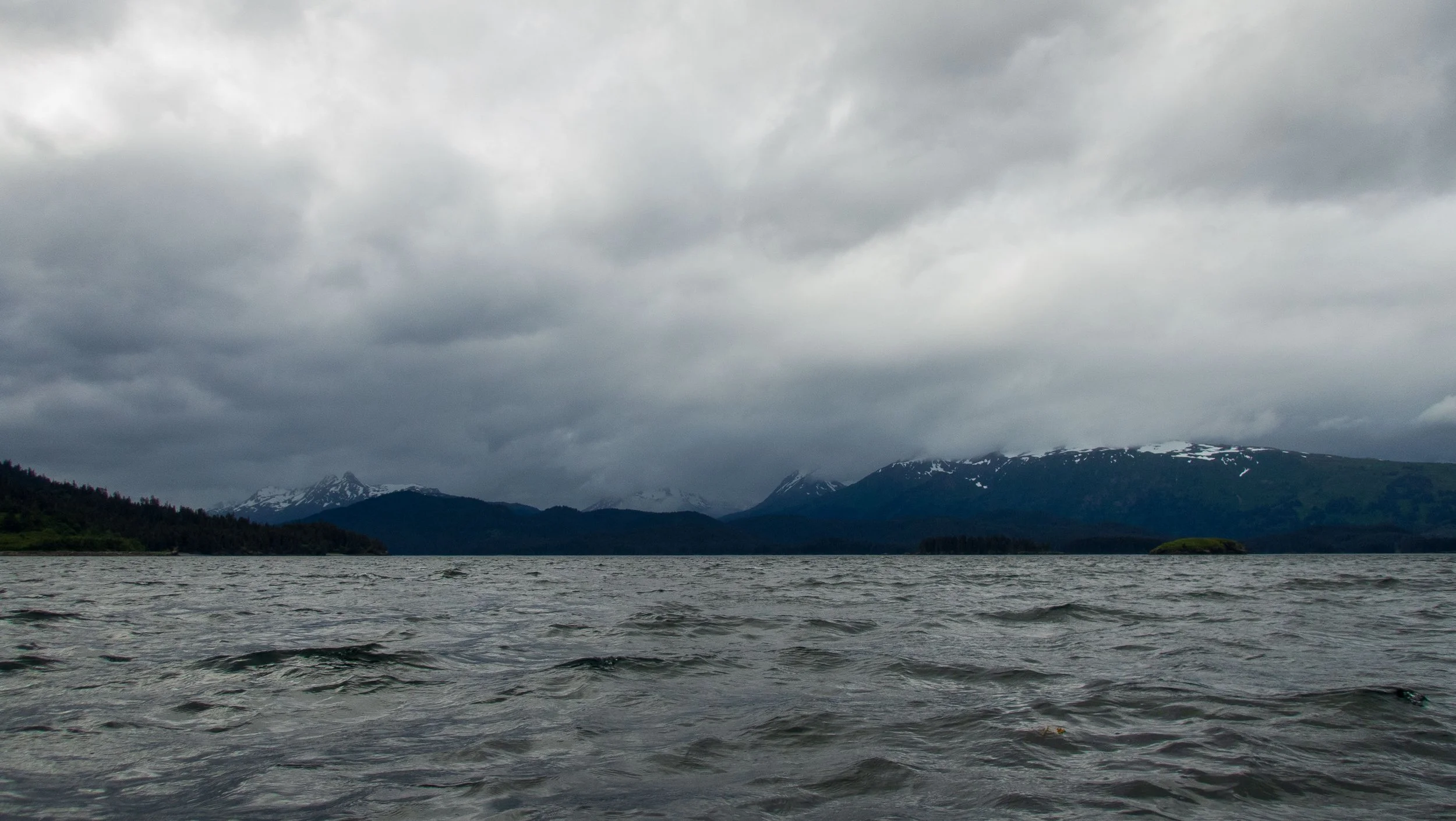
Day 3: S. Elred beach to Seldovia Beach 9.9 nm, 18 km
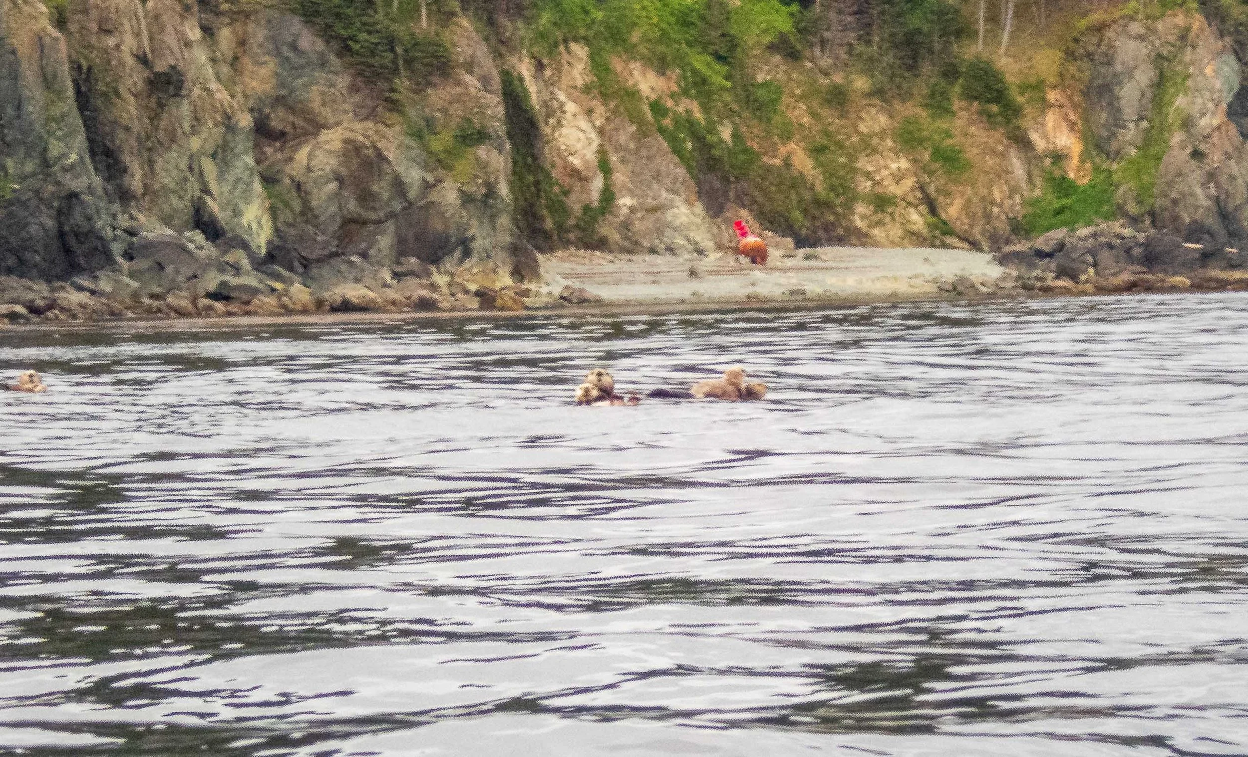
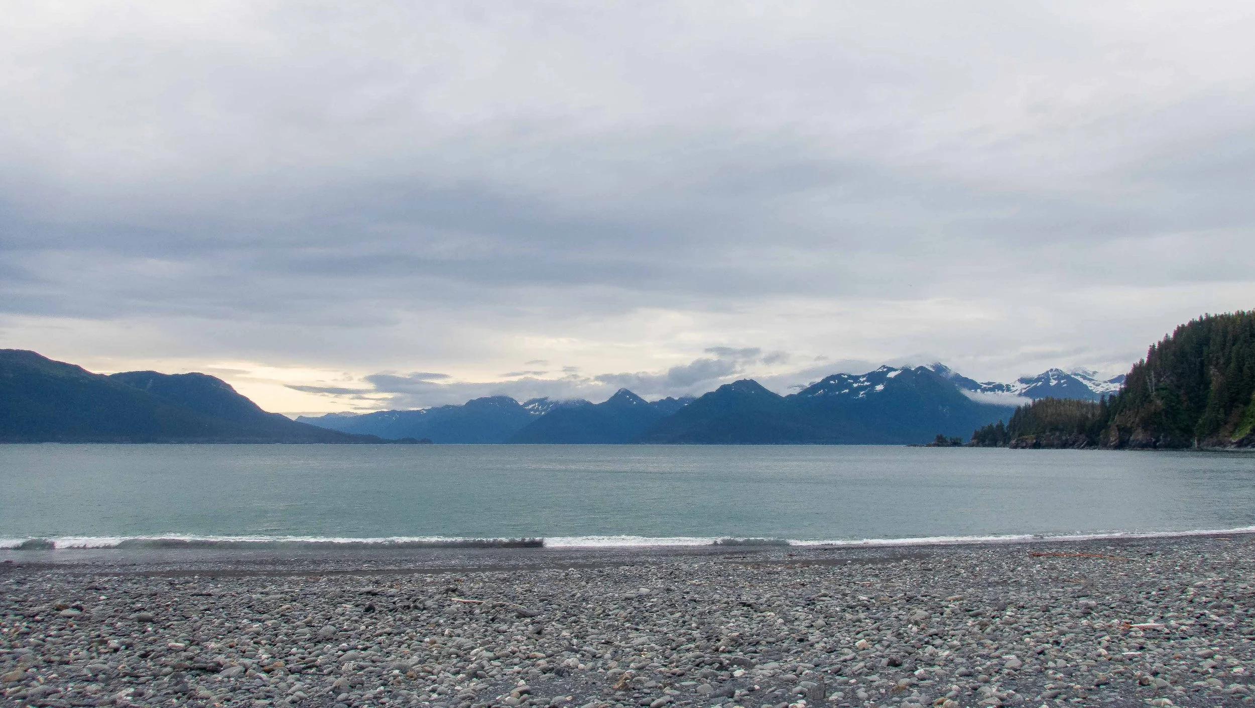
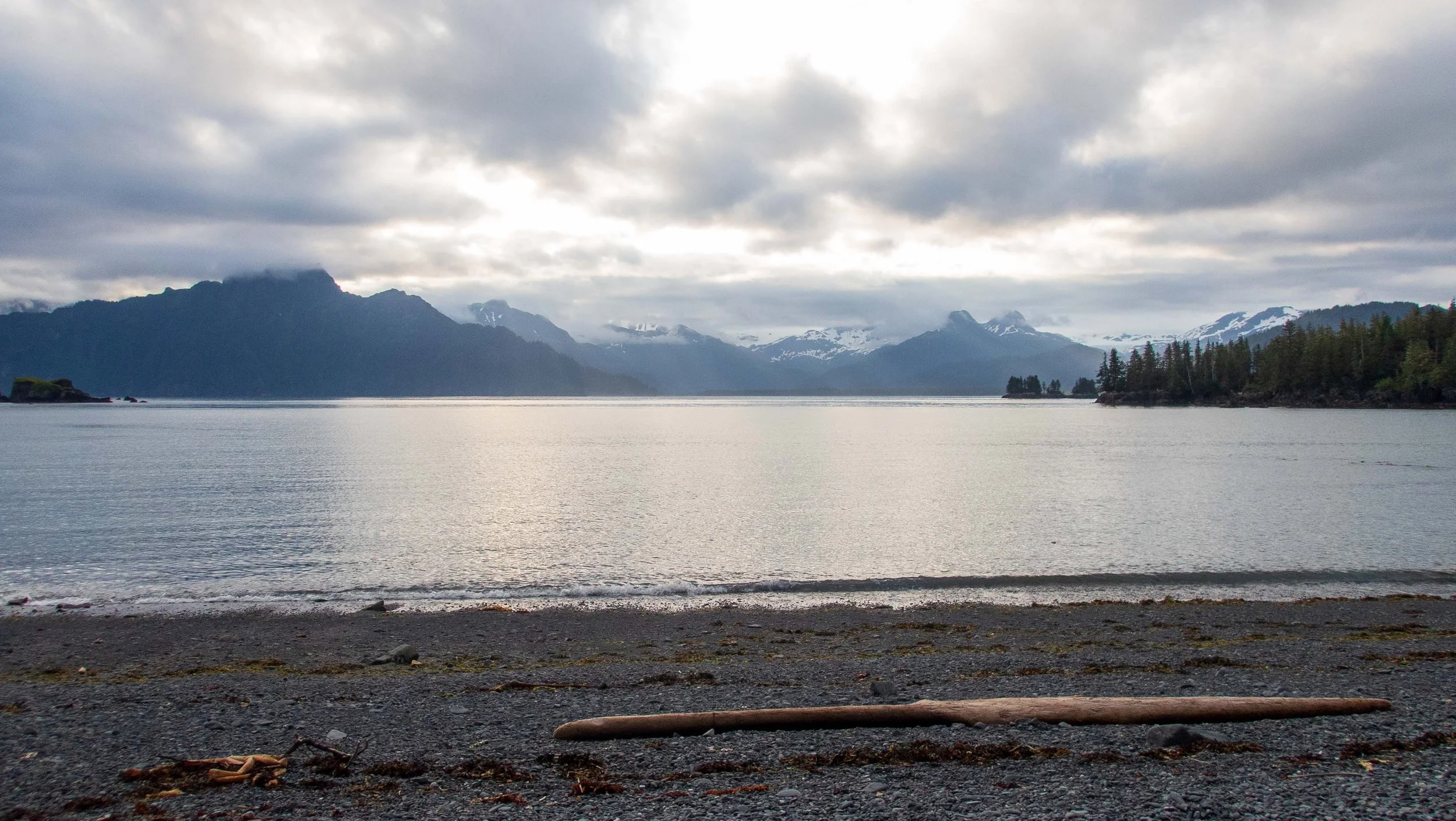
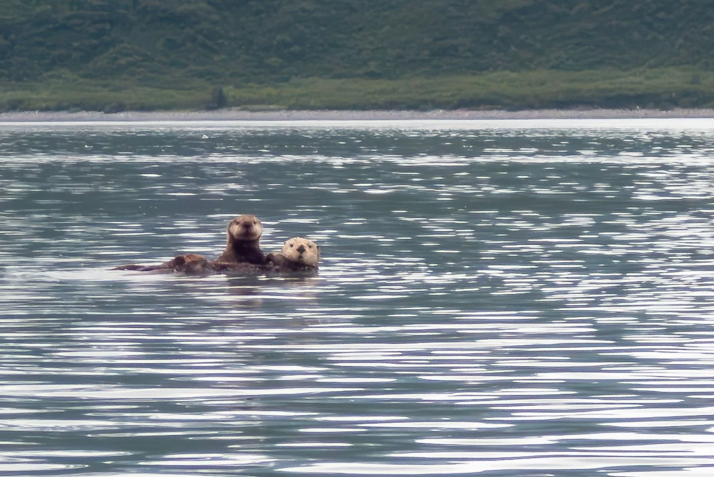
After our day off, we faced a moderate headwind after launching in the morning under gray skies. But after the rounding the corner at Yukon island, we had a nice tailwind all the way to Seldovia Beach. Along the way, we saw rafts of sea otters, white-winged scoters, pigeon guillemots, common murres, and bald eages. After landing, I walked up the beach to scope out camping options, and learned we could camp directly on the beach. We registered for a nominal $11 fee, and set about doing camp chores. Later in the evening, we learned there was no potable water nearby, and after some debate with the others I decided to just walk the 0.4 mile to the RV camp to gather fresh water in my dromedary. Franca joined me, after which she and Stuart walked a mile toward town to a bar for a beer. The view from Seldovia across Cook inlet was spectacular. It stayed light until late at night throughout the trip, so that we didn’t need a headlamp until near midnight. I had been sleeping extremely poorly, and was hoping for a better night’s sleep.
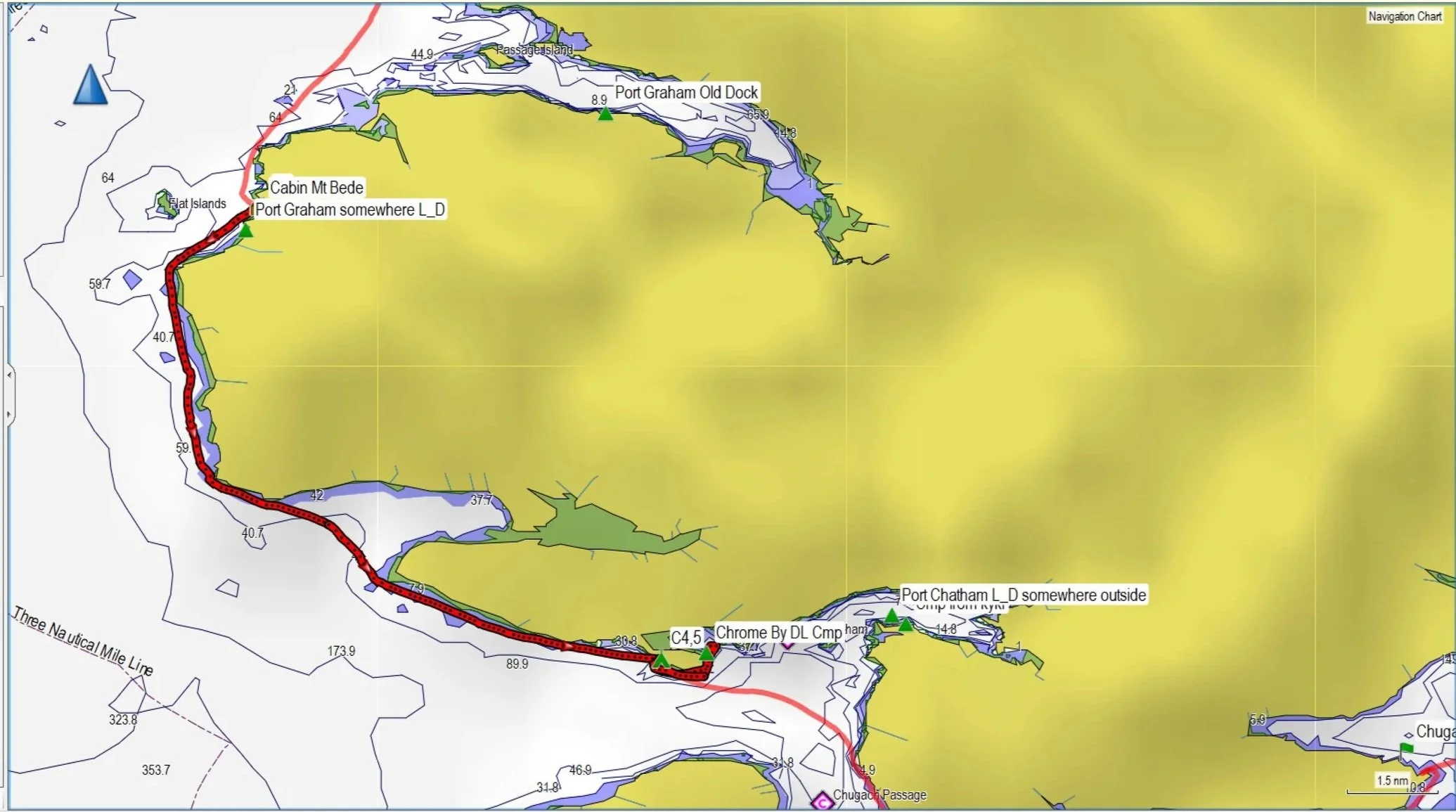
Day 4: Seldovia Beach to N of Mt. Bede Cabin 12.6 nmi, 23.3 km.
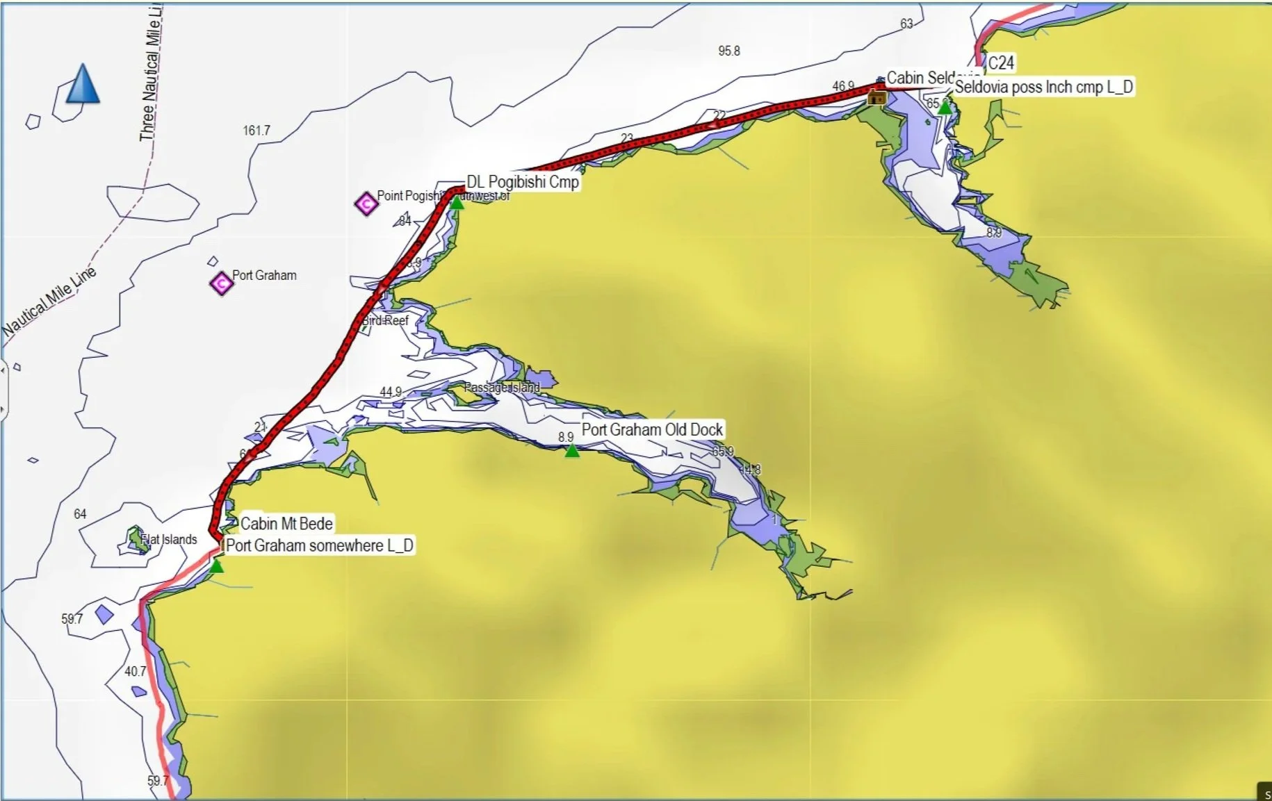
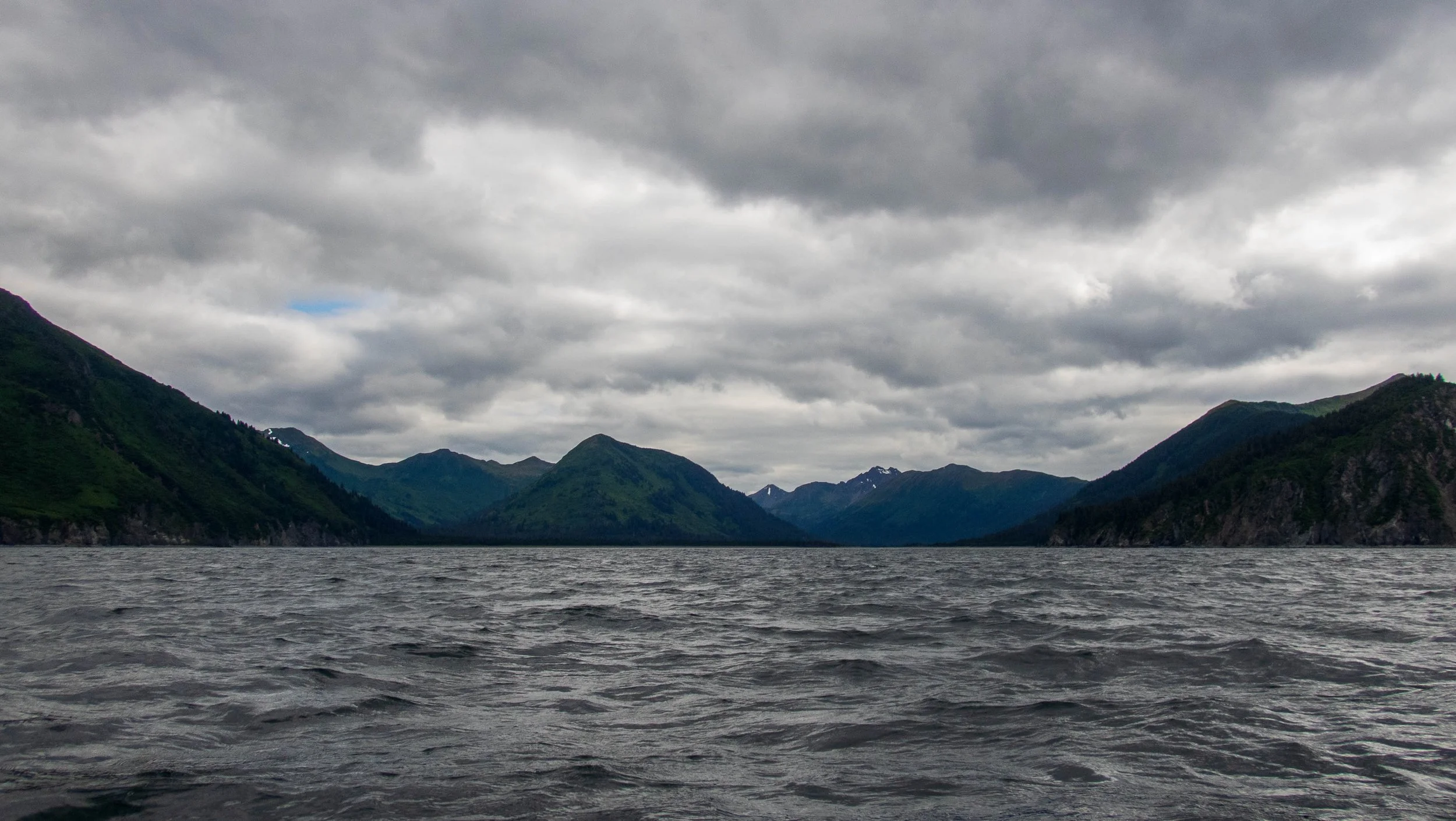
After some significant frustration and delay on my part from loading the bear fence into my kayak, it was a relief to be on the water in the morning. Conditions were good and we had a relaxing paddle going point to point as we headed west toward Point Pogibishi. As we had wisely avoided the 20-30 knot winds of the previous days, rounding the point was friendly.
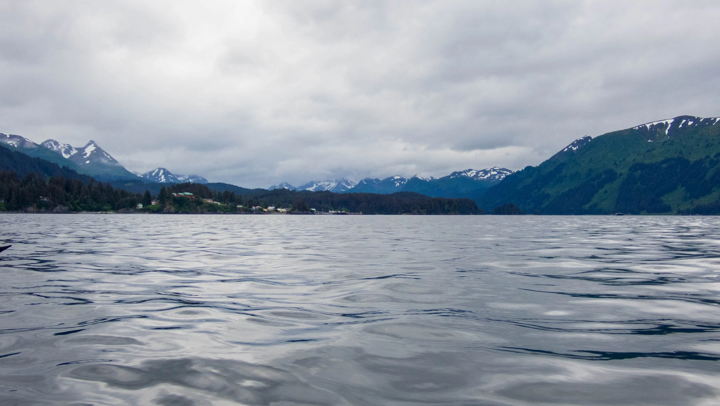
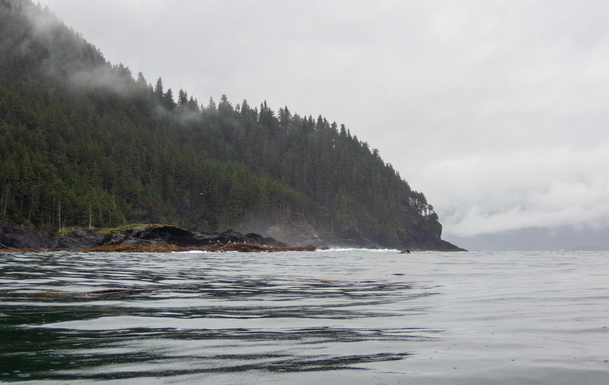
We paddled past the inlet at Port Graham, and then passed Nanwalek, formerly known somewhat ironically as English Bay. It is populated by members of the Sugpiaq tribe who have chosen to avoid contact with non-indigenous folks. I can hardly blame them.
The village of Nanwalek
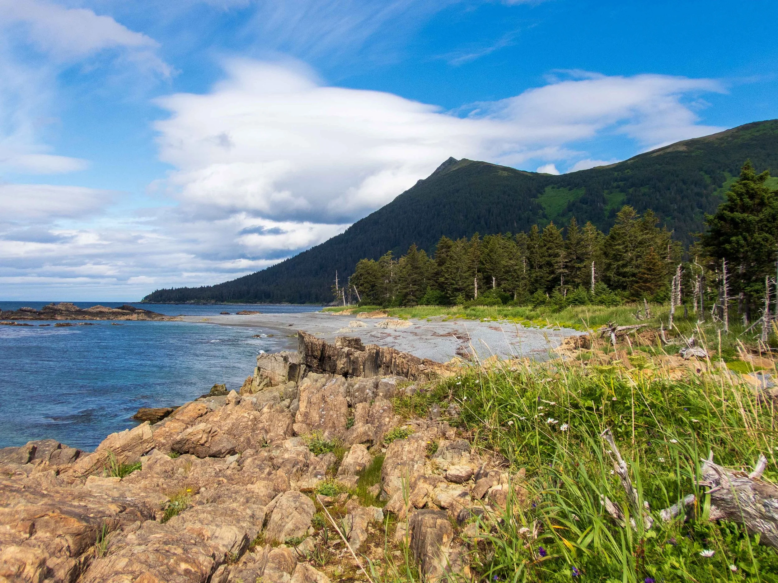
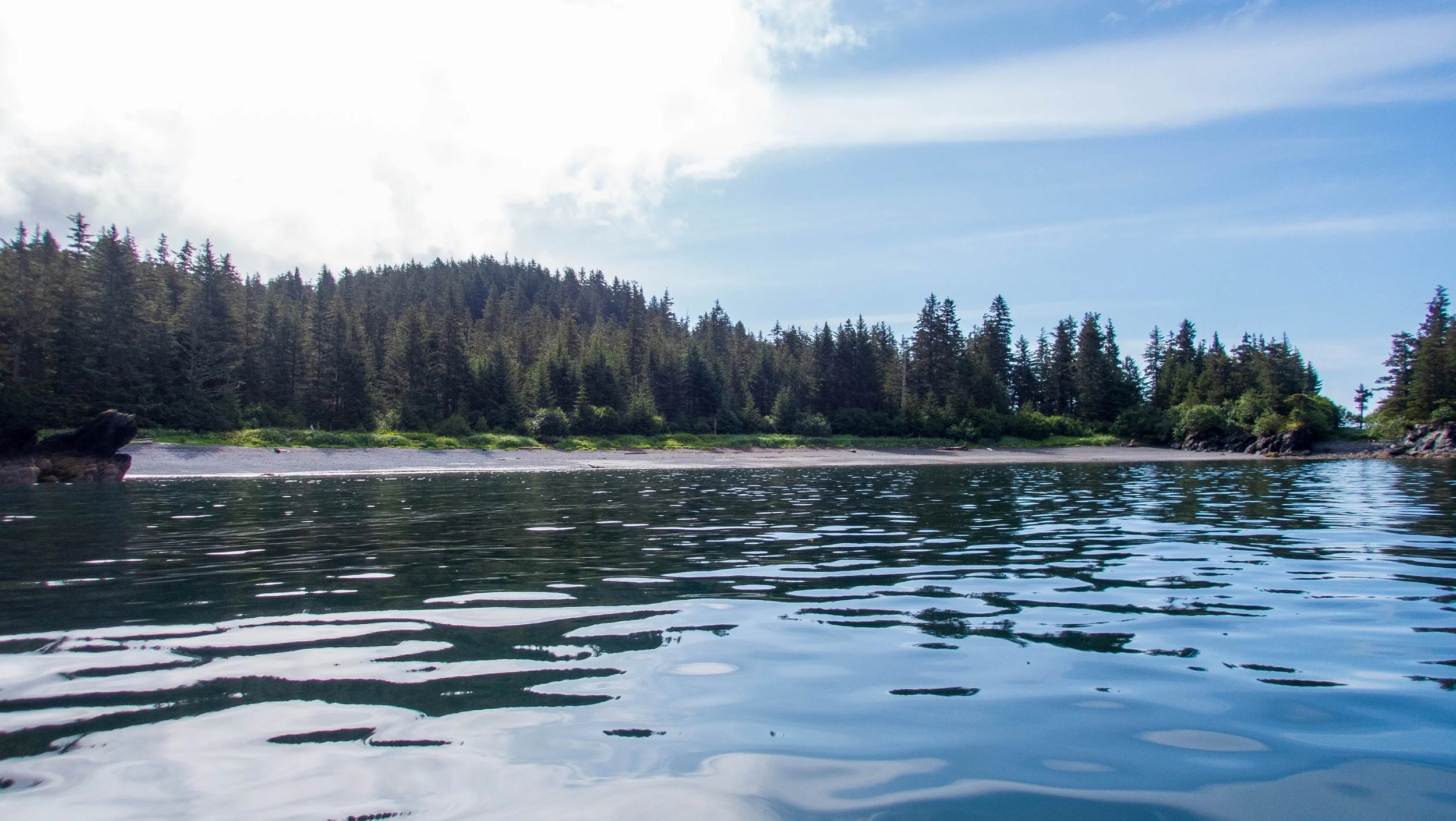
The campsite we found that afternoon was a delight: an easy cobblestone beach with a freshwater creek. We all felt that we could have paddled more miles, but there was no need, as the forecast required us to hole up near Chrome Bay to wait out another storm in the forecast.
Campsite near the former cabin near Mt. Bede
Day 5: Mt. Bede camp to Chrome Bay peninsula - 13.3 nmi, 24.6 km.
Left: Paddling SE toward Chrome Bay before the storm
Right: The delightful beach on the Chrome Bay peninsula
As we paddled out in the morning, we had an easy paddle south point to point until we turned the corner and headed east. There, we were hit by an east headwind that increased as we paddled, as well as an opposing current. The rocks and reef made it difficult to get closer to shore in our Feathercrafts. We landed at a nice beach on the west peninsula at Chrome Bay around 2:30 pm, ready for a lunch break. Based on an aerial view, Stuart thought there might be a campsite inside Chrome Bay, so we paddled to explore it. The campsite was nonexistent, so we headed back to the original site in what was now significant wind and churning waters in the shallow bay. But the campsite on the side of the peninsula was great, offering good protection from the east wind, and an expansive shoreline. We stayed here for an extra day, waiting out the winds that were forecasted to reach 30-40 knots.
Day 7: Chrome Bay through Chugach Passage to Black Sand Beach - 18.2 nmi, 33.7 km.
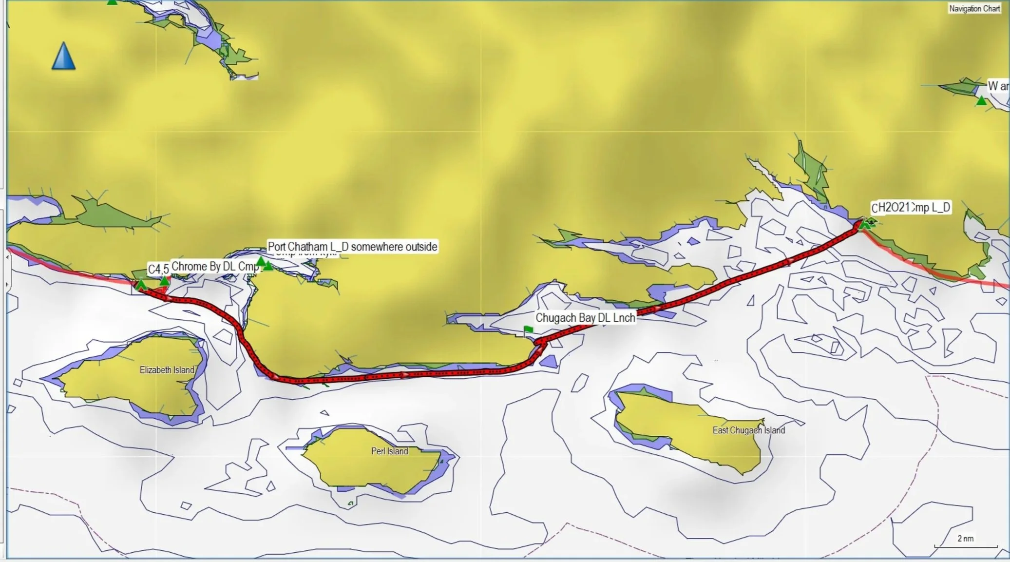
We slept in a bit later as we were planning the paddle through Chugach Passage, which can face significant currents, to be on an easier side of the opposing flood. By sticking to the east side we were able to avoid much delay. The winds were light, which made the longer paddle easier. As we paddled east across Rocky Bay, we could see Black Sand beach from quite a way off. We were happy to have made good progress in favorable conditions.
Day 8: Black Sand Beach to Ranger Beach - 12.8 nmi, 23.7 km.
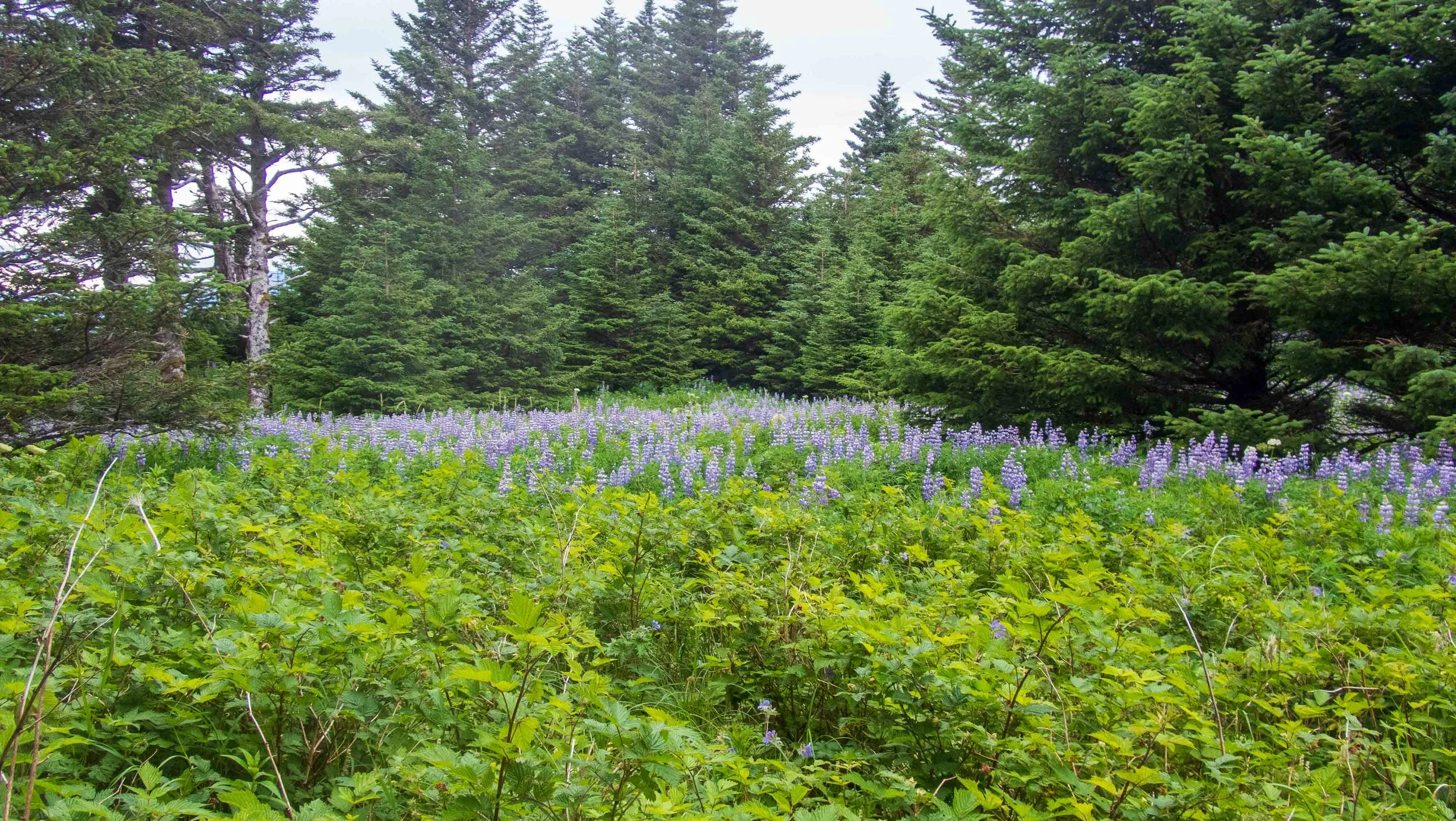
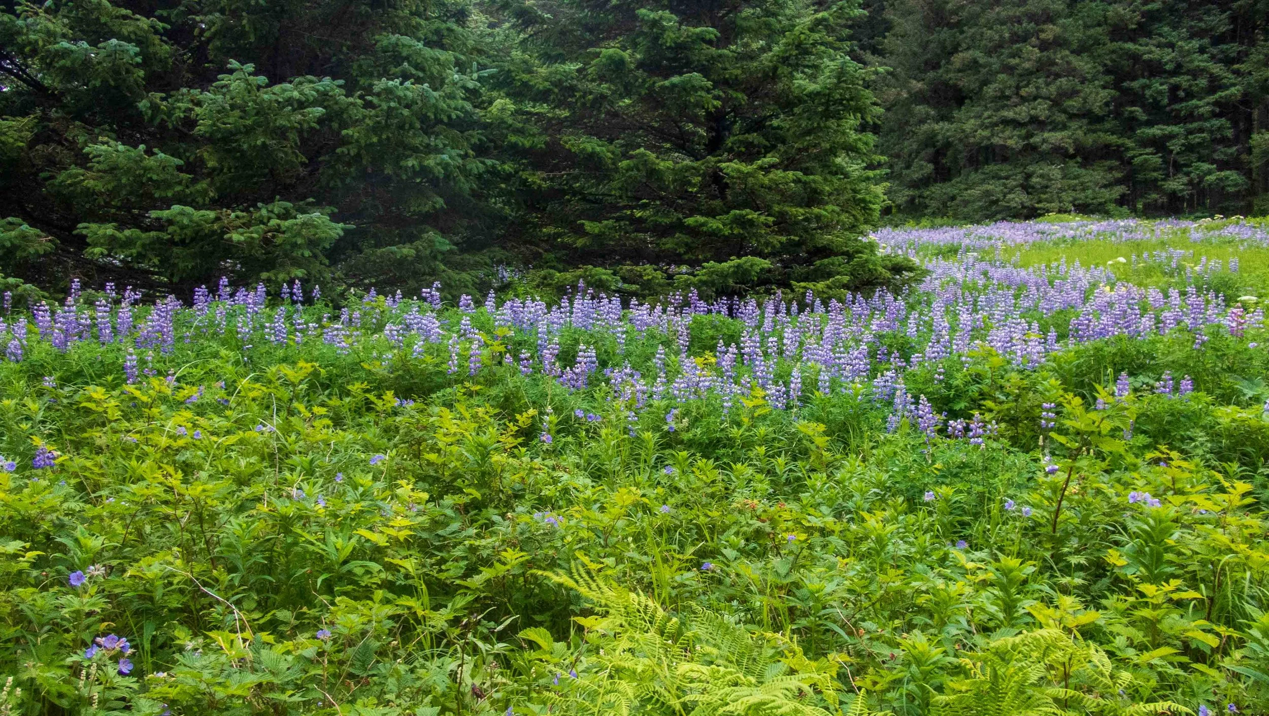
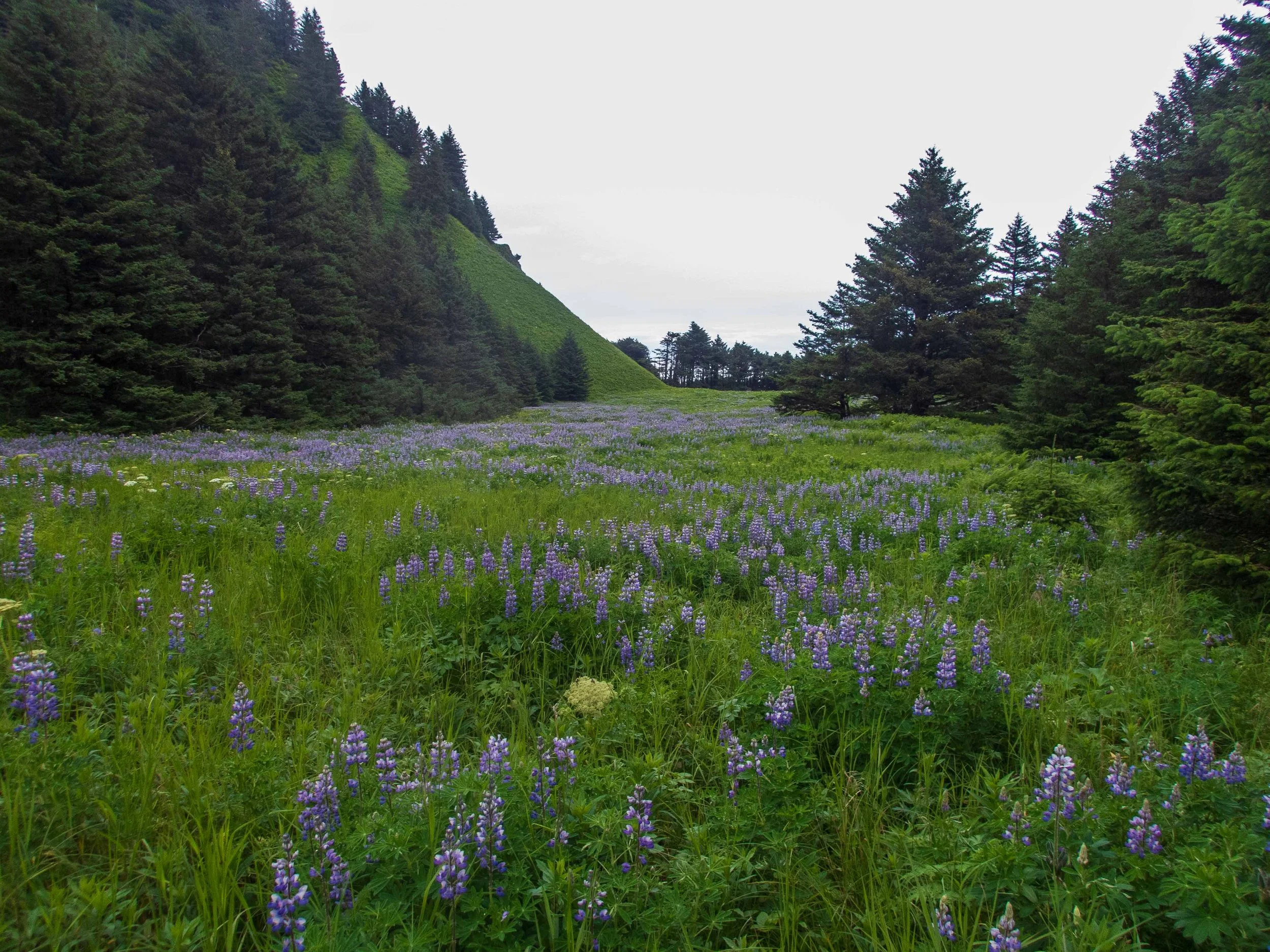
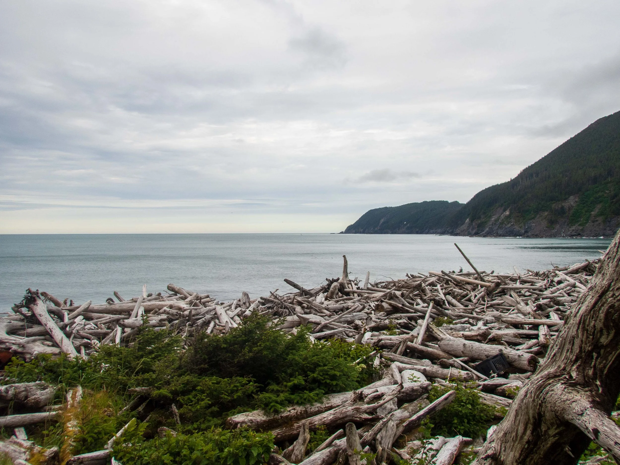
We had an easy and uneventful paddle from Black Sand Beach to Ranger Beach, arriving around 2 in the afternoon. Ranger Beach was an incredible delight, and without question the best beach of the entire trip! After setting up camp, we set off to explore the peninsula and seek out a use trail that led to the opposite side of the beach. Wow, the fields in the peninsula were ablaze with spectacular wildflowers, and the area seemed untouched. We spotted a coyote on the trail as we made our way to the east beach. As described in the guidebook, the east beach was piled over head high with huge logs, clogging the entire beach. It would have been great to spend an extra day or two here, but we had distance to cover.
Ranger Beach Slideshow
Day 9: Ranger Beach around Gore Point to S. Berger Bay - 18.8 nmi, 34.8 km.
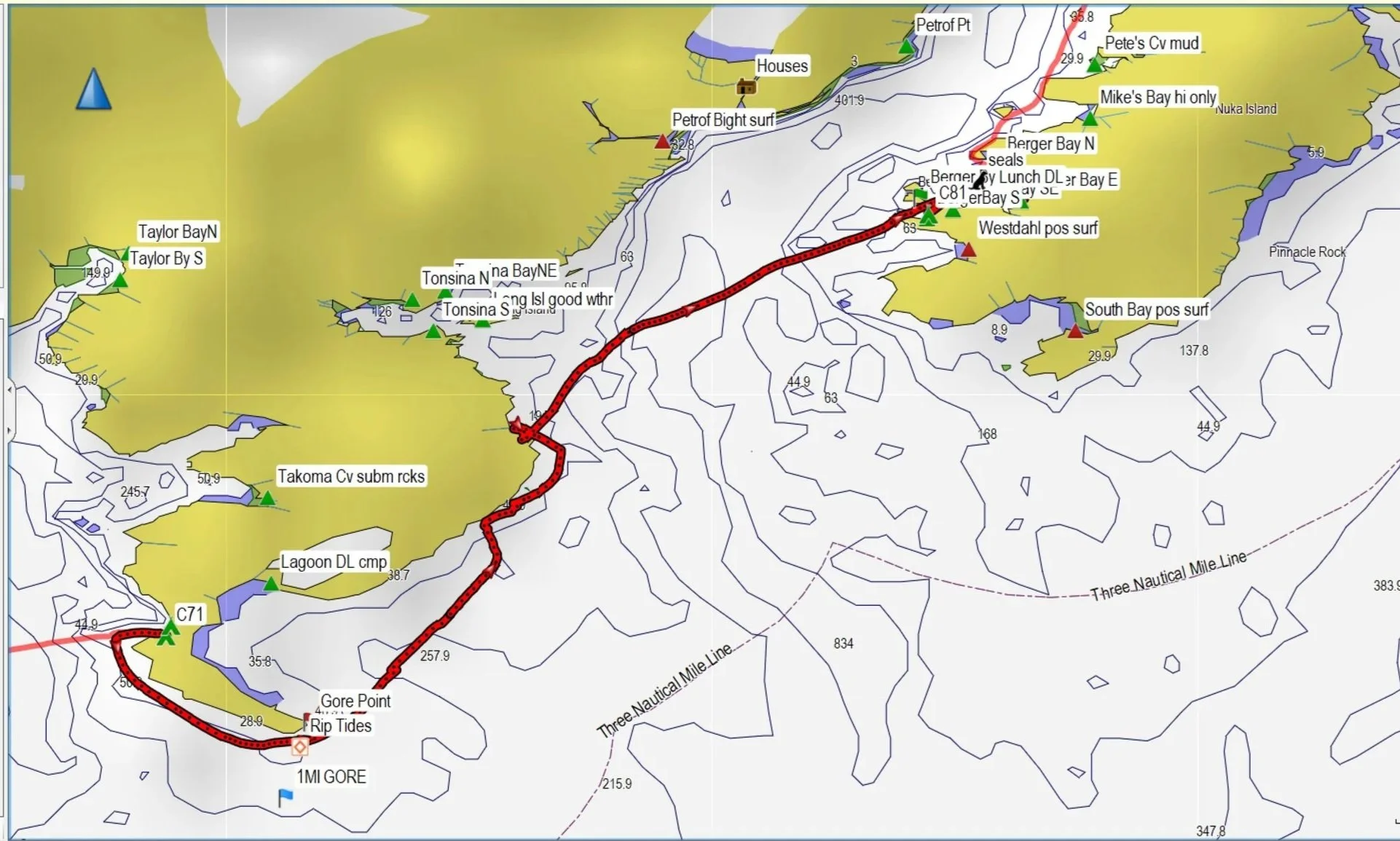
I slept horribly in spite of the previous day’s long paddle, and we were up at 3:15 a.m. to prepare to round the infamous Gore Point during slack. Considered the “crux move” of the entire paddle, the guidebook and charts warn of significant current, rip tides and chop at Gore Point. But as we were near slack and in favorable weather, rounding the point was a non-event. During the long stretch of the Gore Point hillside, we saw mountain goats on the hills above, and a black bear on one of the beaches. The seas were calm with just a slight swell. We had rounded Gore Point by 8 a.m., and although we were thinking of landing at Tonsina Bay, we agreed we’d all rather paddle a bit further and see Berger Bay. After stopping at Front Point for a bio- and lunch break, we headed off across the bay toward Nuka Island. We spied a humpback whale along the way, as well as a few puffins and sea otters. Inside the bays of Nuka Island, I saw a merganser family with 8-12 ducklings in tow. Once inside the shelter of Berger Bay, we spent a bit of time paddling around looking for a decent campsite, before returning to settle on a campsite we’d seen earlier.
Day 10: S. Berger Bay to Islet Basin - 8.3 nmi, 15.4 km.
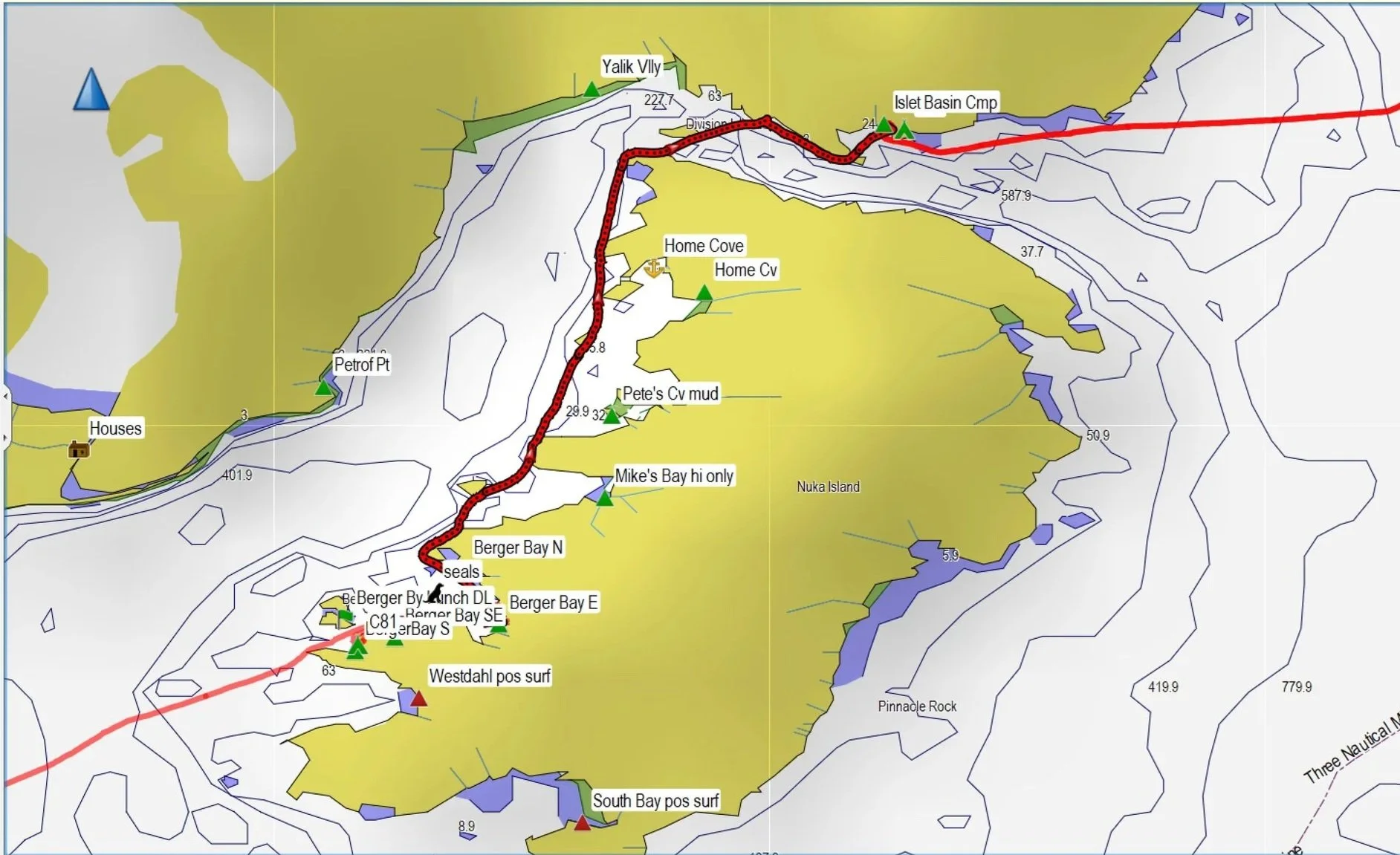
There was another storm in the forecast, expected the next day. We launched with a moderate headwind that faded after a couple hours. But there was clearly an opposing current I could feel while paddling, although others disagreed there could be an opposing flood current out of the bay. But it all depends on bathymetry - it made sense based on volume of water, and the limited information in the Coastal Pilot #9 about McArthur Passage. Our progress was just above 2 knots, much slower than usual. Stuart preferred to stop at Islet Basin to camp rather than crossing to Ariadne Cove. Given the rain and our cumulative fatigue, it was a good call; by 5 pm there were whitecaps out in the narrow channel north of Nuka Island. The campsite was great, with nice, large tent sites in the woods. The next day, we rested and discussed our paddling plan, while the rain, wind, and noisy surf continued outside.
Paddling north toward Islet Basin the day before a storm
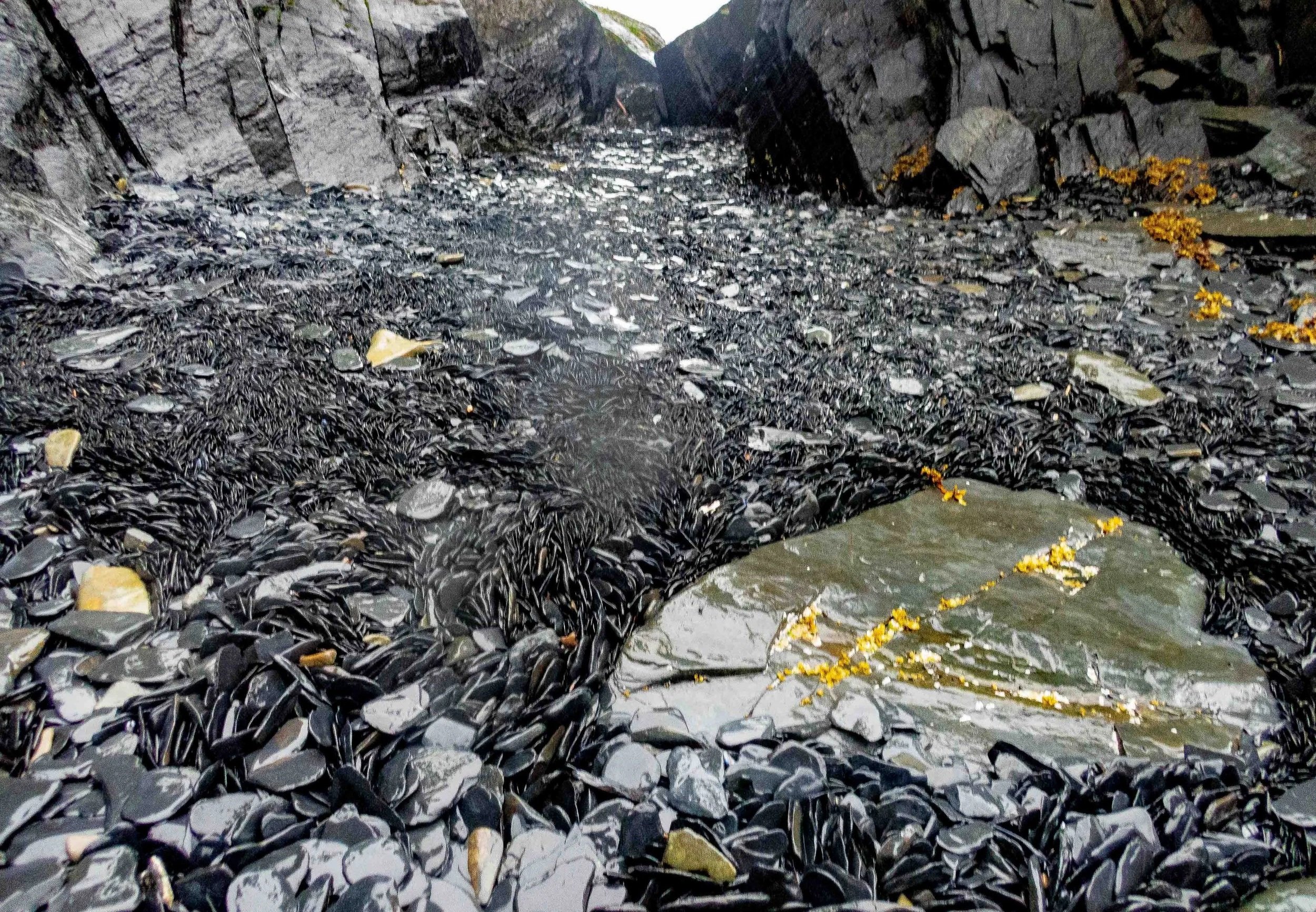
The beach at Islet Basin was filled with beautiful shale rocks that had been softened by the surf.
Day 12: Islet Basin to Chance Lagoon - 14.9 nmi, 27.6 km.
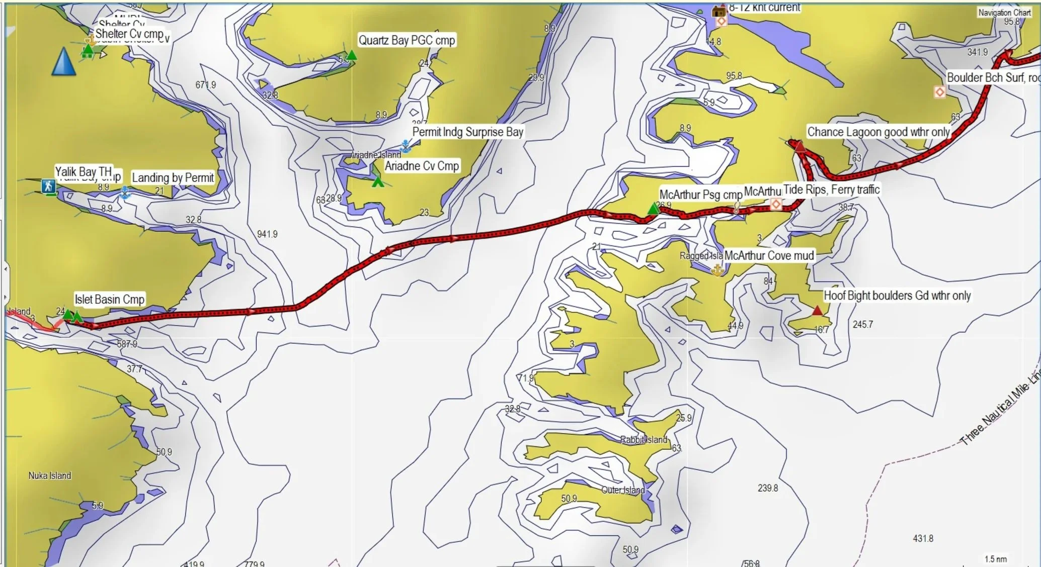
Feeling a bit more rested, we set off from Islet camp to cross the strait to McArthur passage. There was a significant opposing current coming through McArthur passage, which slowed our progress. Stuart and Franca ended up further south, while I pushed a bit north to get further out of the current. We all met up at the mouth to McArthur passage and looked for a suitable place to stop for a break on the north side of the cove. There were no suitable campsites and no suitable landing sites, which was a bit frustrating. Taking note of the tide rips, we stayed to the south side of the passage and avoided most of the churning water on the shallower north side. Once through we pulled into Chance Lagoon to look for the campsite mentioned in the guidebook. It turned out to be very poor quality - really a series of rocks that we were able to land on, just barely. As I had the only working half-pipe sliders, I went first and then handed the sliders off to Stuart and Franca to pull their kayaks up on the rock. We were lucky with tide height in the afternoon, but not for the rest of the stay! Stuart and Franca had to move their tents perched on the rock around 2 a.m. My tent was higher in the forest, but we all had to move gear further up the rock ledge to avoid the tides. Launching in the morning was even worse…
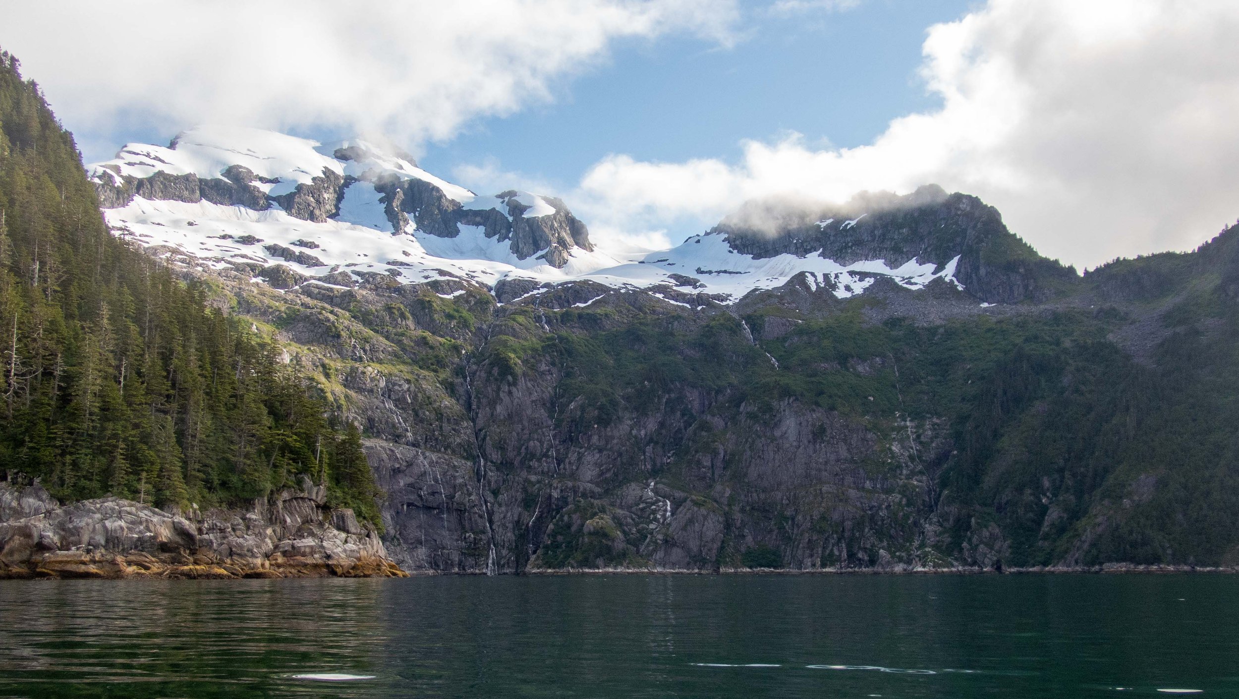
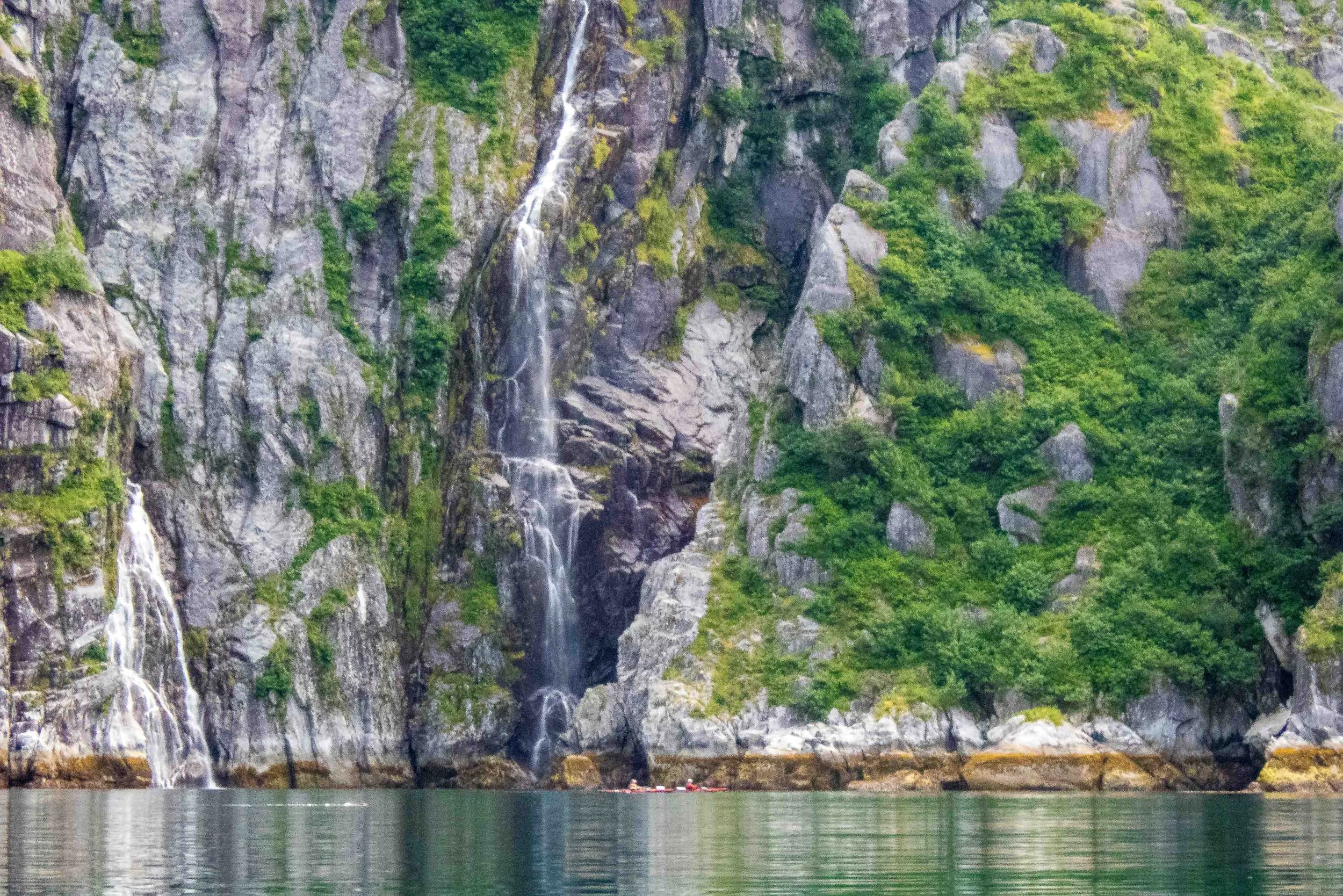
Day 13: Chance Lagoon to Surok Point - 16.6 nmi, 30.7 km.
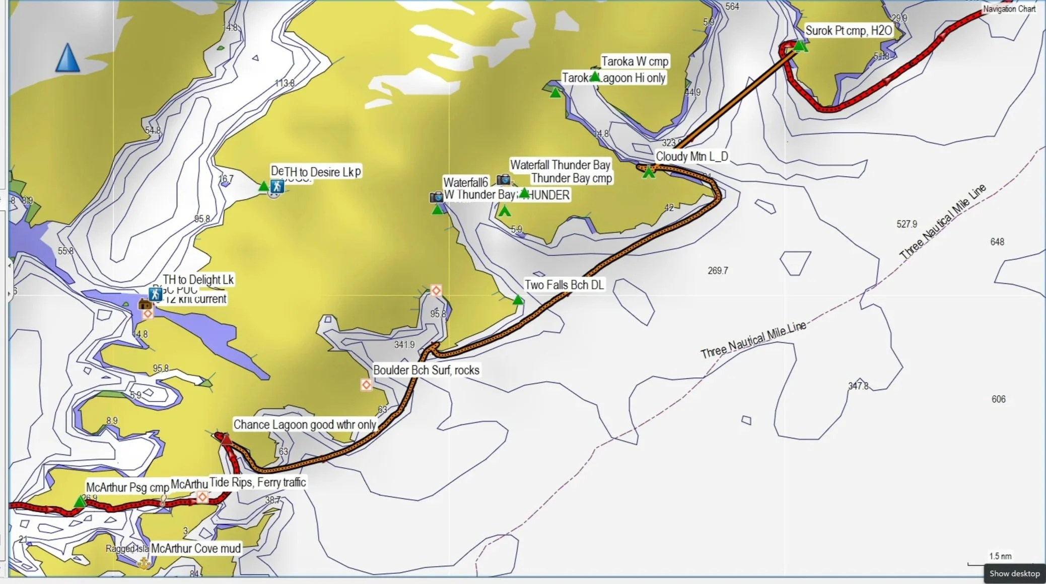
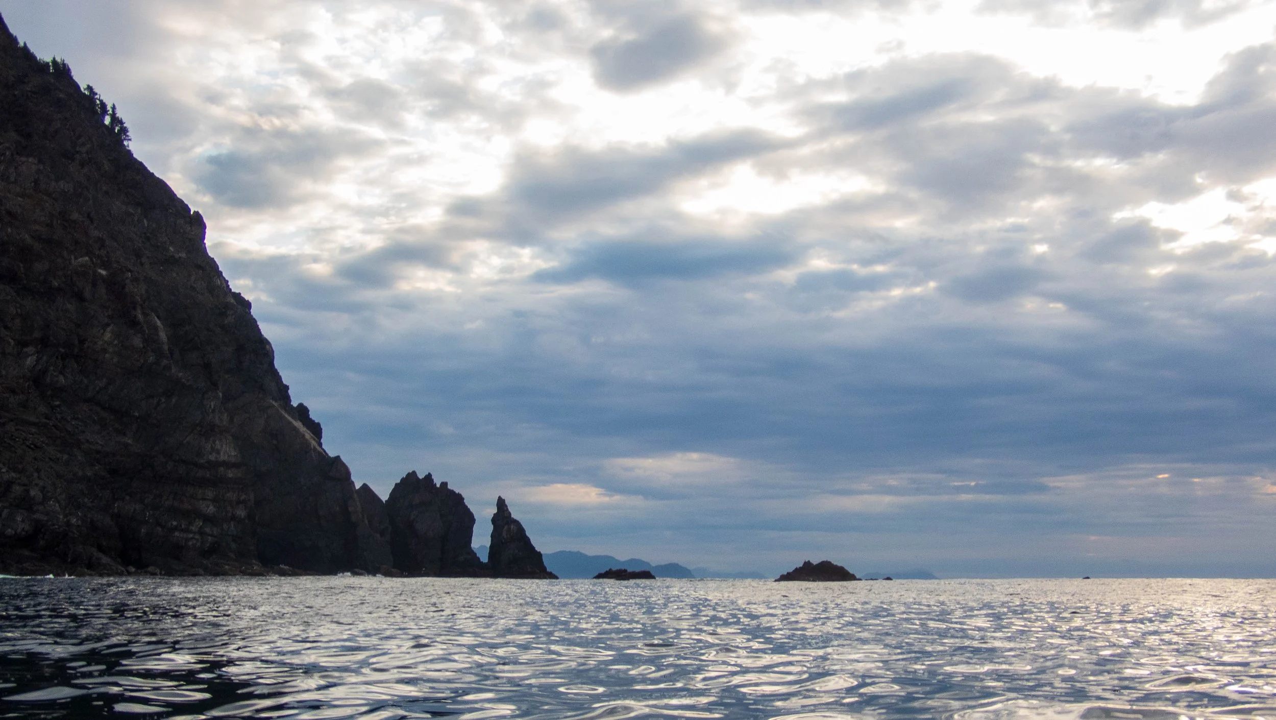
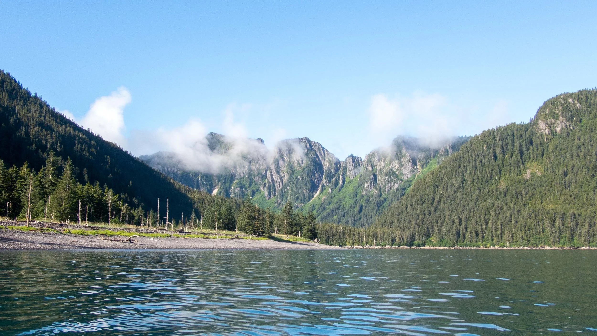
This day was the most unpleasant kayaking I had ever experienced! After being up in the middle of the night to move some of our gear from the tide, the morning brought a low tide that looked horrendous for a launch: rocky, barnacle-covered steep rocks, or a slippery, moss-covered ledge that would allow only one very careful launch at a time. Definitely not a good place for Feathercrafts, so I was glad I had my half-pipe sliders. But, my first problem was a health issue: while starting to walk around to load, I was dizzy, and I developed some vertigo. I’ve had benign positional paroxysmal vertigo before, and often I can correct it soon enough with rest and fluids, as it can be caused by dehydration and ‘rocks’ in the inner ear canal. Worse, I discovered that if I stood still and merely turned my eyes, I became dizzy and my vision blurred. It was a bit frightening, so I began drinking a lot of water while I loaded my gear. In about 30 minutes, it had improved enough that I felt I’d be able to paddle without becoming nauseous, so I loaded up and launched. Now with a full bladder from more than 1.5 L of water, I paddled across the cove to a marginal beach for a bio-break while Stuart and Franca loaded their kayaks. What I didn’t realize is that there were no places to land for the next many miles, as the swell was larger and the beaches were all exposed. As we paddled north past Boulder Beach, my full bladder was painful and began cramping. I did NOT want to lose control in my new drysuit! I was able to make a rough landing on some rocks inside Boulder Bay, but the pain didn’t subside, and it was a long miserable day. I believe I wrenched a muscle in my back while getting in and out of my kayak in surf surge. After a short stop at Cloudy Mountain, we crossed the bay to Surok Point, which turned out to be a delightful campsite.
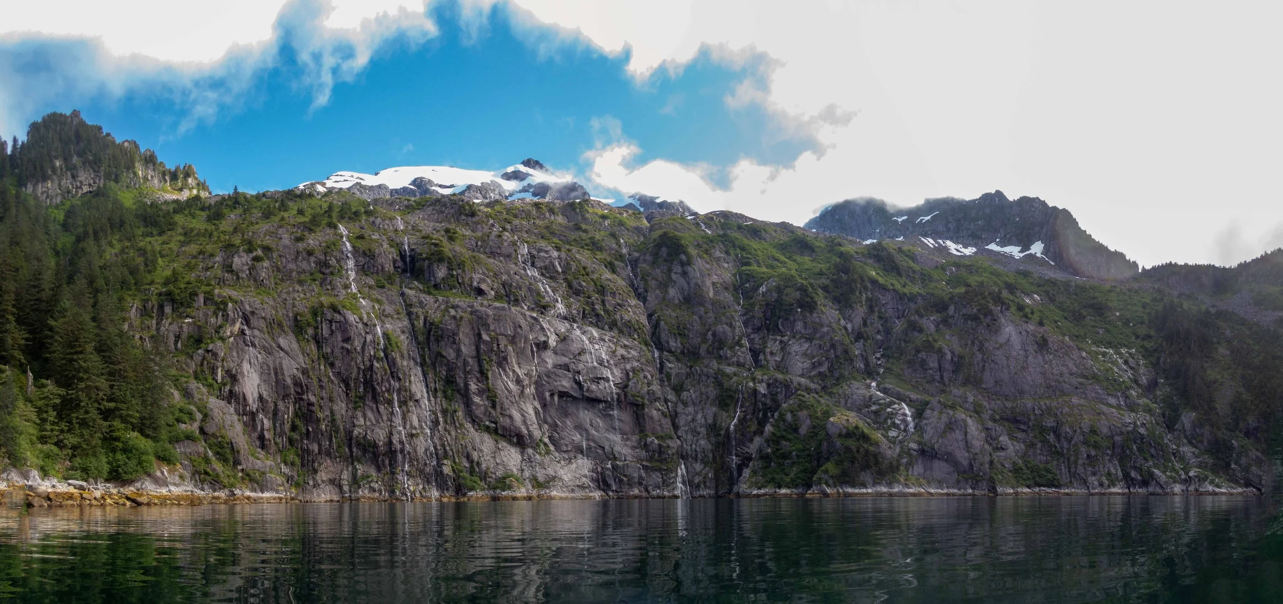
Paddling past beautiful but rocky shores, and finally into a wonderful campsite at Surok point, complete with a waterfall
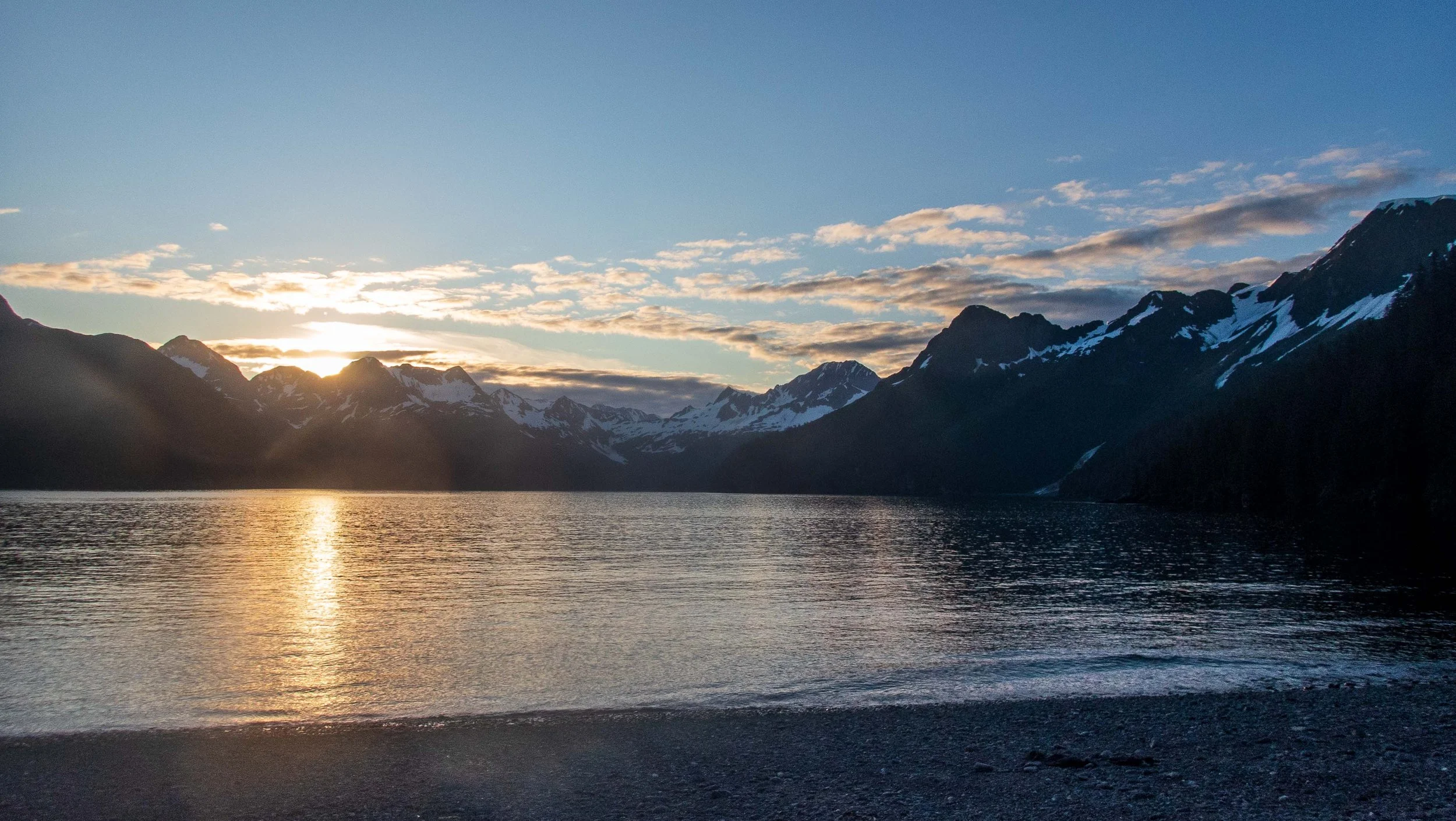
The sunset at Surok Point was fantastic.
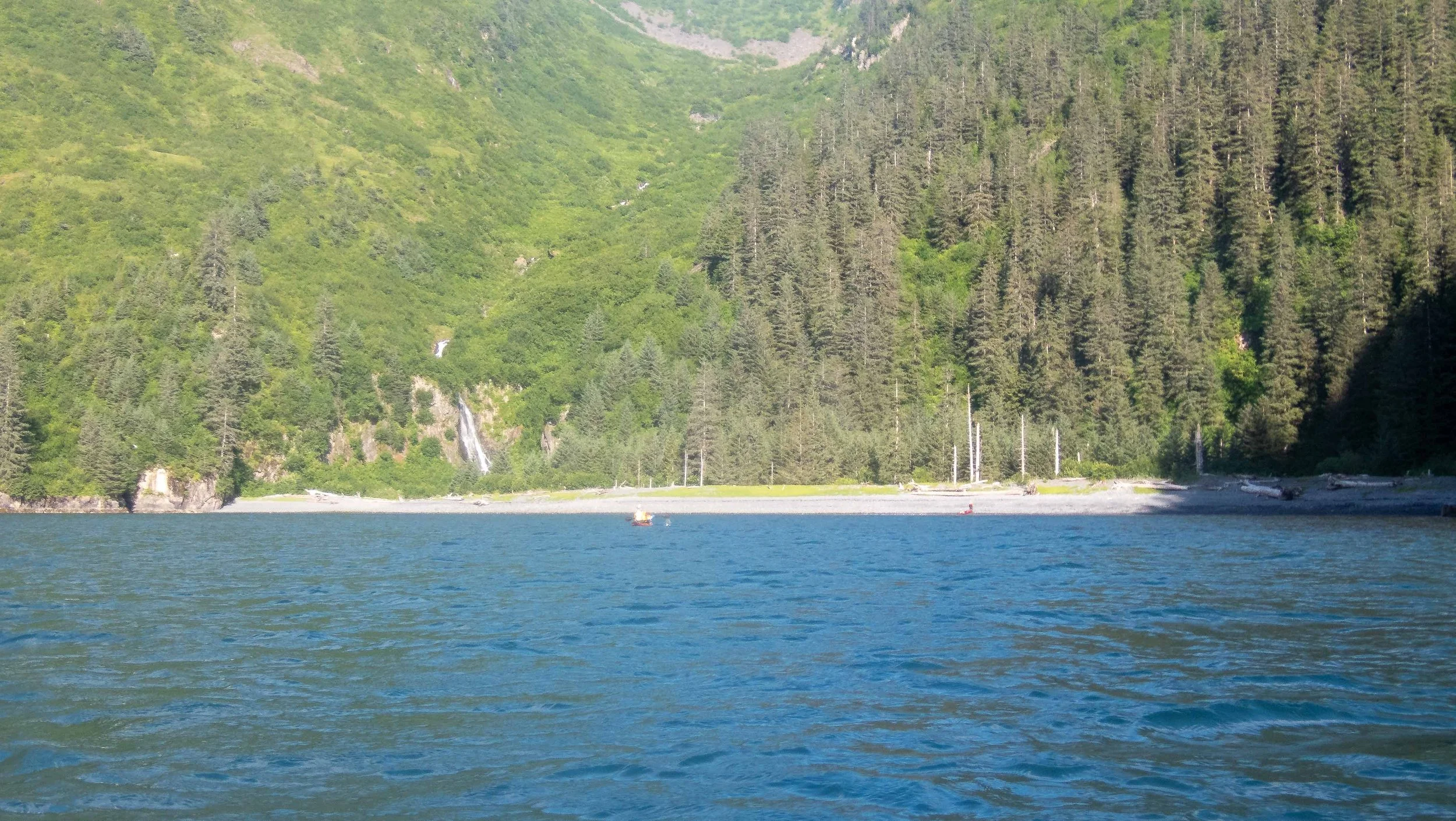
Day 14: Surok Point to S. Ribbonfall : 12.5 nmi / 23.1 km
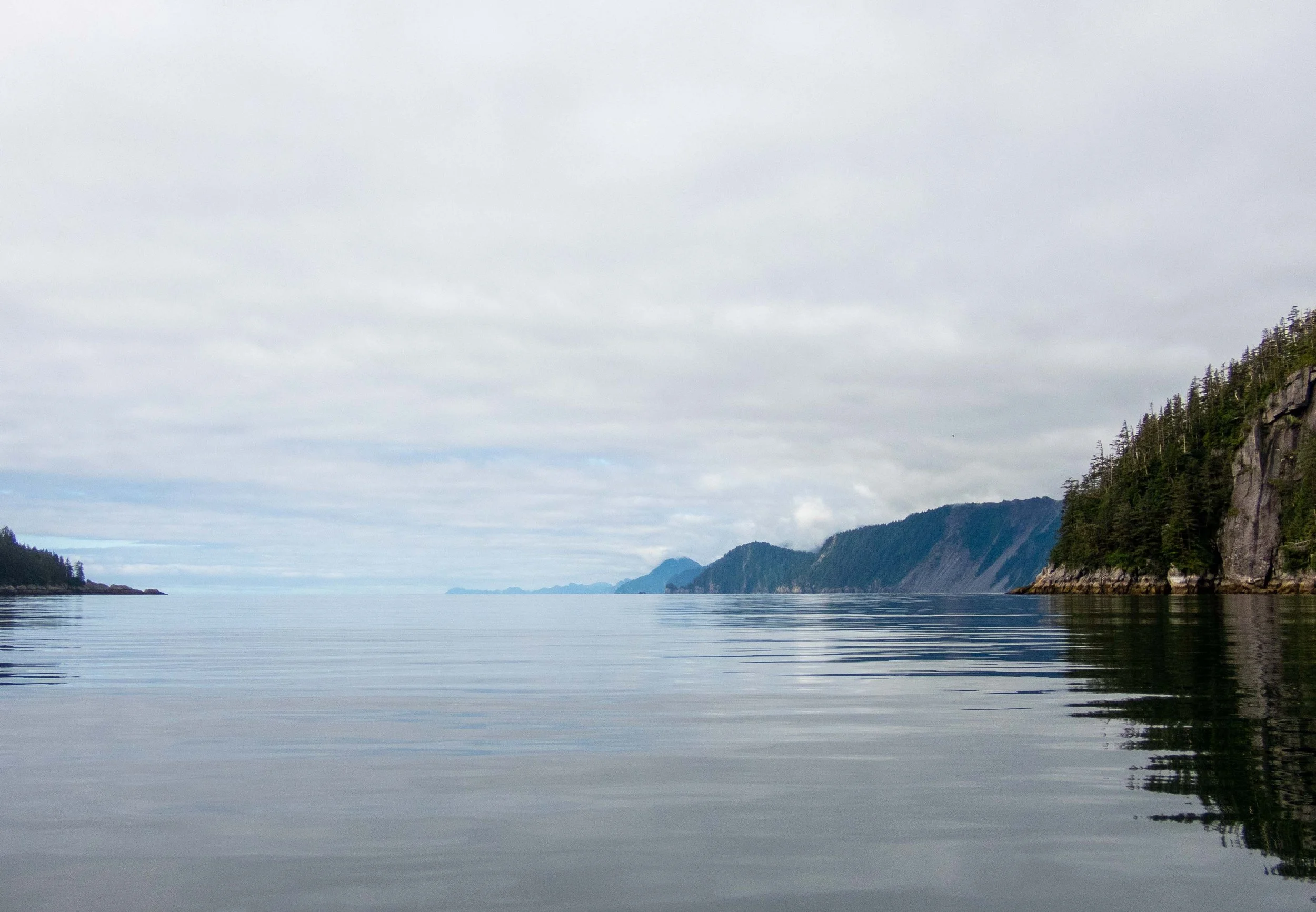
The next day dawned sunny with occasional wisps of mist, and the view from our beach was spectacular. We had a shorter distance to travel around the point and northeast along the coast into the Northwestern Fjord.
Morning at Surok Point
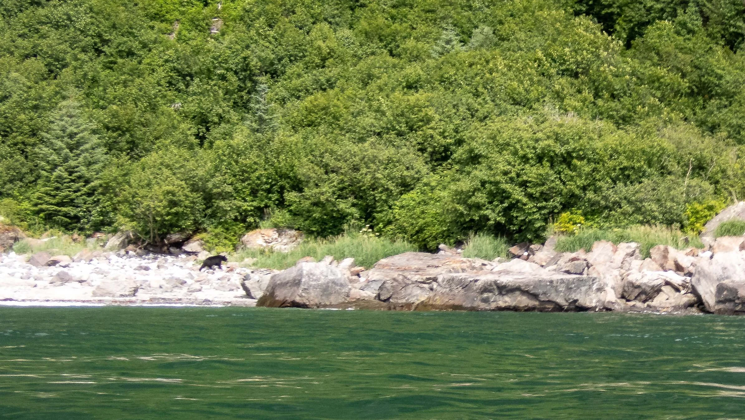
We decided to head straight for the eastern side of the moraine bar as recommended by the guidebook, and I set a bearing and paddled directly there across Harris Bay. Pulling in to the corner of the Northwest passage around 3:45 p.m., there was a small beach where I spotted a black bear foraging. We were eager to stop, so were glad to see that he disappeared into the bushes as we approached. After a short lunch, we rounded the corner into the fjord to find our camp at S. Ribbonfall Cove. It was a beautiful camp, and the sunny day and great views elevated my mood.
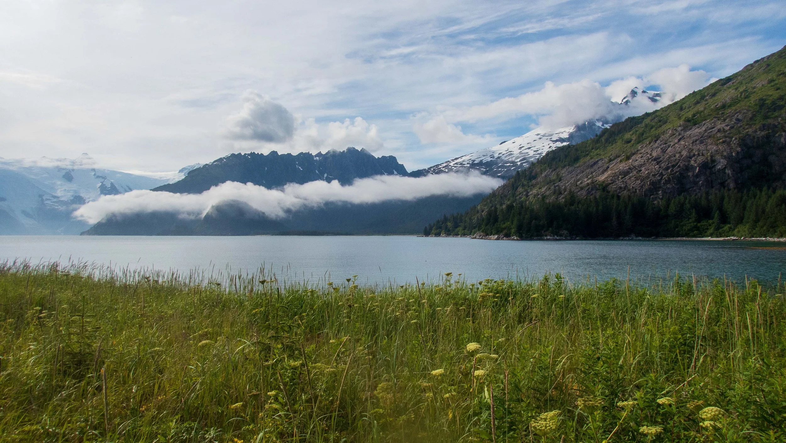
S. Ribbonfall Cove camp - another spectacular campsite
The muscle I had wrenched in my back was hurting, and I was still having bladder issues from my long day without a rest stop, so I took the next day off to rest and repair some gear, while Franca and Stuart paddled up to get a closer view of the Northwest glacier. Having seen many glaciers before, I was happy to recuperate instead. It was a bit buggy in camp as there was little wind. In the late afternoon, some kayakers stopped by, the first we had seen on our trip so far. We met Mike from Adventure Sixty North, a guide who stopped by while out leading clients to the Northwest glacier in the fjord. They camped across the bay and were planning a day trip to visit the glacier the next day. Mike told us that Adventure Sixty North indeed rented kayaks for exploring the Kenai Fjords, in addition to leading guided trips (See Notes below).
Day 16: S. Ribbonfall Cove to Verdant Cove : 14.9 nmi / 27.6 km
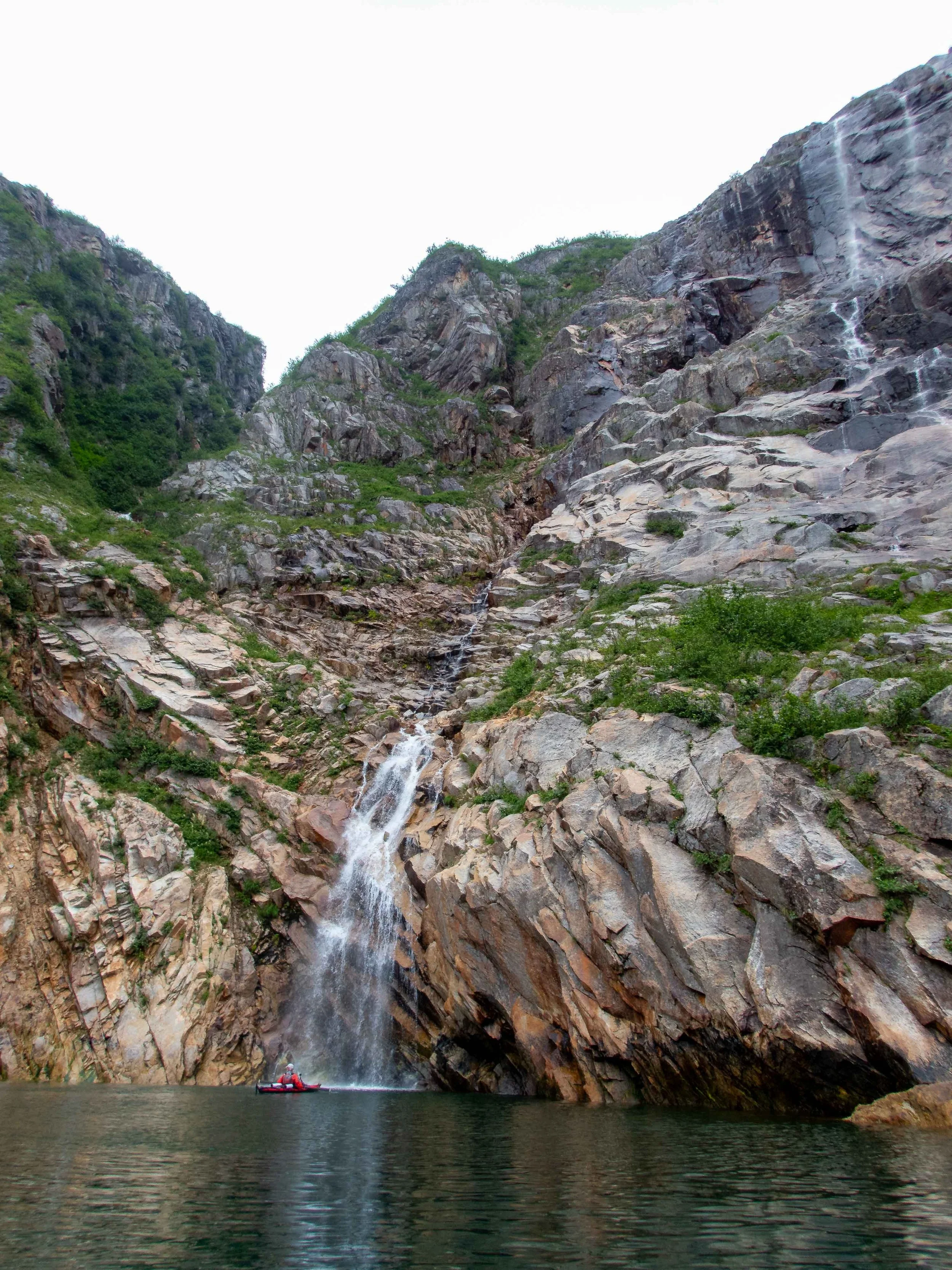
It was quite buggy in the morning, and we had to eat our breakfasts hovered over our food with headnets on. My back pain was getting worse as I loaded and got on the water. The sun was very bright though, and my spirits lifted as we pulled into Cataract Cove, a beautiful little cove filled with must-see waterfalls. Mentioned by the guidebook, it was one of the sights along the way I had wanted to see. Stuart and Franca went for a splash from the largest waterfall while I stayed a bit further out to try to get a panorama photo. (None turned out, as the sun glare causes sunspots). After Cataract Cove, we paddled southeast along Harris Peninsula and through Granite Passage to round Aligo Point. There was unfortunately no place to stop along the way, so we ate lunch in our kayaks before proceeding north. A boat from the National Park Service stopped and chatted with us. They seemed impressed that we had paddled in Feathercrafts from Homer.
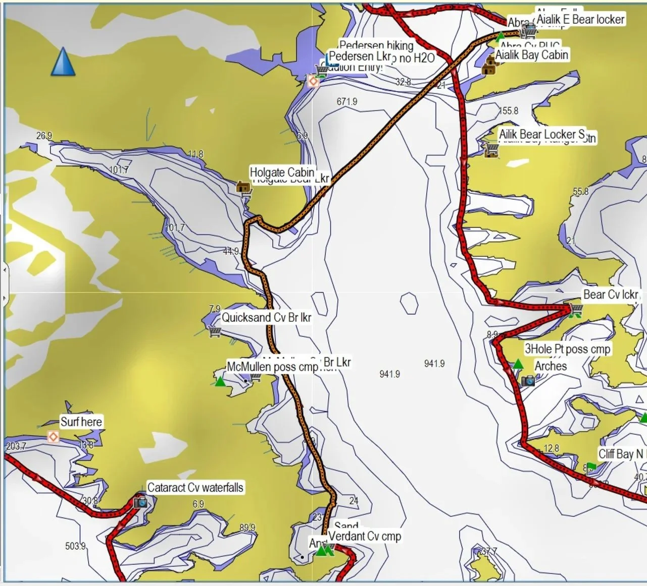
Rounding the corner into Verdant Cove, I spotted the first harbor seal I had seen on the trip. Verdant Cove offered a bear locker and nice campsites in the moss-covered forest. We were thinking of going further to McMullen Cove, but a sailing couple we met on the beach told us that a family of 3 had been dropped off there, and a fisherman’s boat was anchored right next to the beach. We decided to stay where we were. There was a forecast of bad weather the next day, and Verdant Cove seemed like a nice place to rest. It rained all the next day, and I took advantage of the opportunity to rest, read, and catch up on notes and chores.

Day 18: Verdant Cove to Abra Cove: 14.4 nmi / 26.7 km
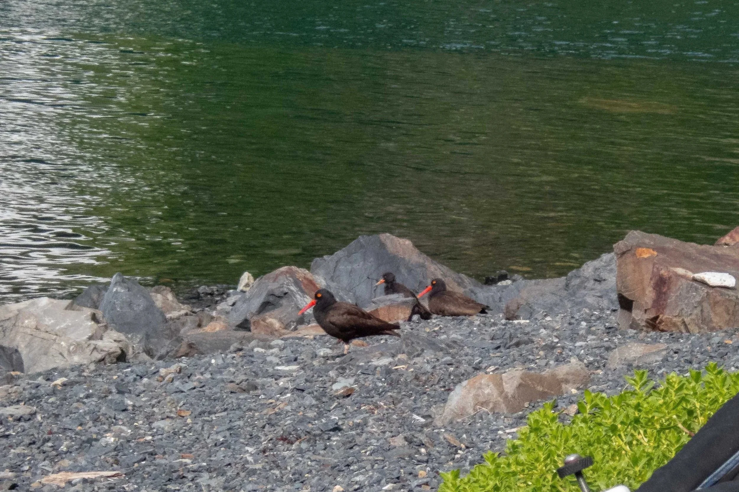
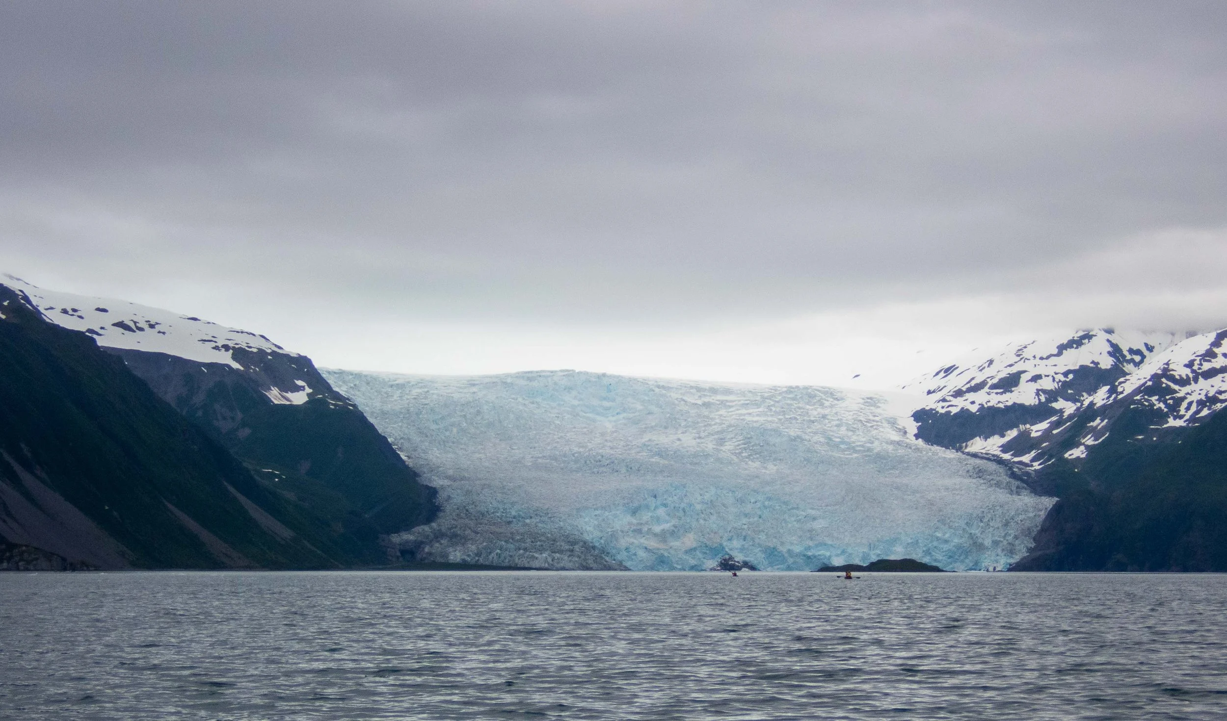
We paddled out of Verdant Bay on a beautiful day with sunshine and no rain nor wind. There was a minor opposition from an ebb, but we could make good progress by hugging the shore. We stopped for a lightning fast lunch and bio-break at the peninsula of Holgate Arm, enjoyed the views of Holgate Glacier, then paddled across Aialik Bay to Abra Cove, described as a “diamond in the rough” by the guidebook. We found a nice campsite with a bear locker on a somewhat rocky shore. We saw another pair of black oystercatchers (one of which was banded) with 2 fledglings. We gave them plenty of room.
Day 19: Abra Cove to Bear Cove: 13.3 nmi / 24.6 km
We launched from Abra Cove in a grey mist, but it wasn’t too cold. An anchoring yachtie called us over and told us that he had watched a large black bear walk toward us around the cove, walk behind our campsite and give us a look as we packed our kayaks. We were completely unaware of his presence. The yachtie wasn’t sure whether to make noise and alarm the bear, or just keep quiet; I was glad he chose the latter. The bear disappeared into the bushes before we departed the beach. With the bear locker there, the bear probably was not accustomed to scavenging much food at the campsite.
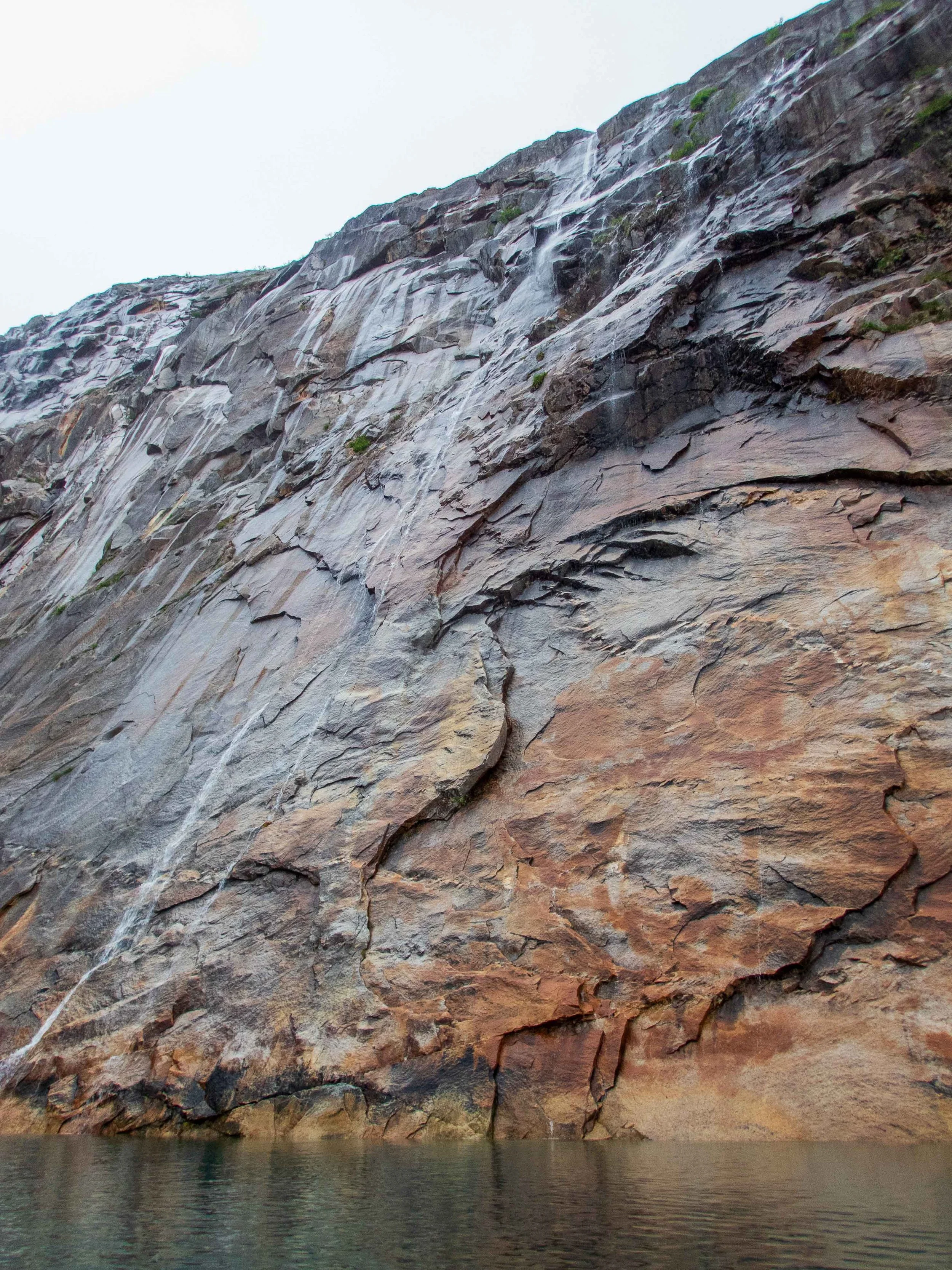
We stopped by Abra Waterfalls, with cascading waterfalls on a magnificent, multi-colored granite wall.
Abra Waterfalls
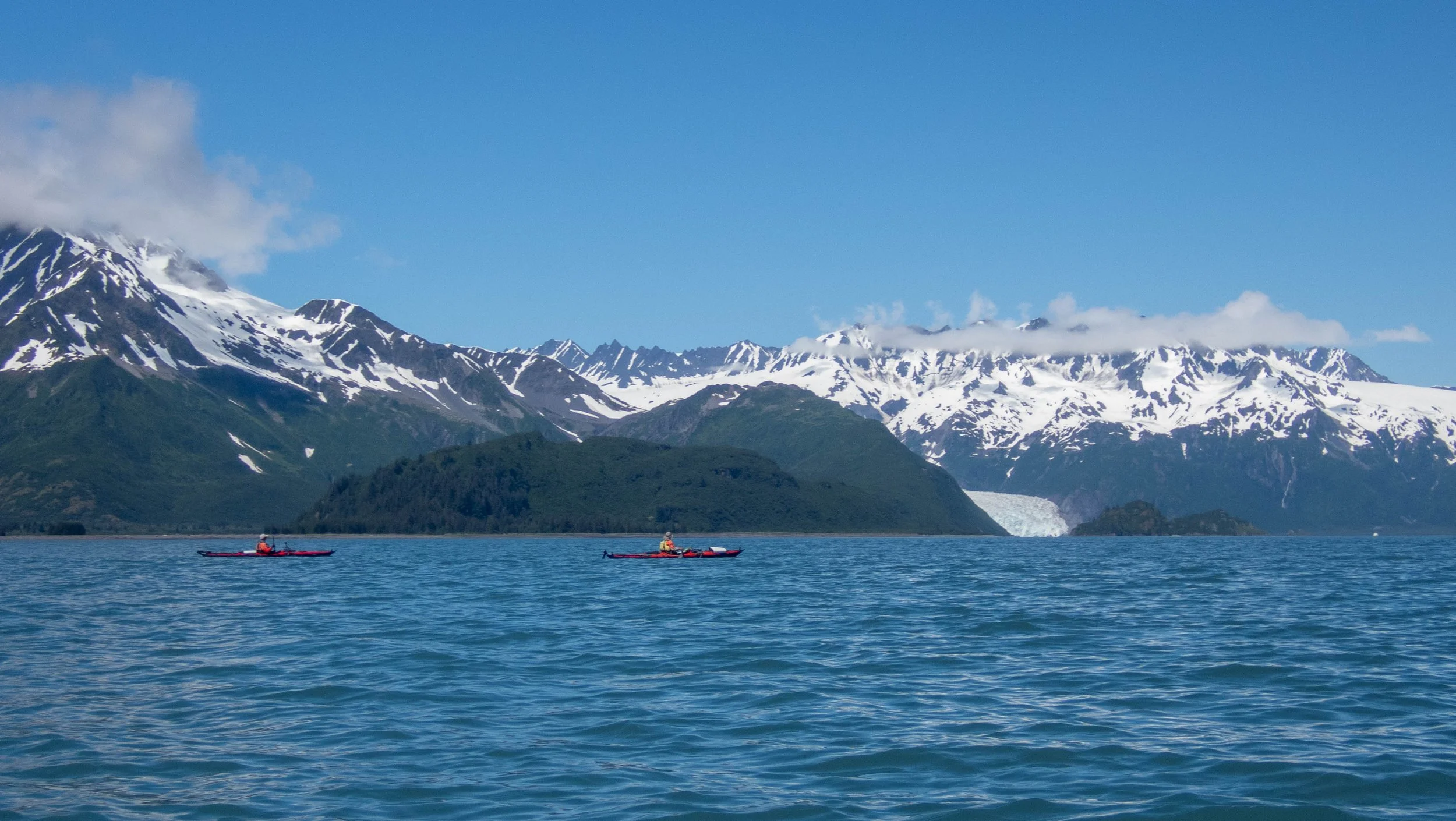
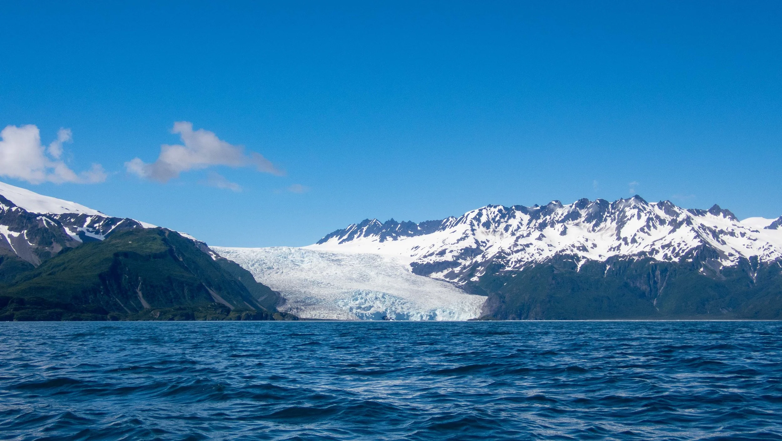
Stuart and Franca wanted to paddle closer to Aialik Glacier, several nautical miles away. Having seen many a cold glacier, I told Stuart I wouldn’t be following them all the way there. Instead, I paddled slowly across to Slate Island, the home of horned puffin and mew gull nests; I was hoping to see some horned puffins. Unfortunately, I saw neither puffins nor nests, but it was late in the year. Stuart and Franca had disappeared into the fog as they passed their original intended destination of Squab Island, so I paddled north to the end of Slate Island to find them without any luck. We connected briefly on the radio, where I told them to proceed south and I’d catch up with them at Bear Cove. I had a delightful paddle south along the peninsula before pulling in to Bear Cove less than 30 minutes behind them. Bear Cove was another delightful campsite. Fortunately, Bear Cove was not occupied, although Aialik Bay was clearly more populous than any area of our trip, filled with occasional cruise boats, sightseeing vessels, and a few touring kayaking outfitters.
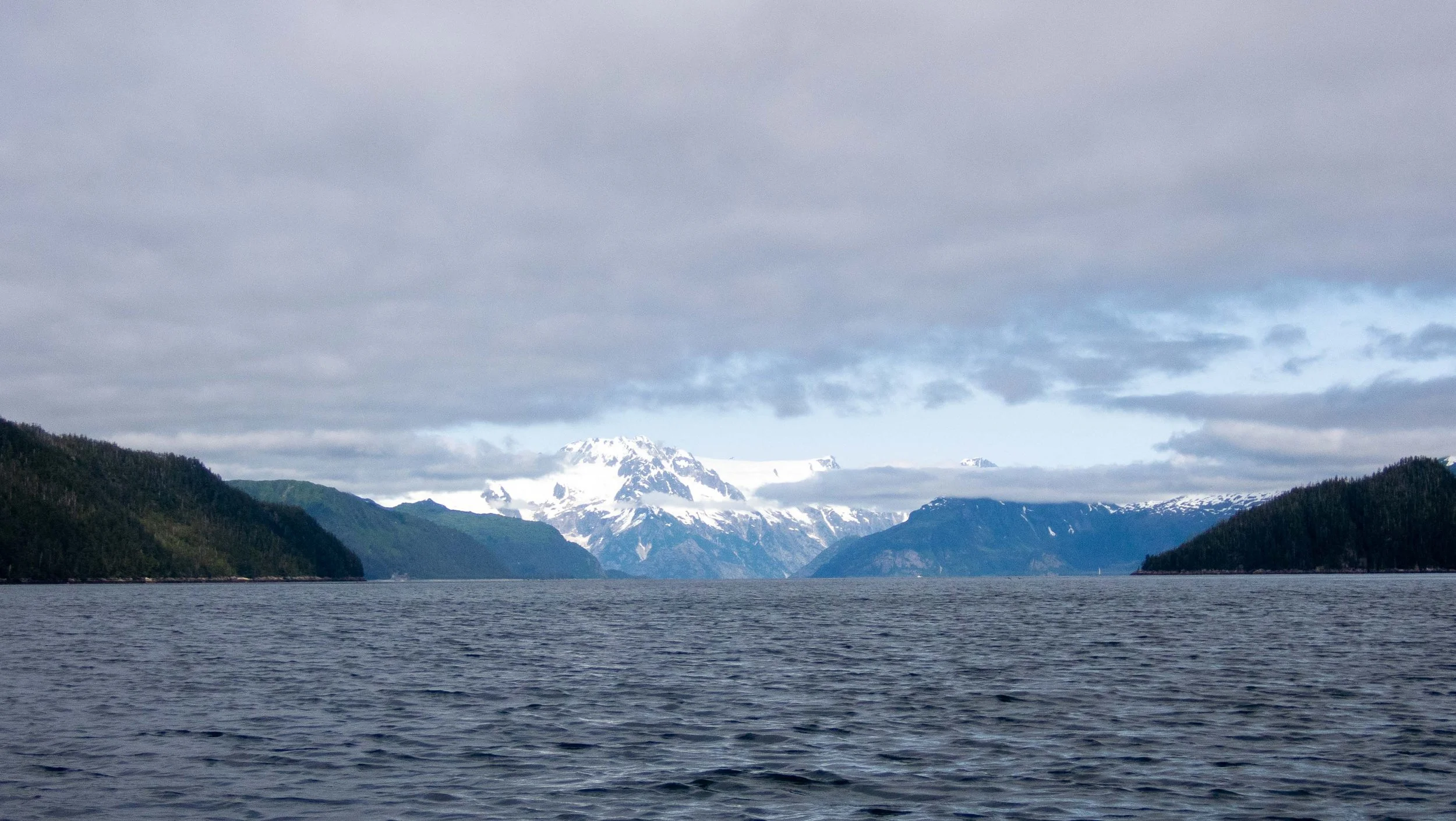
Day 20: Bear Cove to Bulldog Cove: 20 nmi / 37 km
This was to be a long paddling day, as there are no places to stop as we made our way around the long, exposed peninsula and then north into Resurrection Bay. I would have liked to spend more time exploring different areas in Aialik Bay and soaking up the wildlife and birds, but our arrival in Seward was scheduled for the 21st of July, just 2 days away. Moreover, my back was getting worse and loading and unloading my kayak, and movements in certain directions, were extremely painful. I knew I needed to rest that muscle or my upcoming kayaking trip to Greenland would be in jeopardy. Fortunately, my back didn’t hurt too much if I paddled with good torso rotation.
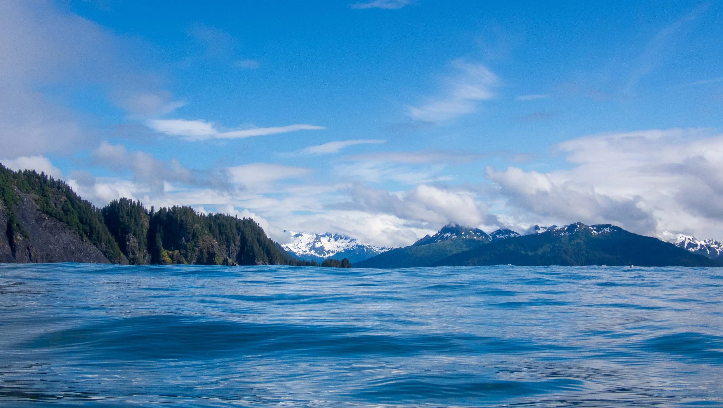
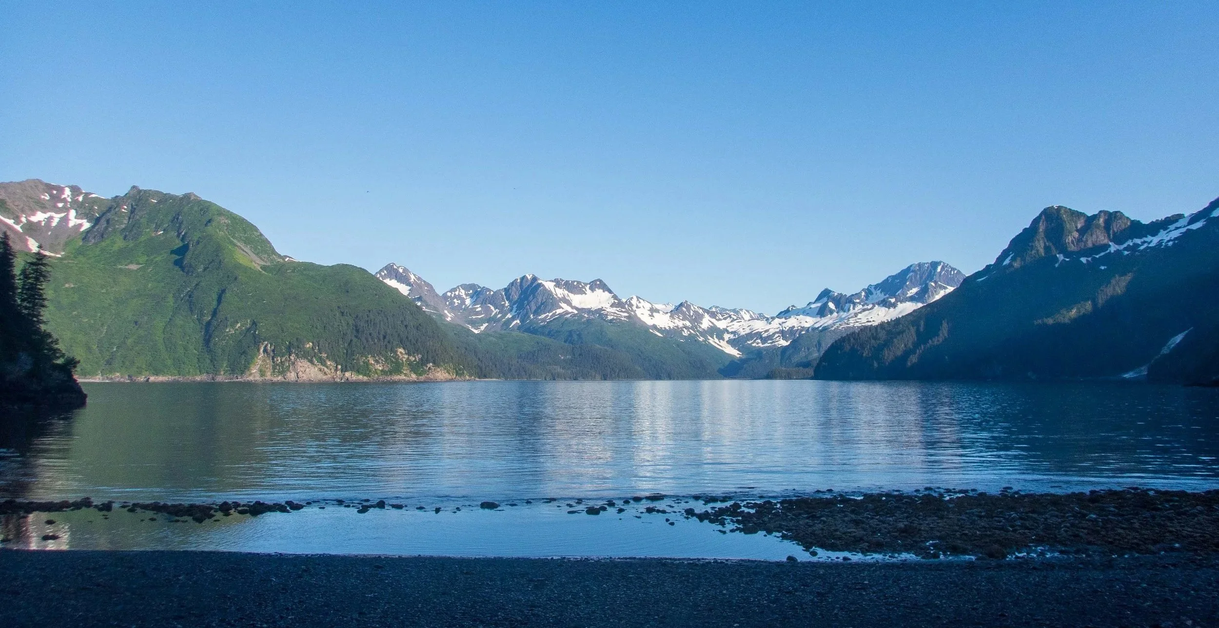
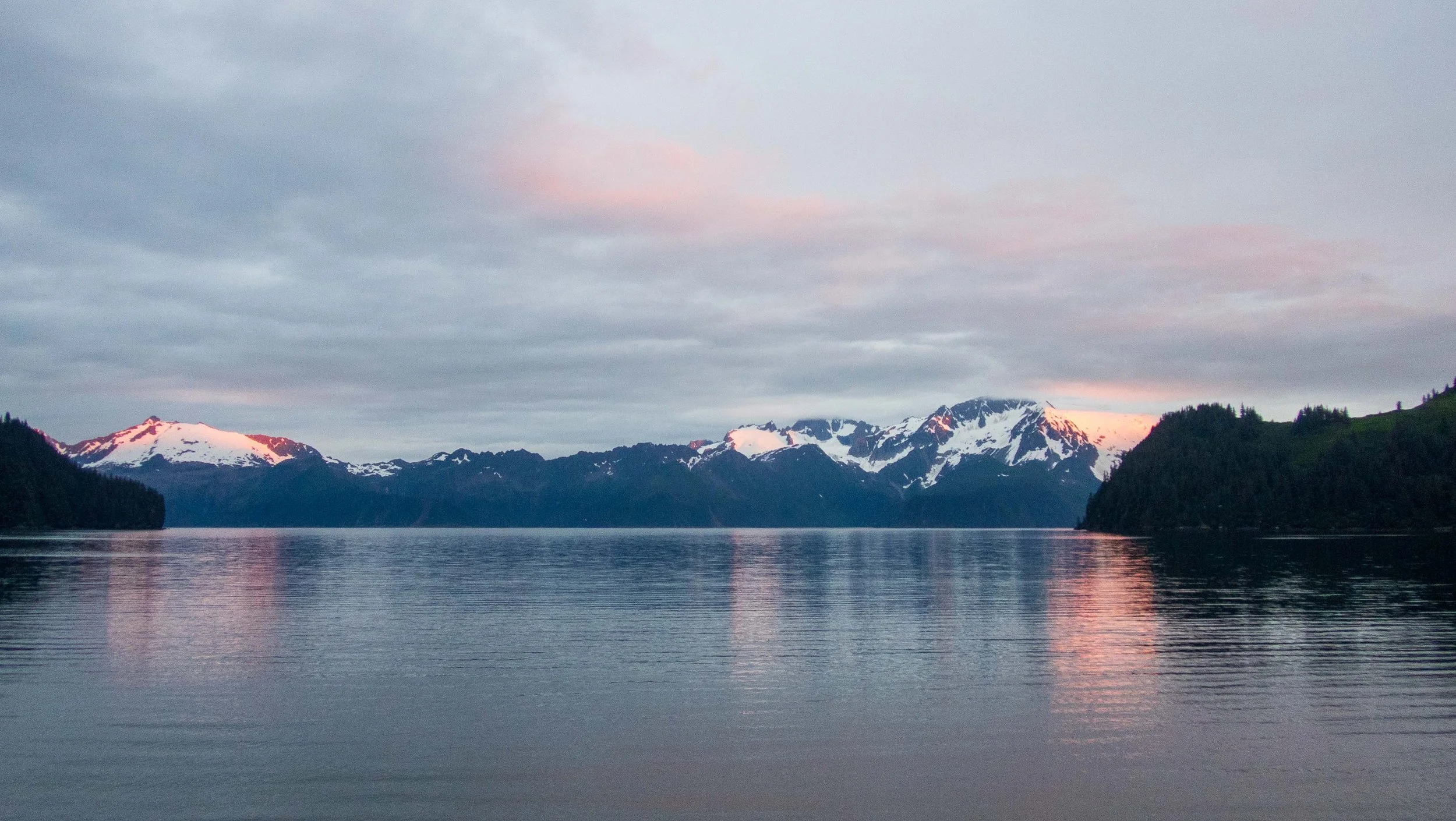
We were up before 5 a.m. and launched at 7:30. The morning sun cast a beautiful light on the mountains and sea.
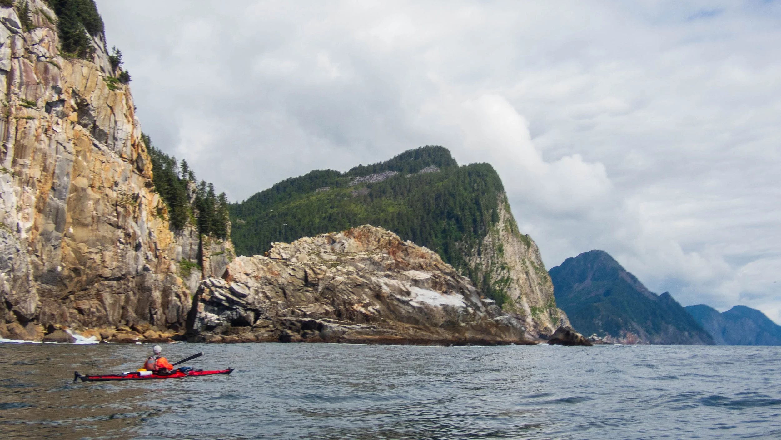
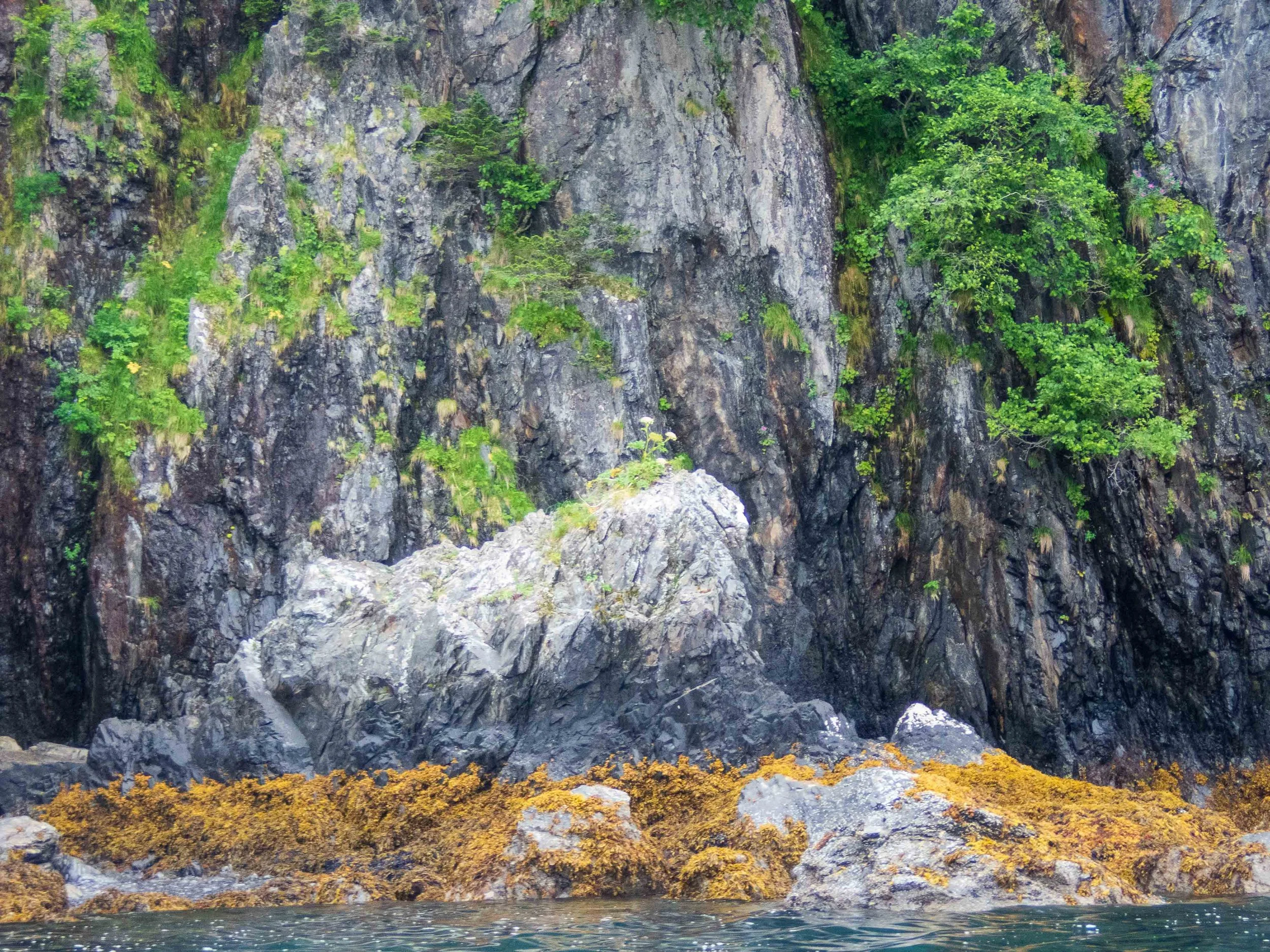
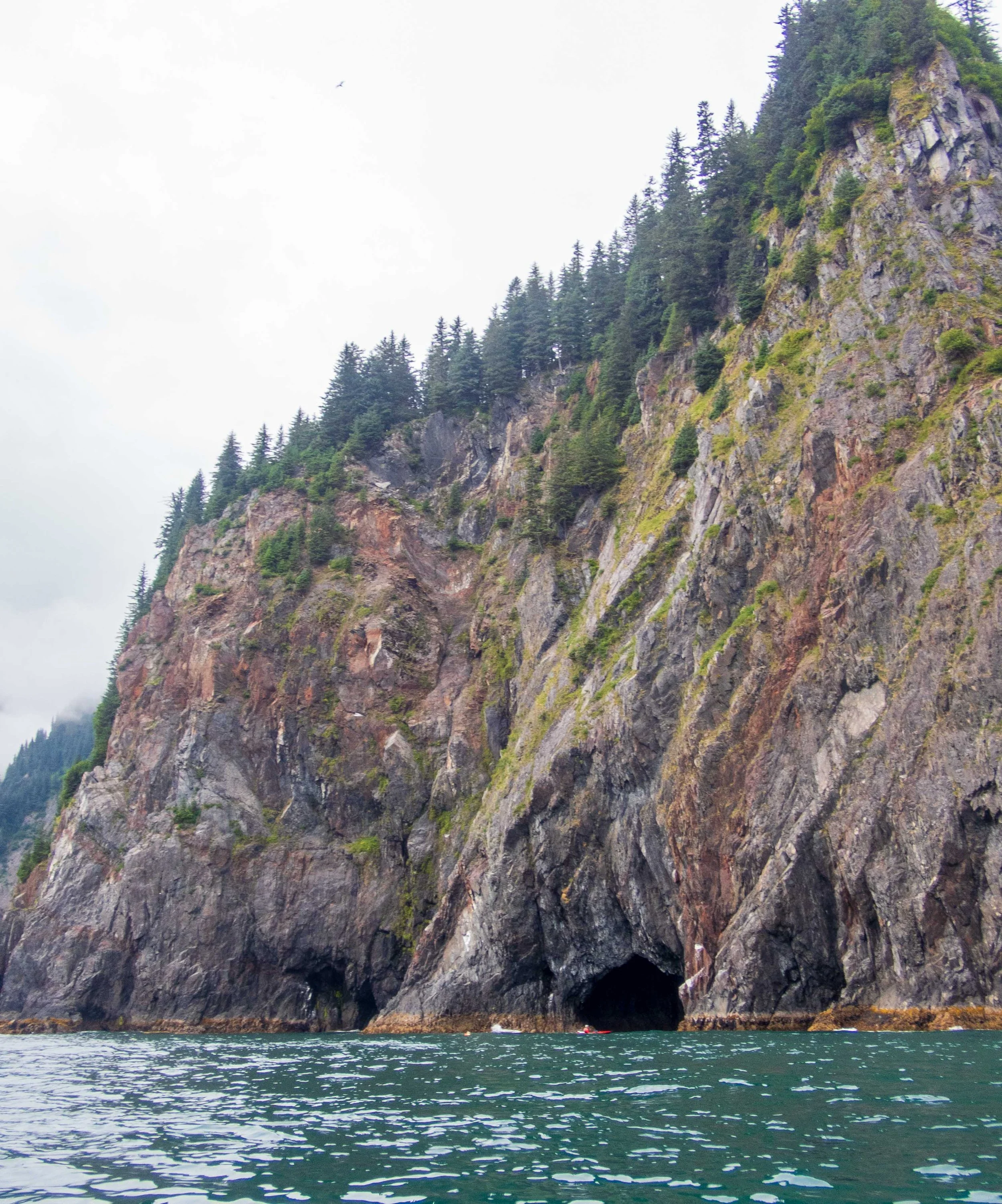
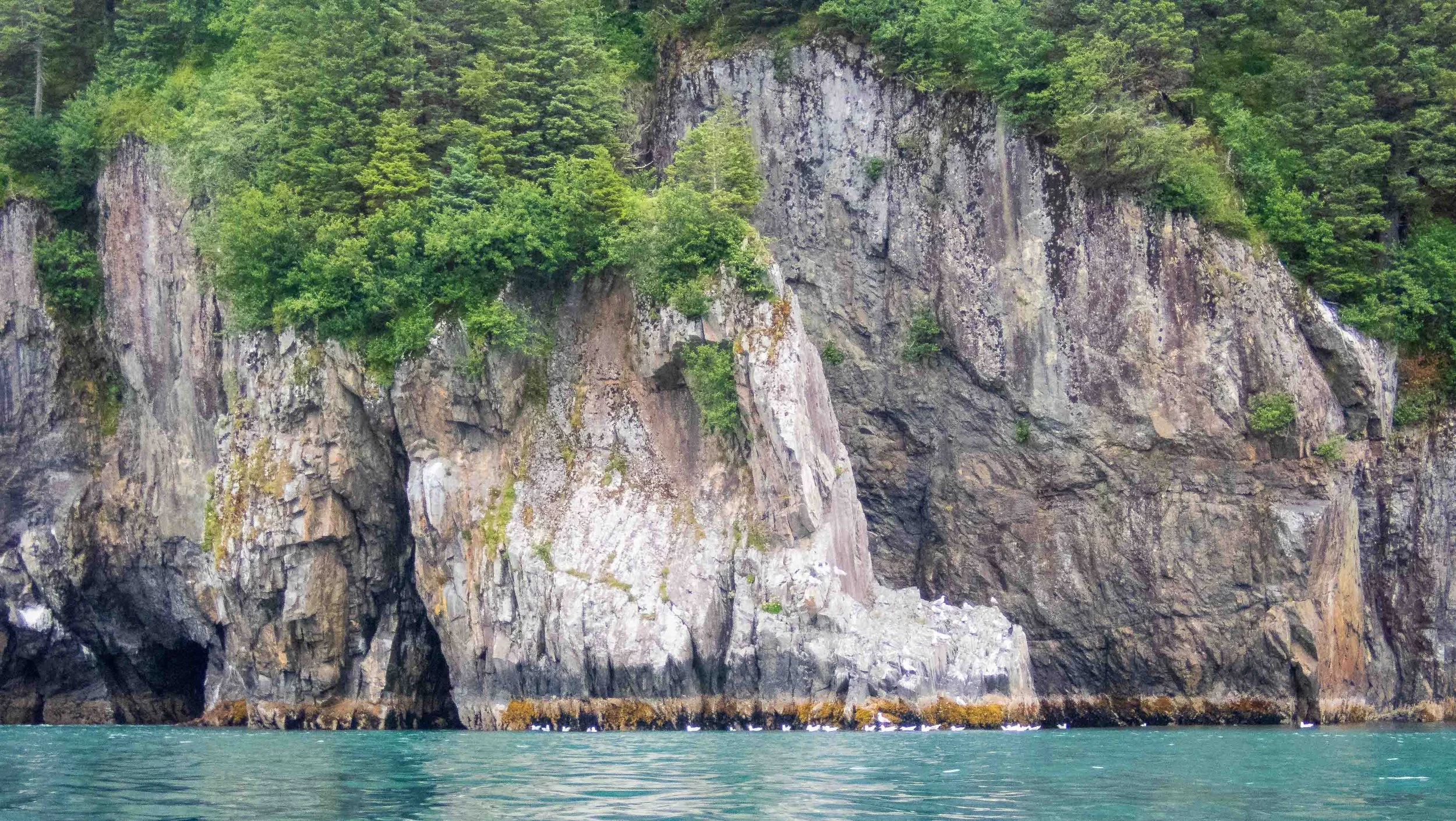
Along the coast, the cliffs and rock features, with arches and caves colored by minerals and lichens, were beautiful. The kayaks were tiny dots compared to the size of the cliffs and caves.
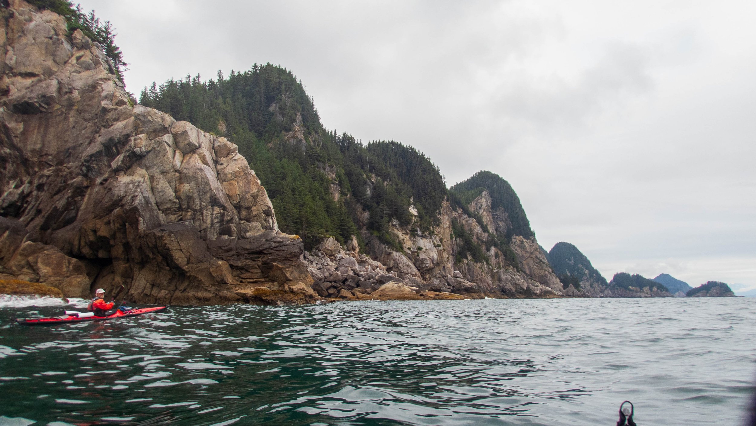
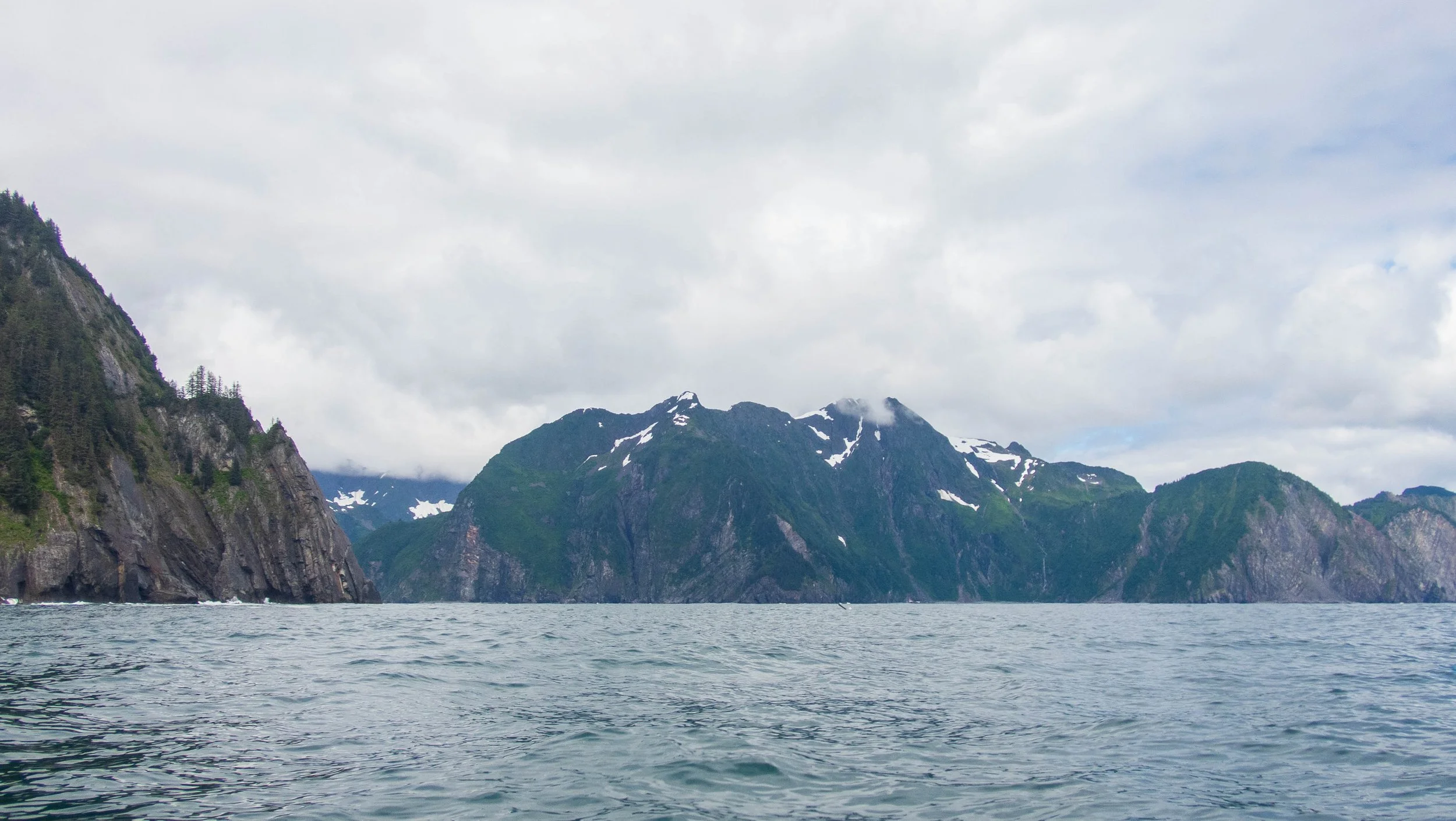
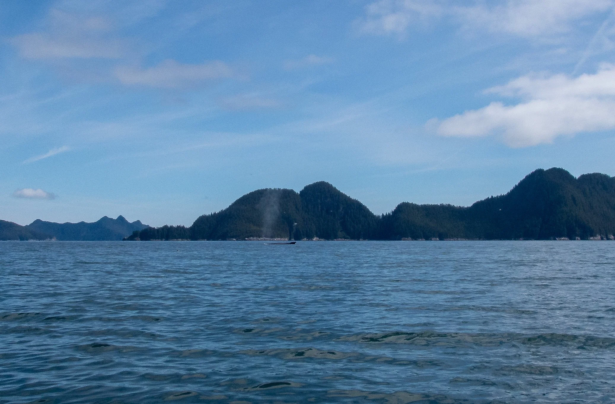
With the ebb, we made good speed of 3-3.5 knots as we paddled south along the rocky peninsula. We rounded Aialik Cape in calm, easy conditions and minor swell, taking care to avoid the tour boats zooming around the point. As we rounded Cape Aialik, we saw many recreational fishing boats in the Bay - what a change from the remoteness of the early days of our trip! We also spotted a group of spouts and diving tails in the distance that we deemed to be a pod of orcas, based on the proximity of several spouts and the sizes of the tails.
Even with the longer mileage, we rounded the spires of Bulldog Point in front of Bear Glacier and pulled in to a nice campsite in the southeast corner of Bulldog Cove before 4 in the afternoon. We had decided to take two days to get to Seward, since we had the time, rather than one long push. This would also allow us to get into Seward with time to unload and disassemble and pack our kayaks. I would have loved to spend more days in Resurrection Bay, in spite of the higher population, to explore the islands on the east side of the bay. But my back pain was getting worse by the day, and we had a schedule to keep.
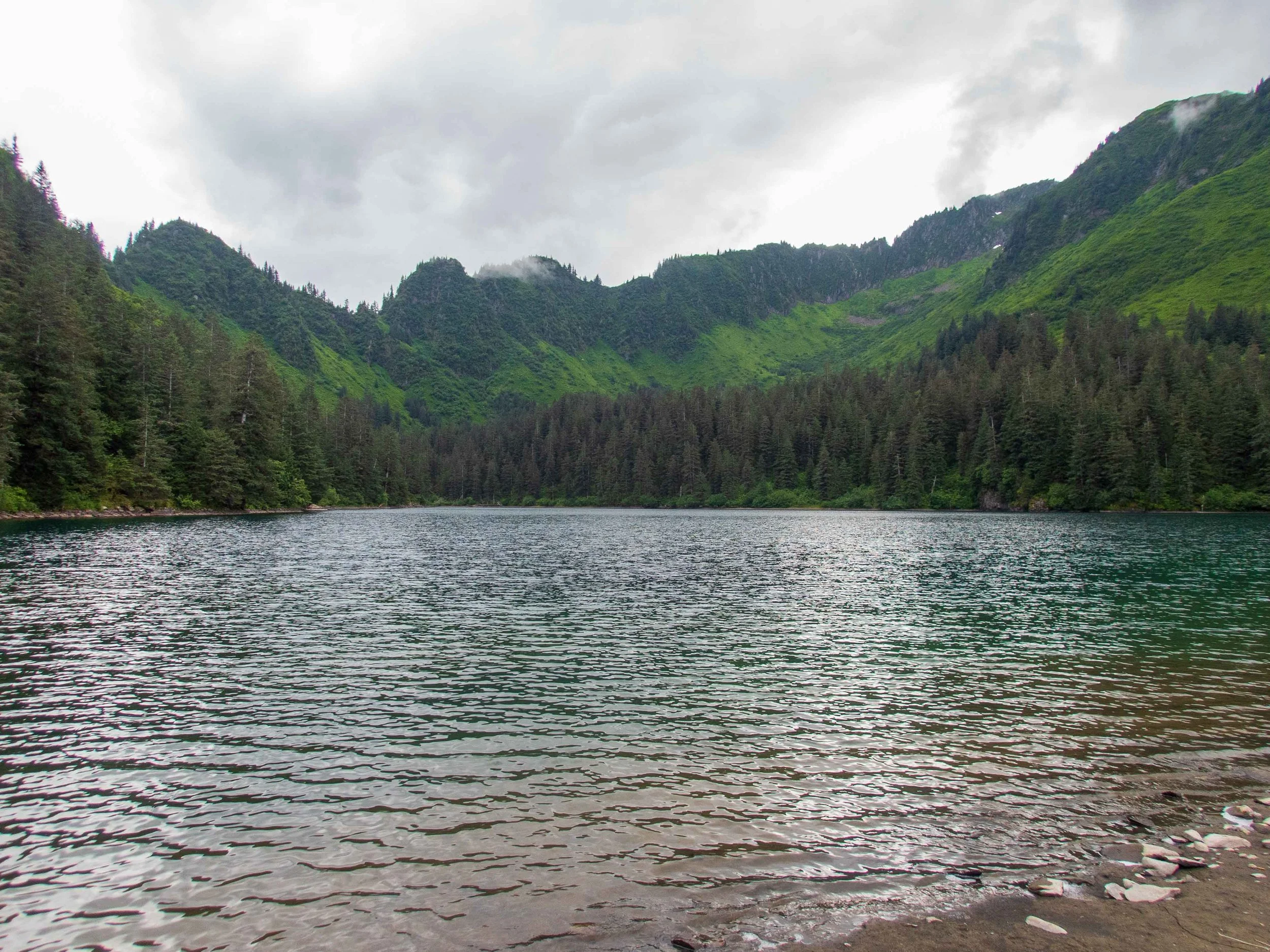
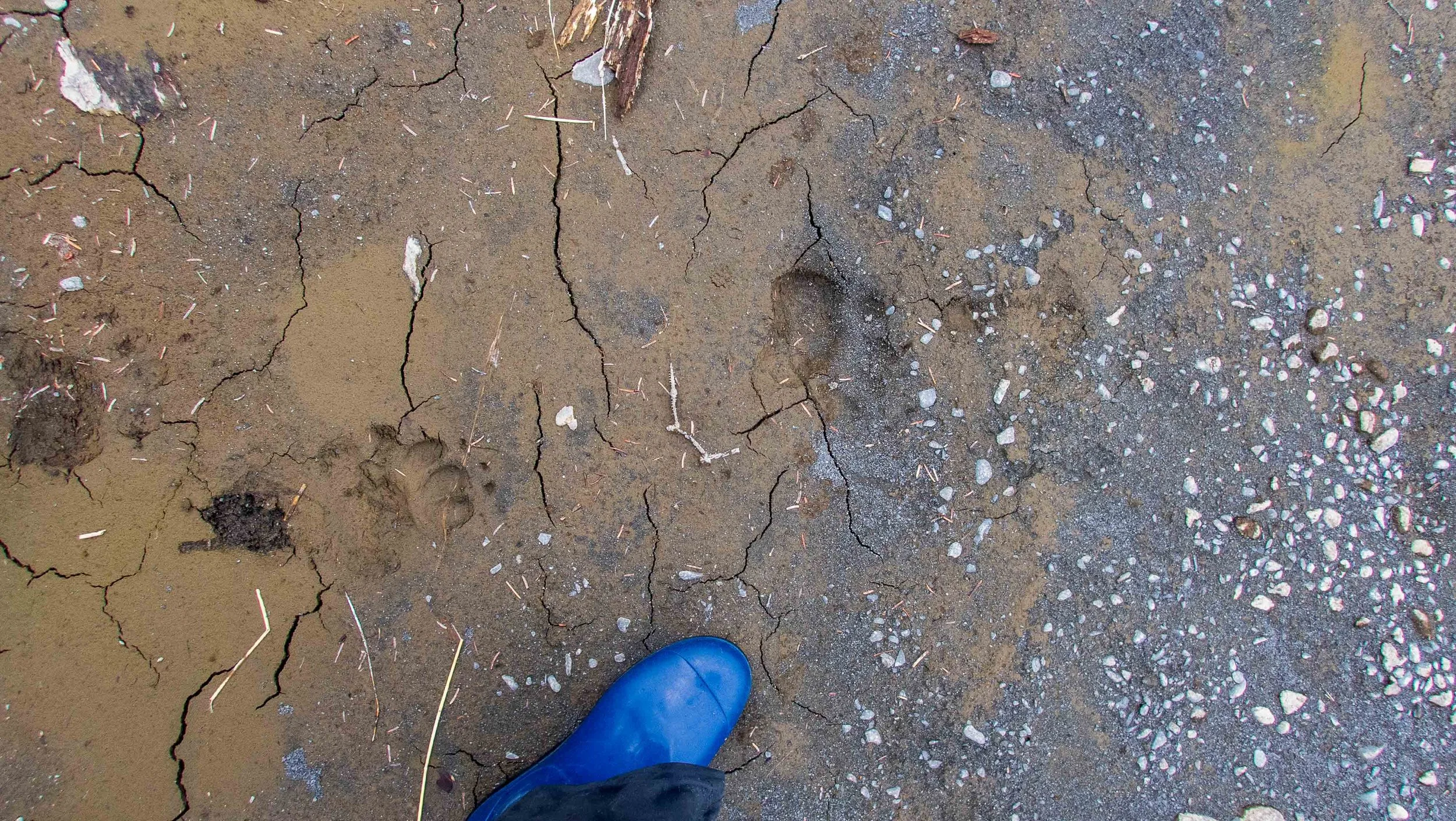
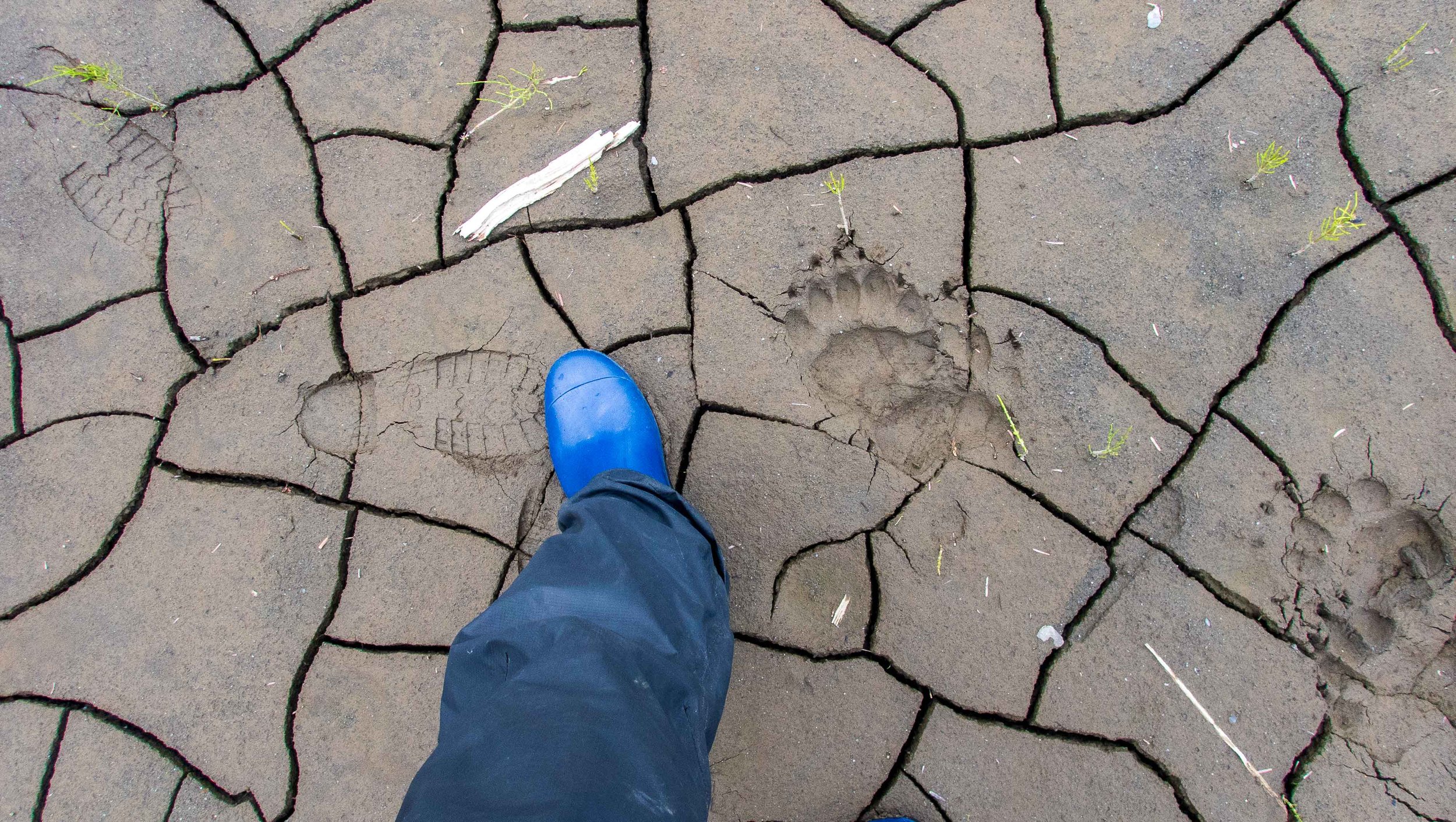
At camp, I went for a walk to find a path to the lake behind the blackberry brambles while the others took a nap. Although there wasn’t a trail, I was able to create one, not without putting a hole or two in my rain pants. The lake was pristine and beautiful! Although there were no human tracks, there were plenty of bear tracks in the mud.
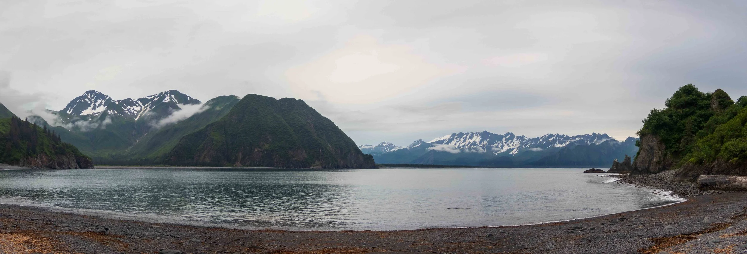
Beautiful Bulldog Cove
Day 21: Bulldog Cove to South Beach: 8 nmi / 14.8 km
It had rained during the night, and we launched in a cool, grey mist. Stuart wanted to see if we could get into the lagoon in front of Bear Glacier, but the tides were such that it would have been challenging to exit. We satisfied ourselves with the view of the glacier over the lagoon. Bulldog Cove was filled with black-legged kittiwakes. We paddled northeast along the beautiful cliffs for a short paddle to South Beach. It wasn’t the greatest campsite, as it had a tidal lagoon behind the beach, and no obvious source of fresh water. Worse, the mosquitoes were plentiful, and the tide came up quite high and strong into the lagoon, requiring us to move the bear fence after dinner. I was feeling tired upon landing and my back was hurting while paddling now, and much more painful with certain movements.
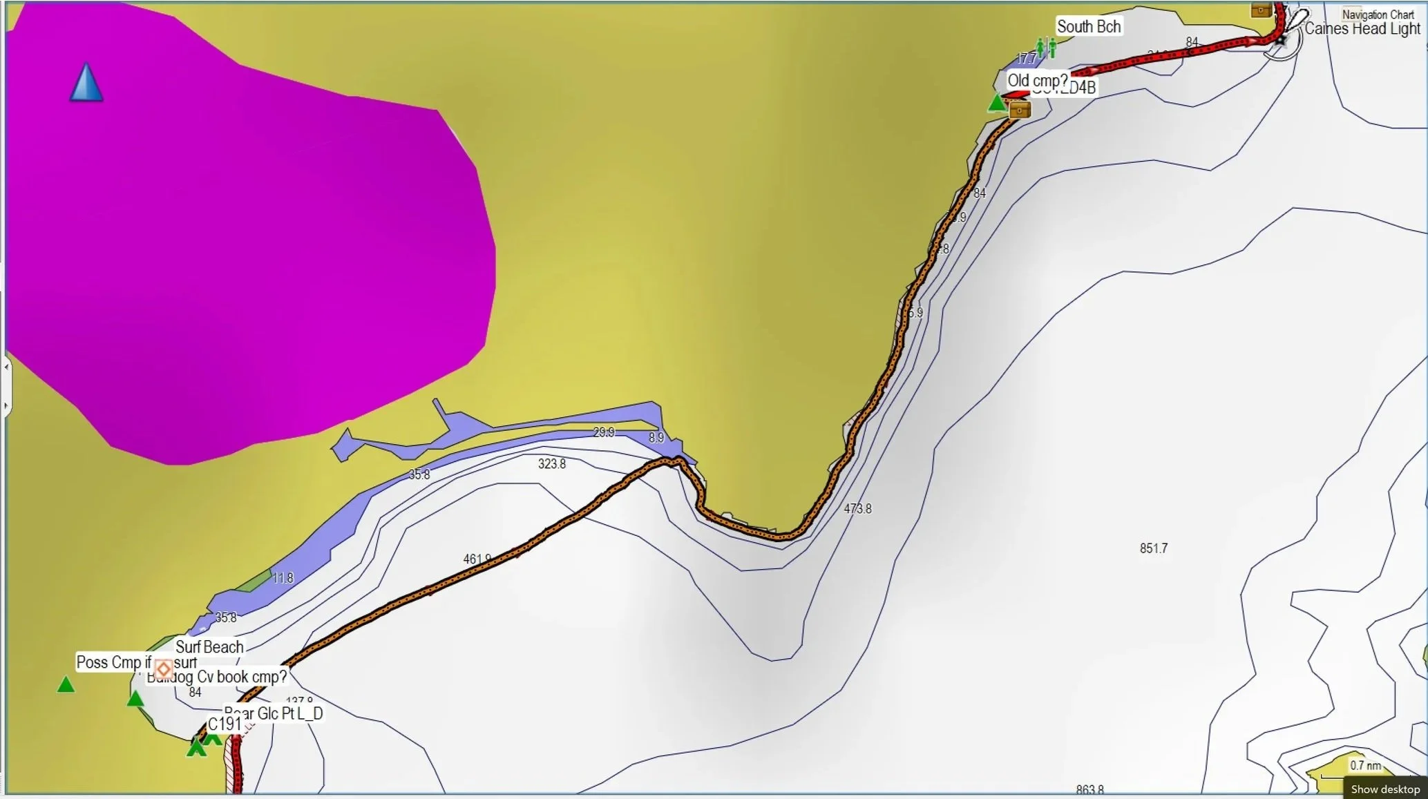
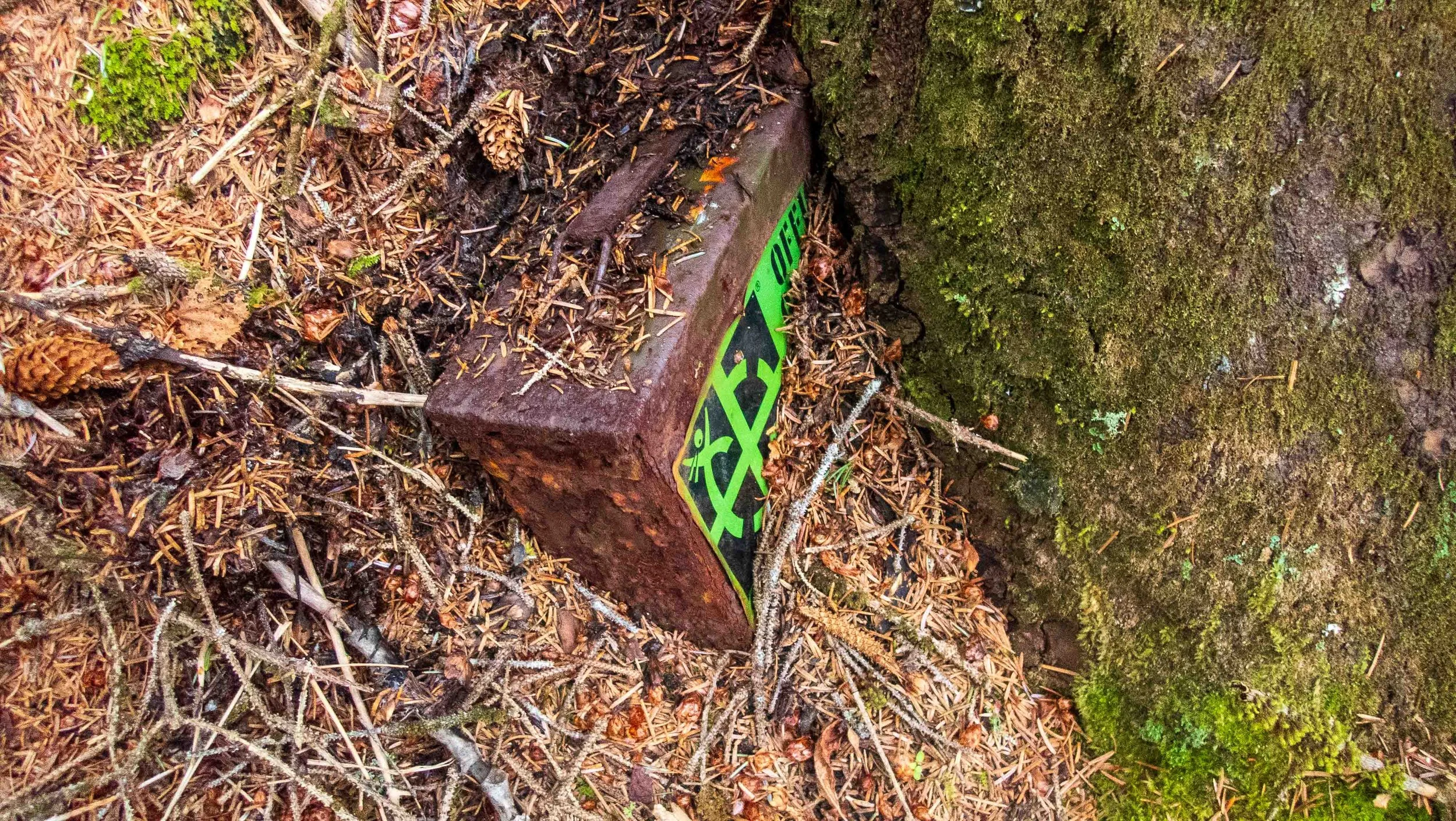
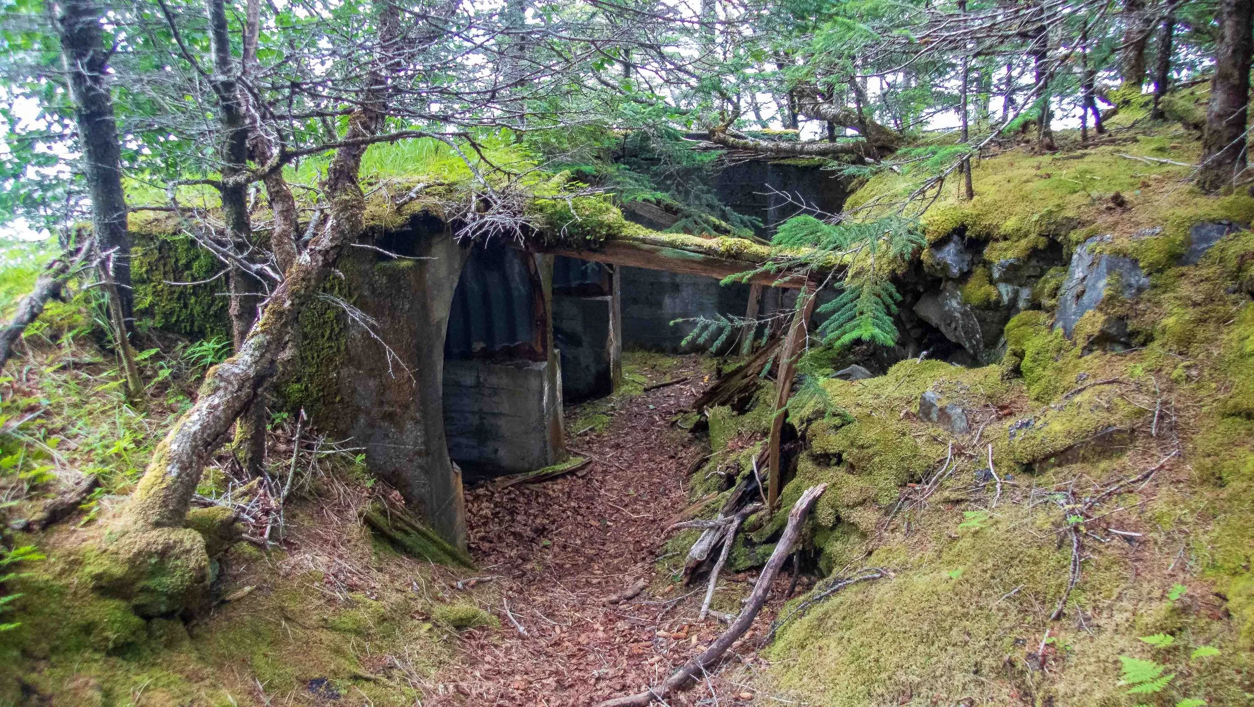
The rain began off and on in the late afternoon, so we rested in our tents. After a big dinner in the light rain, I organized my food and trash in preparation for the end of the trip. Feeling better after dinner, I decided to hike a gentle trail up to a lookout on the hill, the site of a former army garrison. The remains of these buildings were still at the top of the hill, as well as a geocache, one of the few to be found on this trip. I hoped the short walk would help to loosen up my back muscles.
Day 22: South Beach to Seward : 9.4 nmi / 17.4 km
Seward in the distance
I awoke to severe back pain, barely able to move without gasping in pain. I tried to stretch gently, but every movement was painful, and I was barely able to carry my kayak to the shore. Bending over and loading the cursed bear fence was excruciating. Never again will I bring a bear fence this large to Alaska, nor be the only one stuck hauling it around!
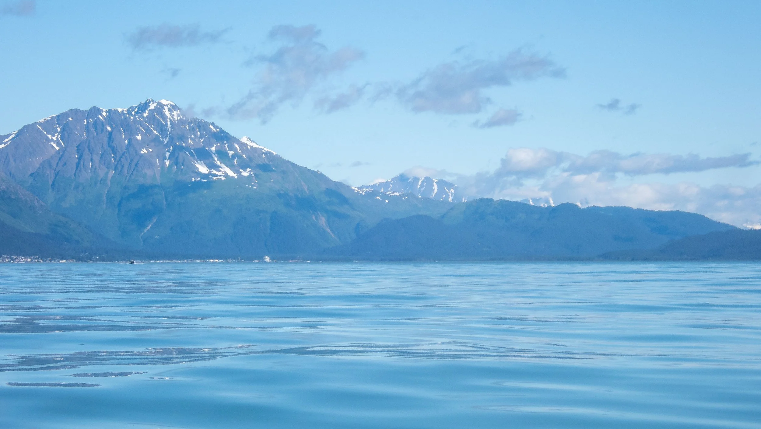
Once on the water, my back pain didn’t subside, and every paddling stroke hurt. I was glad I had made it until the last day, as I would probably have had to evacuate from the trip if it had been this bad earlier. Once we rounded Caine Head, we could see Seward in the far distance. We faced a SSW headwind that slowed my progress as it picked up in the afternoon. I stopped to eat lunch on the water near Tonsina Point while Stuart and Franca paddled ahead. Feeling more energized after lunch, I continued slogging through the wind until finally arriving at our intended campsite at Resurrection South in Seward. Although we had originally intended to camp here and dry and disassemble the kayaks before leaving the next morning, Stuart was in a hurry to depart, so we began the unpacking and disassembly. I was unable to carry my kayak, but slowly completed the disassembly before packing it into Stuart’s uncle’s truck, which he had kindly dropped off for us in Seward. My back pain was manageable while walking around, but every movement still required caution. I was glad the trip was over.
This sea kayaking expedition in the Kenai Fjords offered the most spectacular scenery I had ever experienced in Alaska (of 7 trips), and it far surpassed that of southeast Alaska. The conditions were favorable, and we had relatively few weather days that required us to lay over. However, the challenges of getting our kayaks this far north without the benefit of the Alaska Marine Highway Ferry required us to take folding kayaks, and added a great deal of cost and hassle to the trip. The advantage of the exposed coast meant that the beaches, where they existed, were generally favorable for landing in our folding Feathercrafts, and the use of my half-pipe sliders (see below) made the few difficult beaches we encountered much easier. If you need a conquest, this Homer to Seward paddle offers the advantage of a stop at the unparalleled Ranger Beach, at the cost of extra days to allow for weather. However, the transportation logistics of a Homer to Seward trip is a challenge, and the scenery prior to Ranger Beach is not that noteworthy, making this point to point trip better suited for those paddlers wanting the challenge of a conquest. A more relaxing trip could be done by launching and returning from Seward. This would offer more time to see the wildlife and explore Resurrection and Aialik Bay, even exploring as far west as Northwest Arm and Nuka Island. Either trip is best suited for experienced paddlers that have studied the notes in the guidebooks and are comfortable managing and navigating tides, currents, glacial currents and icebergs, rough sea states, bears, and remote wilderness camping.
Photos by Cris Lewis: Olympus TG-6
REFERENCES, LOGISTICS AND NOTES
*All mileage is provided from GPS tracking, which will be a slight overestimate of actual mileage.
The best reference source for paddling the Kenai Fjords is “Kenai Fjords: A Marine Guide to the Kenai Peninsula Outer Coast” by David Wm. Miller, 2004, published by Wilderness Images Press. ISBN: 0-9613954-1-9
The best maps for the area are National Geographic’s maps for Kenai Fjords National Park and Kachemak Bay State Park, both available on waterproof and tear resistant paper. The detail of these maps was more than sufficient during daily paddling, especially combined with the knowledge imparted in the Miller guidebook.
Guided kayaking tours of different lengths are offered by two outfitters in Seward: Miller’s Landing and Adventure 60 North. Both also offer kayaks for rent to experienced paddlers, although the cost may be prohibitive for a longer expedition.
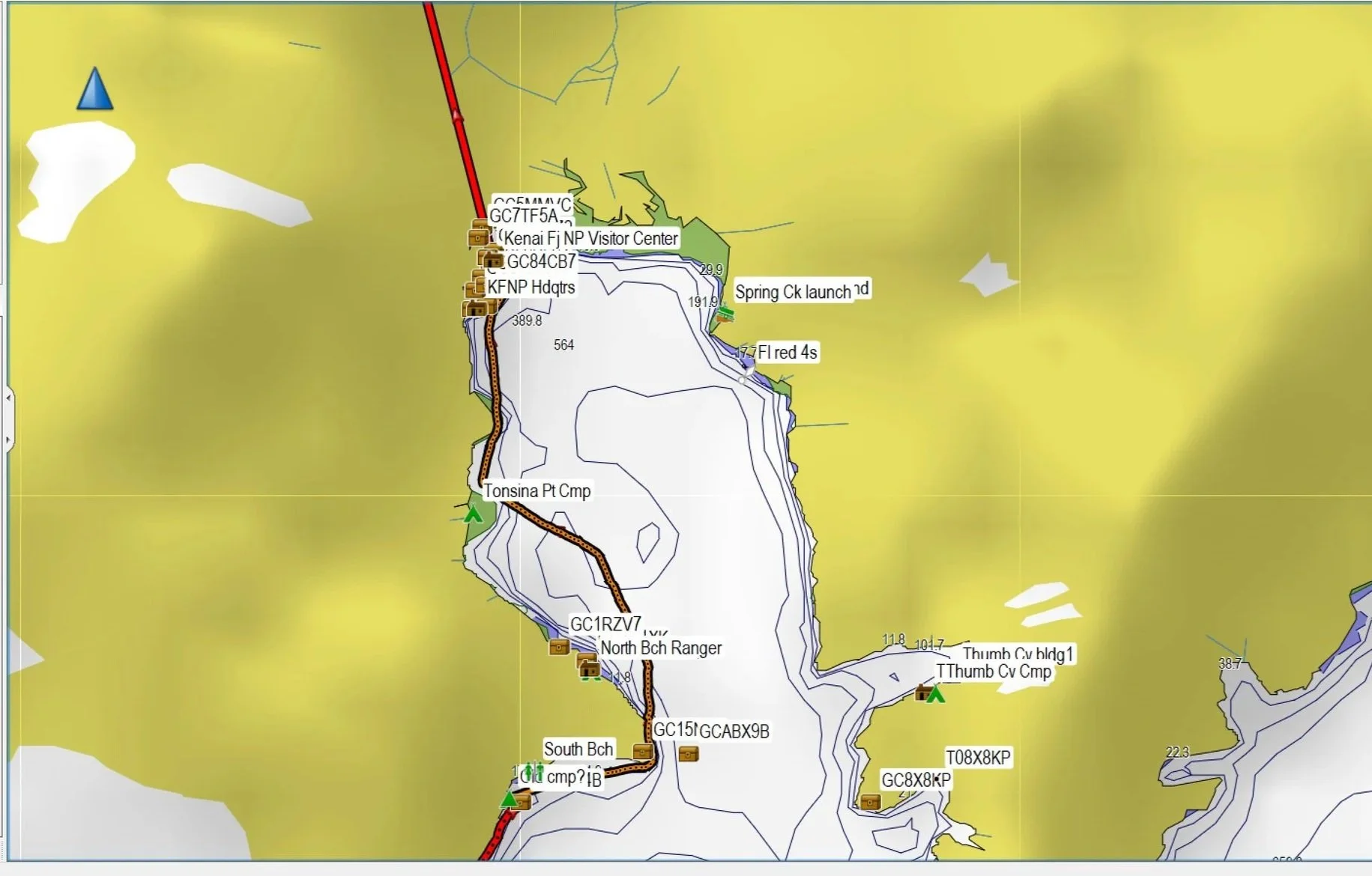
The city of Seward offers several municipal campsites. The Resurrection Municipal Campground on the Seward waterfront has reasonable launching and landing locations for kayaks, and additional campgrounds lie further north close to the large harbor.
These half-pipe kayak sliders proved invaluable for keeping my Feathercraft hull protected during launching and landing from rocky beaches. By placing the 4 sliders spaced out along the beach, the kayak could easily slide along these pipes, elevated from the beach. They prevent wear and tear on the kayaks, and make the strain of launching and landing much easier than simply trying to drag a loaded kayak up a barnacle- or gravel-filled beach.
The currents in some of the inlets are not necessarily what would be expected from a simple in-out tidal flow, as they are dependent on the volume of water on one side of a passage and local bathymetry. For example, the passage from the Coast Pilot suggests that the ebb at McArthur pass flows east, consistent with an opposing current we experienced during a flood. Additionally, I was unable to find current tables for many of the small inlets and passages in the Nuka Bay to Aialik Bay areas. As with ocean currents, the failproof method is to feel the current as you paddle and respond accordingly.
“Coast Pilot 9 Cape Spencer to Cook Inlet
The tidal currents in McArthur Pass have an estimated velocity of 3 to 4 knots. All except lowpowered vessels will have little difficulty through the pass at any stage of tide, but east weather and ebb tide may cause dangerous seas in the entrance. See the Tidal Current prediction service at tidesandcurrents.noaa. gov for specific information about times, directions, and velocities of the current at numerous locations throughout the area.”
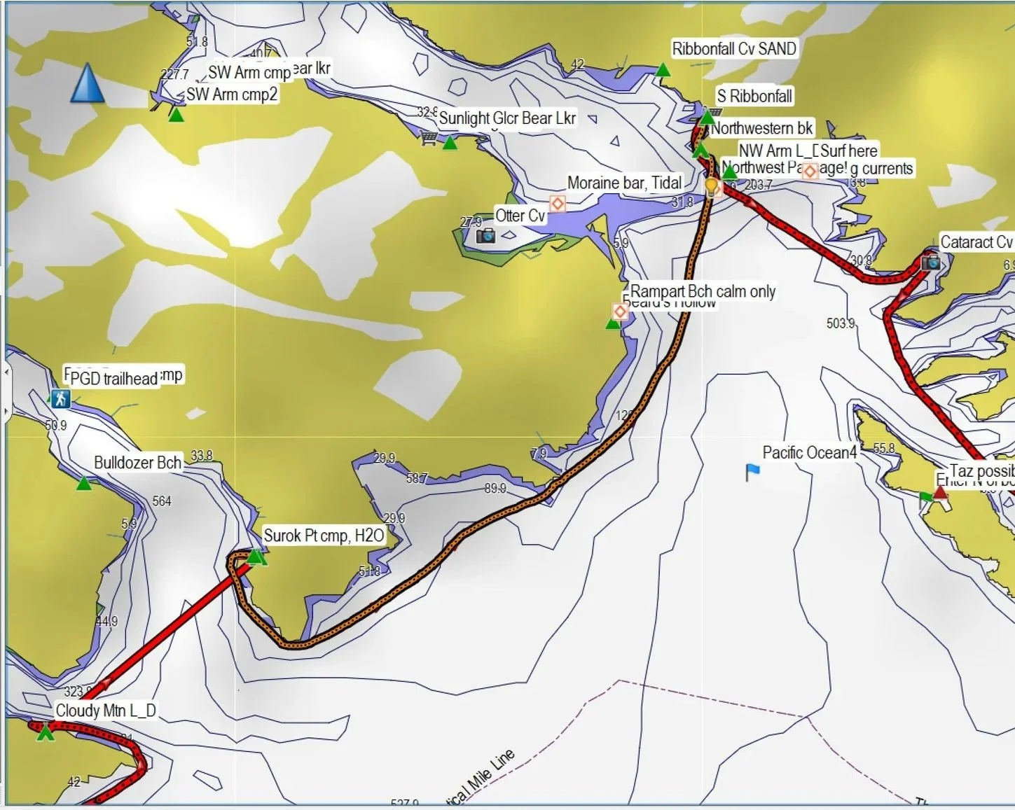
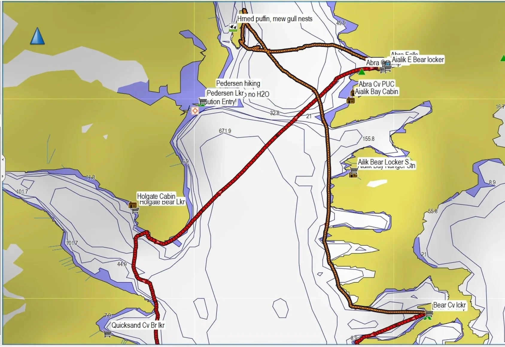
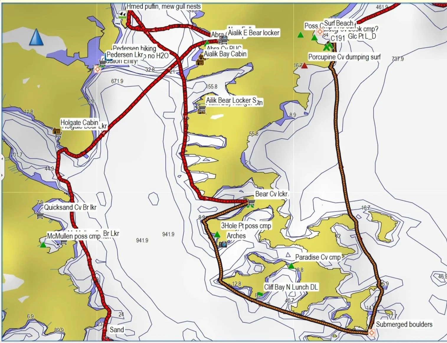
Feel free to download and share this GPX file of waypoints and campsites. More detail is available if the GPX file is opened in Garmin Basecamp or Homeport. Campsites marked as tents were used by us, or marked as campsites in the guide book. Campsites marked as green triangles were approximated from descriptions from other paddlers or from Google maps. Bear locker locations are indicated with grocery carts. Detailed information on water, campsites, bear locker locations, and more, can be found in the guide book by David Miller.